
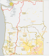
Oregon/Washington National Conservation Lands
The BLM's National Conservation Lands currently includes 906 units covering over 38 million acres designated by Congress and the President to conserve special features, from winding rivers to mountain vistas. The National Conservation Lands offer the American people exceptional opportunities for hunting, solitude, wildlife viewing, fishing, history exploration, scientific research and a wide range of traditional uses. The BLM manages these public lands for the benefit of current and future generations, supporting conservation as a part of the BLM's multiple-use and sustained yield mission. This means respecting the ties that native and traditional communities have to public lands, as well as being welcoming of diverse interests and uses.
BLM Oregon/Washington manages national monuments, National Scenic and Historic Trails, wild and scenic rivers, wilderness and more unique National Conservation Lands.
Please visit the pages for the National Conservation Lands in Oregon and Washington:
- National Conservation Areas and Similar Designations
- National Monuments
- National Scenic and Historic Trails
- Wild and Scenic Rivers
These rivers are designated for preservation of their free-flowing condition, water quality, and outstandingly remarkable scenic, recreational, geologic, cultural, or other values and managed in accordance with the Wild and Scenic Rivers Act of 1968. More information is available at Wild and Scenic Rivers of Oregon.
- Wilderness Areas
The BLM manages nine Wilderness Areas in Oregon (nearly 255,000 acres) and one Wilderness Area in Washington (over 7,100 acres). Wilderness Areas are designated by Congress. The Wilderness Act of 1964 defines wilderness as “an area ... which (1) generally appears to have been affected primarily by the forces of nature ...; (2) has outstanding opportunities for solitude or a primitive and unconfined type of recreation; (3) has at least five thousand acres of land...; and (4) may also contain ecological, geological, or other features of scientific, educational, scenic, or historical value.
- Wilderness Study Areas
- Abert Rim
- Aldrich Mountain
- Alvord Desert
- Basque Hills
- Beaver Dam Creek
- Blitzen River
- Blue Canyon
- Bowden Hills
- Bridge Creek
- Camp Creek
- Castle Rock
- Cedar Mountain
- Chopaka Mountain
- Clarks Butte
- Cottonwood Creek
- Cougar Well
- Deschutes Canyon–Steelhead Falls
- Devils Garden Lava Bed
- Diablo Mountain
- Disaster Peak
- Dry Creek
- Dry Creek Buttes
- East Alvord
- East Lava Field
- Fifteenmile Creek
- Fish Creek Rim
- Four Craters Lava Bed
- Gerry Mountain
- Gold Creek
- Guano Creek
- Hampton Butte
- Hawk Mountain
- Heath Lake
- High Steens
- Home Creek
- Homestead
- Honeycombs
- Jordan Craters
- Lookout Butte
- Lower John Day
- Lower Owyhee Canyon
- Lower Stonehouse
- Mahogany Ridge
- Malheur River-Bluebucket Creek
- McGraw Creek
- Mountain Lakes
- North Fork
- North Pole Ridge
- Oregon Canyon
- Orejana Canyon
- Owyhee Breaks
- Owyhee River Canyon
- Palomino Hills
- Pat’s Cabin
- Pueblo Mountains
- Red Mountain
- Rincon
- Saddle Butte
- Sage Hen Hills
- Sand Dunes
- Sand Hollow
- Sheep Mountain
- Sheepshead Mountain
- Slocum Creek
- South Fork
- South Fork Donner und Blitzen
- Spaulding
- Sperry Creek
- Stonehouse
- Strawberry Mountain - Indian Creek
- Strawberry Mountain - Pine Creek
- Strawberry Mountain - Sheep Gulch
- Sutton Mountain
- Table Mountain
- Thirtymile
- Twelvemile Creek
- Upper Leslie Gulch
- Upper West Little Owyhee
- West Peak
- Wild Horse Basin
- Wildcat Canyon
- Willow Creek
- Winter Range