
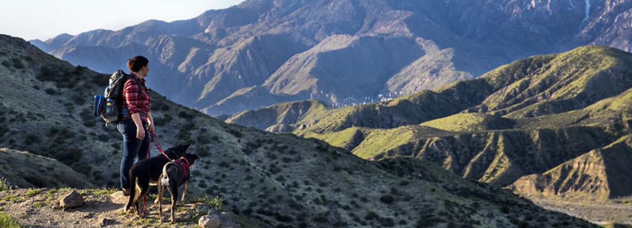
California National Conservation Lands
From rocks and islands off the California coastline to native grasslands and from an historical army post to rugged mountain ranges, from National Scenic or Historic Trails to wilderness and wilderness study areas, BLM California manages many remarkable parts of the National Conservation Lands.
Discover more National Conservation Lands in California:
- National Monuments
- National Conservation Areas and Similar Designations
- National Scenic and Historic Trails
- Wild and Scenic Rivers
- Wilderness
Search for details about these wilderness areas at Wilderness Connect.
Find geospatial data for each wilderness area on the GIS Hub.
- Aqua Tibia
- Argus Range
- Avawatz Mountains
- Beauty Mountain
- Big Maria Mountains
- Bigelow Cholla Garden
- Bighorn Mountain
- Black Mountain
- Bright Star
- Bristol Mountains
- Brushy Mountain/English Ridge
- Buzzards Peak
- Cache Creek
- Cadiz Dunes
- Carrizo Gorge
- Cedar Roughs
- Chemehuevi Mountains
- Chimney Peak
- Chuckwalla Mountains
- Cleghorn Lakes
- Clipper Mountain
- Coso Range
- Coyote Mountains
- Darwin Falls
- Dead Mountains
- Domeland
- El Paso Mountains
- Elkhorn Ridge
- Fish Creek Mountains
- Funeral Mountains
- Golden Valley
- Granite Mountain
- Grass Valley
- Great Falls Basin
- Hollow Hills
- Ibex
- Indian Pass
- Inyo Mountains
- Ishi
- Jacumba Mountains
- Kelso Dunes
- Kiavah
- King Range
- Kingston Range
- Little Chuckwalla Mountains
- Little Picacho Peak
- Machesna Mountain
- Malpais Mesa
- Manly Peak
- Mecca Hills
- Mesquite
- Milpitas Wash
- Newberry Mountains
- Nopah Range
- North Algodones Dunes
- North Mesquite Mountains
- Old Woman Mountains
- Orocopia Mountains
- Otay Mountain
- Owens Peak
- Pahrump Valley
- Palen/McCoy
- Palo Verde Mountains
- Picacho Peak
- Pinto Mountains
- Piper Mountain
- Piute Mountains
- Red Mountain
- Resting Spring Range
- Rice Valley
- Riverside Mountains
- Rocks and Islands
- Rodman Mountains
- Sacatar Trail
- Saddle Peak Hills
- San Gorgonio
- Santa Lucia
- Santa Rosa
- Sawtooth Mountains
- Sheephole Valley
- Soda Mountains
- South Fork Eel River
- South Nopah Range
- Stateline
- Stepladder Mountains
- Surprise Canyon
- Sylvania Mountains
- Trilobite
- Trinity Alps
- Turtle Mountains
- Ventana
- Whipple Mountains
- White Mountains
- Yolla Bolly-Middle Eel
- Yuki
- Wilderness Study Area
The Bureau of Land Management is responsible for 68 Wilderness Study Areas in California and northwest Nevada totaling over 1 million acres. These areas encompass dramatic landscapes ranging from chaparral clad mountains of the Coast Range to sagebrush mesas of the Modoc Plateau.
- Bear Canyon Rare II Contiguous
- Bear Mountain Rare II Contiguous
- Beauty Mountain
- Big Butte
- Bitterbrush
- Black Mountain
- Bodie
- Bodie Mountain
- Buffalo Hills
- Caliente Mountain
- Carrizo Gorge
- Casa Diablo
- Cerro Gordo
- Chidago Canyon
- Crater Mountain
- Dry Valley Rim
- Eden Valley
- Excelsior
- Fish Slough
- Five Springs
- Garcia Mountains
- Hauser Mountain
- Independence Creek
- Lava
- Machesna
- Massacre Rim
- Merced River
- Milk Ranch/ Case Mountain
- Moses
- Mount Biedeman
- Owens Peak
- Panoche Hills North
- Panoche Hills South
- Pit River Canyon
- Piute Cypress ISA
- Poodle Mountains
- Rockhouse
- Rocky Creek-Cache Creek
- Sacatar Meadows
- San Benito Mountain
- San Felipe Hills
- San Ysidro Mountain
- Sawtooth Mountains A
- Sawtooth Mountains C
- Scodie
- Sheep Ridge
- Sheldon Contiguous
- Skedaddle
- Slinkard
- South Warner Contiguous
- Southern Inyo
- Symmes Creek
- Table Mountain
- Thatcher Ridge
- Timbered Crater
- Tule Mountain
- Tunnison Mountain
- Twin Peaks
- Volcanic Tablelands
- Wall Canyon
- White Mountains
- Yolla Bolly Contiguous