
Spaulding Wilderness Study Area
The Spaulding Wilderness Study Area (WSA) (OR-1-139) is located 18 miles east of Adel, Oregon, in both Lake and Harney counties. Its boundaries are defined by the right-of-way of Oregon State Highway 140 for approximately 3 miles on the southwest, a high standard dirt road on the west and low standard roads on the north, east, and south. The WSA boundary extends up the dead-end road to Spaulding Reservoir and around a 320-acre parcel of private land adjacent to this road. All lands adjacent to the WSA are public.
The Spaulding WSA contains 69,530 acres of BLM land and 440 acres of private inholdings.
The WSA is 17 miles long from north to south and from three to nine miles wide in a roughly oval shape with a panhandle on the south. The study area is characterized by rolling sagelands broken by low and interlaced by a network of intermittent stream drainages. Antelope Butte at the south end of the WSA rises to an elevation of 6,440 feet. Sage Hen Canyon, central to the study area, funnels outward from steep high to a broad swale near Spaulding Reservoir, which is excluded from the WSA boundary. West of the reservoir the drainage is also known as Spaulding Creek. At the south end of Sage Hen Canyon near the eastern WSA boundary is a one-mile series of pools known as The Potholes. These pools hold water after spring run-off well into the summer.
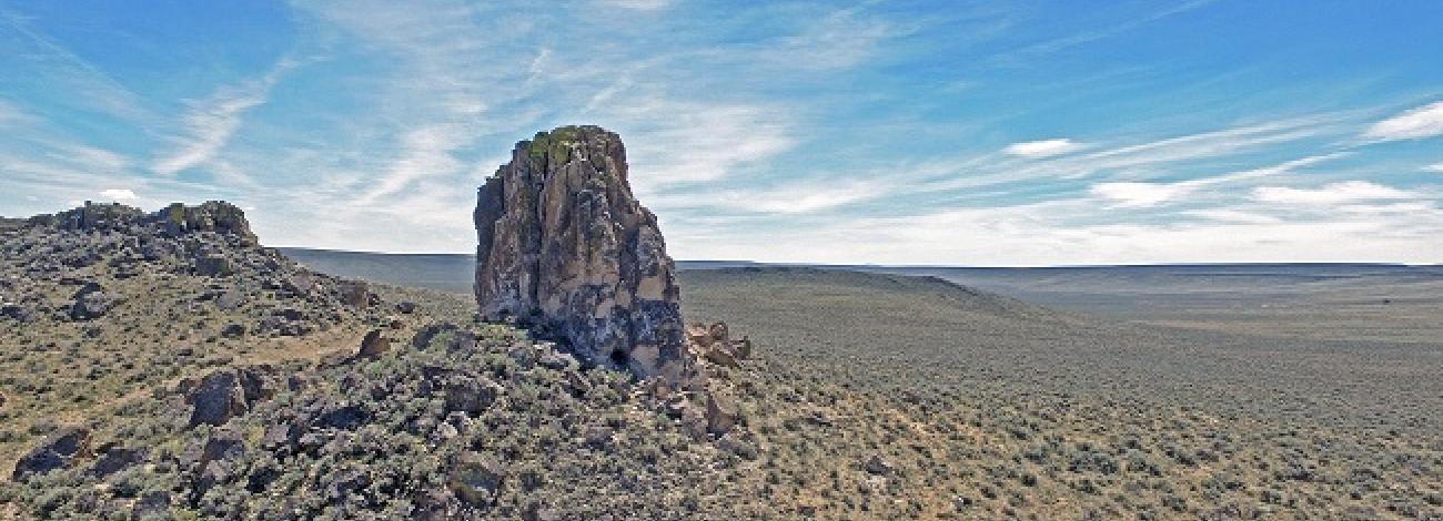
The western portion of the WSA is dominated by a 13 mile section of Guano Rim, also called Dougherty Rim, which reaches a height of 900 feet. The rim is incised by seven steep canyons and the major drainage known as Rocky Canyon. Eleven sink lakes are scattered throughout the area above and to the east of Guano Rim. Along the eastern boundary are a large erosion basin and a prominent landmark, Chimney Rock. Vegetation consists generally of communities, with some aspen groves beneath rims, scattered occurrence of mountain mahogany, and juniper growing at the base of some rims. Various shrub species occur in the canyons.
The WSA was studied under Section 603 of the Federal Land Policy and Management Act and was included in the Final Oregon Wilderness Environmental Impact Statement filed in February 1990.


