
Owyhee Breaks Wilderness Study Area
The Owyhee Breaks Wilderness Study Area (WSA) (OR-3-59) is located in Malheur County, Oregon, approximately 24 miles northwest of Jordan Valley, Oregon, and U.S. Highway 95. The WSA is roughly oval shaped, approximately 7 miles long, and from 2 to 6 miles wide. It contains 13,380 acres of BLM land. In addition, four 40-acre parcels of private property are in the northern portion of the study area. The WSA is bordered on the south and southwest by high standard county dirt roads and private property, on the northwest by a graded dirt BLM road and private property, and on the northeast by private property and public land administered by the Bureau of Reclamation. Seven parcels of private property adjoin the WSA. Three are adjacent to the Owyhee Breaks WSA: Blue Canyon WSA (OR-3-73) on the northeast; Jordan Craters WSA (OR-3-128) on the southeast; and Lower Owyhee Canyon (OR-3-110) on the west. The four are separated by roads.
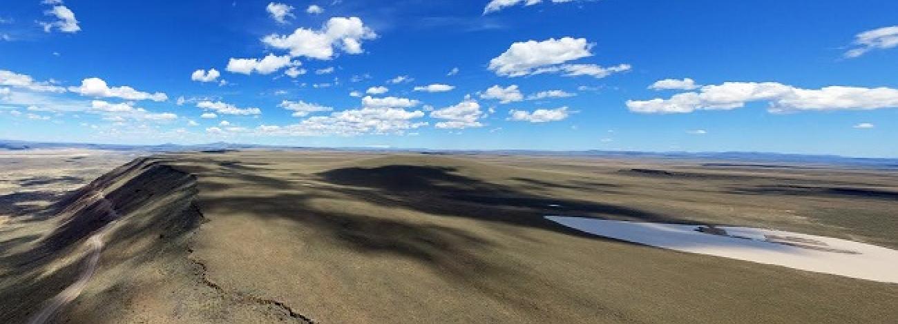
Approximately 75 percent of the WSA is located in rugged, dissected badlands along the Owyhee River. The study area is characterized by cliffs, outcrops, steep bluffs, dramatic erosional features, twisting gulches, sharp ridgelines and a deep river canyon. The “Owyhee Breaks” refers to this rugged topography. The Owyhee River, flowing through the badlands, bisects the WSA. The southern 25 percent of the study area is a gently-rolling plateau overlooking the river that is approximately 1,700 feet below.
Vegetation throughout the WSA is characteristic of a sagebrush steppe ecosystem, with sagebrush and grasses dominant. Salt desert shrub communities are represented in approximately a third of the area, and riparian vegetation occurs along the Owyhee River and Birch Creek.
Approximately 660 acres of the Jordan Craters Research Natural Area (RNA) and Area of Critical Environmental Concern (ACEC) are located in the southeast portion of the Owyhee Breaks WSA. In addition, approximately 3,020 acres of the Owyhee River ACEC is in the WSA. The portion of the Owyhee River flowing through the WSA is part of a segment that has been designated a wild river component of the National Wild and Scenic River System. The stretch of the Owyhee River in the WSA also is designated an Oregon State Scenic Waterway.
Several private parcels, acquired by BLM under the National Wild River Management Plan for the Owyhee River, have been incorporated into the WSA. They include two parcels inside the WSA, a parcel spanning the Owyhee River at Greeley Bar, a 40-acre parcel north of Greeley Bar, and an 80-acre parcel fronting the Owyhee River and adjacent to the western portion of the WSA.
The Owyhee Breaks WSA was initially identified and studied under Section 603 of the Federal Land Policy and Management Act (FLPMA) with additional acquired lands studied under section 202. The WSA was included in the Final Oregon Wilderness Environmental Impact Statement (EIS) filed in February 1990.


