
Basque Hills Wilderness Study Area
The Basque Hills Wilderness Study Area (WSA) (OR-2-84) is located 90 miles south of Burns, Oregon (18 miles west of Fields and miles north of the Oregon/Nevada state line) in Harney County, Oregon. The WSA is 24 miles south of the end of Oregon State Highway 205 and less than one mile from the county road that runs from Highway 205 to Fields.
About half of the Basque Hills WSA is in the Burns District, the remainder (the western side) lies within the District.
The triangular-shaped study area contains 137,220 acres of BLM land. There is one 320-acre private parcel located along a dead-end road; overall, 520 acres of private land are located within the WSA. The WSA also contains 4,190 acres of split-estate land. At the extremes, the study area is 22 miles long and 17 miles wide. Most of the eastern and western boundaries are formed by BLM low standard roads and private land. A portion of the area’s northern boundary line is also formed by a BLM low standard dirt road, but most of this boundary is adjacent to private property. The southern boundary line, located in the District, is a dirt road.
Three dead-end roads, totaling 25 miles, penetrate the WSA and also form part of the overall boundary line. These roads enter the study area in the north- west corner, from the eastern boundary and from the southeastern boundary.
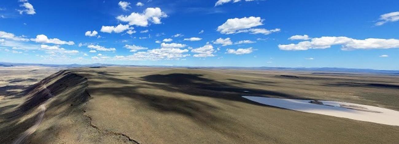
The Basque Hills WSA is a high desert area with some foothills and the landscape is predominantly flat to very gently-rolling. Most of the study area consists of broad, flat expanses and a few low foothills. The major topographic features of the area include Fish Fin Rim in the northwestern corner, Red Butte and another rock outcropping also referred to as Fish Fin Rim near the center of the WSA, Coyote Rim and Valley in the northeast, and Basque Hills in the southeast.
Scattered throughout the area are dry which are commonly found in shallow depressions. The largest of these lakebeds, Lake, is located in the northeastern portion of the study area in Valley. The average elevation of the WSA is about 5,000 feet. The lowest elevation, 4,520 feet, occurs near the northern boundary in Valley. The highest point in the WSA, 5,909 feet, occurs in the Basque Hills along the southeastern boundary.
There are no perennial streams within the WSA. Many shallow intermittent drainages cross the study area, generally draining the area to the north and northeast into the Valley.
The vegetation throughout the WSA includes big sagebrush, rabbitbrush, scattered patches of low sagebrush and a variety of grasses. A variety of salt desert shrub species occurs in Valley, the northeastern portion of the study area. These species include shadscale, greasewood, spiny winterfat, Nuttal’s, and Great Basin.
The WSA was initially studied under Section 603 of the Federal Land Policy and Management Act (FLPMA), but since the wilderness inventory phase, additional lands were added and modified and as a result, these areas were studied under Section 202 also of FLPMA. These lands were included in the final Oregon Wilderness Environmental Impact Statement (EIS) filed in February 1990.


