
South Fork Wilderness Study Area
The South Fork/Sand Hollow Wilderness Study Areas (OR-5-33 and OR-5-34 respectively) are in Crook County, approximately 60 miles east of Bend, Oregon, and 170 miles southeast of Portland. U.S. Highway 20 passes 20 miles to the south of the WSA.
There are 27,482 acres of BLM land within the South Fork/Sand Hollow WSA. In addition, there are 940 acres of split-estate lands in this WSA totaling 28,422 acres. The South Fork/Sand Hollow WSA also has 440 acres of private inholdings consisting of a 320-acre, 80-acre and 40-acre tract.
The west and southwest boundaries are located along a well maintained county gravel road. The north boundary follows a dirt road until it enters private land where it follows the boundary of the private land. On the east side of WSA the boundary follows a primitive dirt road. Along the southeast corner the boundary follows private land until it intersects a county gravel road.
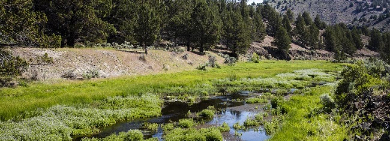
Geology of the region is characterized by rugged dark brown Columbia River Basalt escarpments encompassing the rolling hill and desert plateaus. Over thousands of years, the Crooked River has eroded through approximately 7-8,000 feet of basalt exposing numerous combinations of reddish-tan, dark brown, and black columns along with gigantic irregular blocks of this basaltic material. These formations greatly add to the scenic beauty and diversity for anyone hiking through this canyon. The river is pristine and free flowing through a diverse riparian zone has a rainbow trout fishery. The canyons provide nesting for songbirds and numerous types of raptors.
Juniper-dominated rolling hills in the west, with patches of sagebrush and grass extend to the western rim of the South Fork of the Crooked River canyon. The rim overlooks a riparian zone of sedges, rushes and bluegrass that grades into juniper and sagebrush communities on the canyon slopes. Beyond the eastern rim is Twelvemile Table which supports a low sagebrush/Idaho fescue community.
The WSA was studied under Section 603 of the Federal Land Policy and Management Act and was included in the Final Oregon Wilderness Environmental Impact Statement (EIS) filed in February of 1990.


