
Rincon Wilderness Study Area
The Rincon Wilderness Study Area (WSA 82) is located 95 miles south of Burns, Oregon, 10 miles west of Fields and 1 mile north of the Oregon/Nevada border in Harney County. The WSA is 24 miles south of the end of Oregon State Highway 205 and 8 miles of Nevada State Highway 140.
Most of the WSA is located in Burns District. A very small portion in the southwestern corner of the study area lies within the District. The WSA includes a panhandle extending to the north from the main portion of the WSA.
The WSA contains 97,545 acres of BLM land. Within the study area are two parcels of private land totaling 120 acres and 6,420 acres of split-estate land.
The Rincon WSA is 23 miles long (including the panhandle) and 12 miles wide. The area is bounded almost entirely by roads. The northern boundary line is formed by the Long Hollow Road (county-maintained) and private land. The eastern boundary line is composed of several BLM roads, scattered parcels of private land and the Rincon crested-wheatgrass seeding. The southern and southwestern boundary lines are formed by a BLM-maintained road (the Long Draw Road) and a portion of the Hawk Valley crested wheatgrass seeding. The western boundary line is formed by the Funnel Canyon Road maintained).
Four dead-end roads totaling 13.5 miles enter the study area and form part of the boundary line. All of these roads enter the WSA from the eastern boundary line. Two of the dead-end roads (each 1.5 miles in length) are in the northern portion of the study area. The other two dead-end roads are located in the central portion of the WSA and are 6 miles and 4.5 miles long. The section of road that forms the northern boundary line is a high standard gravel road. The roads that form the remainder of the boundary lines on the east, west and south, as well as the four dead-end roads that enter the WSA, are all low standard roads.
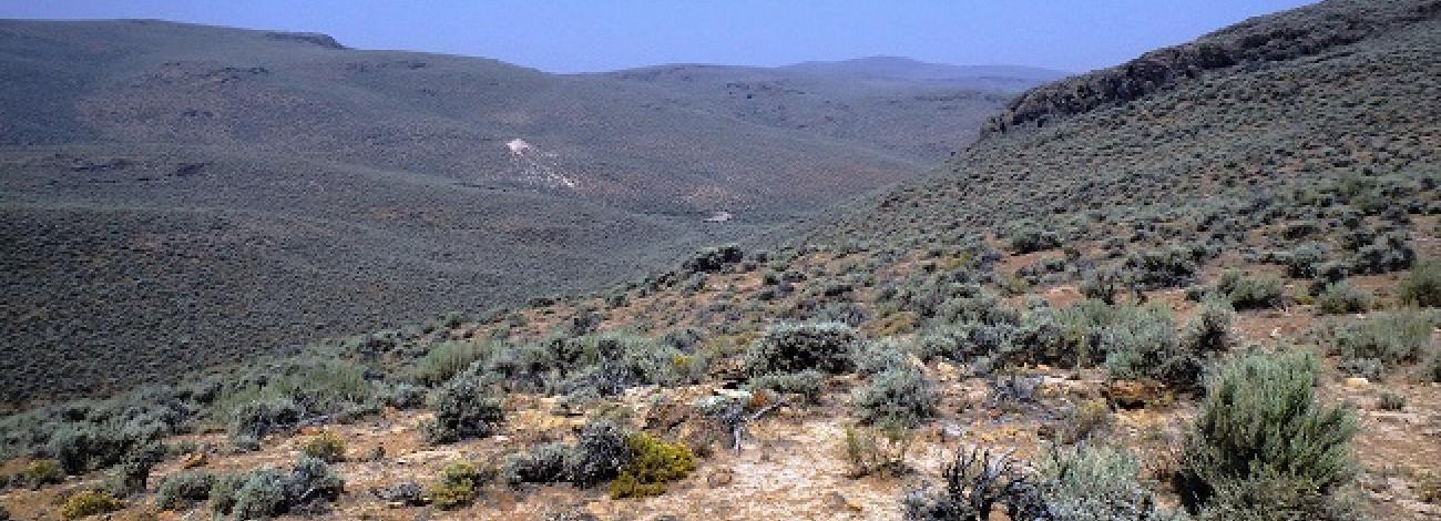
The Rincon WSA contains a variety of physical features, including portions of Rim, Lone Mountain and Oregon End Table. On the northwest side of the panhandle, Catlow Rim extends almost 15 miles into the WSA and reaches an elevation of 6,350 feet at Square Mountain in the north end of the WSA.
The part of Catlow Rim located within the WSA has several deep canyons with intermittent streams and is characterized by rugged, westerly-facing rock cliffs. A flat, open valley (part of Catlow Valley) lies between the toe of Catlow Rim and the western boundary road in the northwest portion of the WSA. Along this boundary road is the study area’s lowest elevation, 4,450 feet. Within a small area along the rim the study area’s greatest elevation change occurs. It features a drop from the top of Square Mountain to Catlow Valley, within a distance of approximately 1 mile.
The southwestern portion of the WSA contains the Lone Mountain area which extends 6 miles to the east from the western boundary. Lone Mountain and the surrounding hills are characterized by rock pinnacles and columns of volcanic origin. The summit of Lone Mountain near the southwestern boundary is the highest point in the study area, reaching an elevation of 6,903 feet. The average elevation of the study area is approximately 5,500 feet.
A large, generally valley lies between Lone Mountain and Oregon End Table to the southeast. Oregon End Table is a large, flat-topped plateau 3 miles by 5 miles in size. This area is extremely rocky and is characterized by around the table’s edge.
The WSA was initially studied under Section 603 of the Federal Land Policy and Management Act (FLPMA). Lands added after the wilderness inventory were studied under Section 202, also of FLPMA. These lands were included in the final Oregon Wilderness Environmental Impact Statement (EIS) filed in February 1990.


