
Jordan Craters Wilderness Study Area
Jordan Craters Wilderness Study Area (WSA) (OR-3-128) is located 15 miles west of U.S. Highway 95 in Malheur County, Oregon, approximately 20 miles northwest of Jordan Valley, Oregon.
The WSA contains 27,875 acres of BLM land and 25 acres of split-estate land. This land consists mainly of the Jordan Craters Lava Flow. An 80-acre private parcel is located within the study area at Crater Lake in the west-central portion of the WSA. A 40-acre parcel of private land is located at the end of a road to Coffee Pot Reservoir in the northern pan of the WSA. State lands, including the shoreline of Lower Cow Lake, form the eastern boundary. The northern boundary is formed by a county gravel road. BLM high standard dirt roads form the southern and western boundaries. The WSA is adjacent to Breaks WSA (OR-3-59) to the north, and Butte WSA (OR-3-120) to the south.
These are separated from the Jordan Craters WSA by roads.
Four dead-end roads totaling 5 miles and three ways totaling 3 miles are within the WSA; however, one 0.25 mile way has been fenced off, and a second 0.25 mile way is almost completely revegetated. The third way extends 2.5 miles over extremely rough, broken terrain.
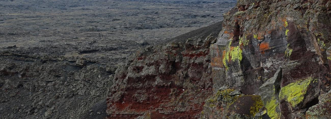
Most of the WSA is covered by the bare rock surface of a geologically recent extrusion of basaltic lava. It averages 4,450 feet in elevation and slopes gently toward the southeast. The surface is irregular with innumerable domes, cracks and sinks. Depressions in the southeastern tip of the flow fall below the water table and a number of water-filled potholes and ponds have been formed. The largest depression forms Batch Lake.
Topography adjacent to the lava flow varies from flat to gently-rolling. A north-south ridge, which defines the highest elevations in the WSA, borders the lava flow on the west. Vegetation on the lava is composed principally of lichens and mosses. The predominant vegetation outside the lava flow is a big sagebrush-bluebunch wheatgrass community.
Most of the WSA overlaps the Jordan Craters Research Natural Area (RNA) and Area of Critical Environmental Concern (ACEC). The RNA was designated to protect unique ecological, geological and biological features for scientific and educational endeavors. The ACEC was designated to provide special management to protect these features. Only the western portion and four peninsula-like fingers along the eastern boundary of the WSA are not included. The RNA and ACEC also extend beyond the northern and southern boundaries of the WSA, and these designations indicate the WSA’s scientific and educational importance.
The WSA was studied under Section 603, with additional acquired split estate lands studied under Section 202 of the Federal Land Policy and Management Act (FLPMA), and was included in the Final Oregon Wilderness Environmental Impact Statement filed in February 1990.


