
Clarks Butte Wilderness Study Area
Clarks Butte Wilderness Study Area (WSA) (OR-3-120) is located in Malheur County, Oregon, approximately 18 miles west of Jordan Valley, Oregon, and 6 miles north of U.S. 95.
The WSA contains 31,450 acres of BLM land and 40 acres of split-estate land. While there are no private inholdings in the WSA, two 40-acre private parcels are nearly enclosed by the boundary. One parcel is adjacent to the western boundary, and the other is on the eastern boundary.
The WSA is bordered on the north by a BLM low standard dirt road, on the east and south by private land, and on the west by BLM low standard dirt roads and fenced areas containing extensive land treatments (crested wheatgrass seedings). A 0.5 long, dead-end low standard din road enters the WSA, forming part of the boundary, and provides access to Junction Pit Reservoir from the western boundary road. There is one way in the WSA of 0.25 mile.
The WSA is adjacent to Jordan Craters WSA which is directly to the north of Clarks Butte WSA and separated from it by a road. The northern portion of Clarks Butte WSA includes a small portion (3,270 acres) of the Jordan Craters Research Natural Area (RNA) and Jordan Craters Area of Critical Environmental Concern (ACEC). The RNA was designated to protect unique ecological, geological and biological features for scientific and educational endeavors, and the ACEC was designated to provide special management to protect these features.
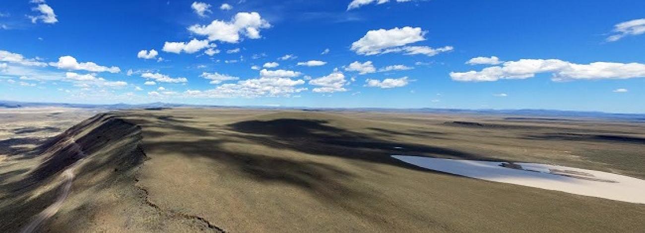
Clarks Butte is approximately 1 mile north of the study area’s center and Lava Butte lies approximately 1 mile south of the center. The WSA contains two distant lava flows. The older flow includes Clarks Butte, the probable source of the flow, and the surrounding slopes. This lava flow has weathered to a relatively smooth soil mantle and occupies the northern third of the WSA.
The younger flow consists of two probable sources, Lava Butte and an unnamed companion butte, and the surrounding gently sloping circular outflow. This flow occupies most of the southern two-thirds. The surface features here are more distinct than the older Clarks Butte flow. Craters, spatter cones, lava tubes, caves, domes and gutters still are recognizable even though some weathering and soil deposition has occurred.
Prior to a 1986 wildfire that decimated vegetative cover over the WSA, vegetation predominantly had been a Wyoming big sagebrush-bluebunch grass community. Except for remnant stands, sagebrush was eliminated by the wildfire. The community now consists predominantly of grasses and forbs. Much of the vegetation in the Lava Butte flow is relatively pristine because livestock grazing is limited by the area's lack of water and its broken surface.
The WSA was studied under Section 603 (and 202) of the Federal Land Policy and Management Act (FLPMA), and was included in the Final Oregon Wilderness Environmental Impact Statement (EIS) filed in February of 1990.


