
Lower Owyhee Canyon Wilderness Study Area
The Lower Owyhee Canyon Wilderness Study Area (WSA) (OR-3-110) is located in Malheur County approximately 4 miles northwest of Rome, Oregon. Highway 95 lies 5 miles south of the WSA. The WSA contains 72,250 acres of BLM land and 3,385 acres of split-estate land in nine parcels. In addition, 1,020 acres of private land in 11 parcels, are located within the boundaries of the WSA.
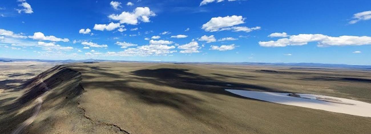
The boundaries of the WSA are formed by standard gravel roads, scattered private property parcels, a Congressionally-designated Wild and Scenic River boundary extending from the River in the southeast, and a line 300 feet from the along the Owyhee River in the east-central portion of the region. The study area is approximately 24 miles long north to south and is as wide as 9 miles east to west in the northern portion.
The Owyhee River Canyon is the central feature of this WSA. Along its 32-mile course through the study area, the canyon varies in width from to several miles, and varies in depth from 800 to 1,000 feet. The sheer canyon walls recede near Creek, The Hole in the Ground, and Mud Creek. The topography of the tributaries also varies from canyon-like to gently rolling slopes. Bogus Creek is spring fed and provides the only perennial water other than the Owyhee River. Lambert Rocks and Chalk Basin, which narrow the canyon near Ryegrass Creek, are highly scenic because their white appearance provides a contrast to the surrounding country.
Above the canyon rim, the plateau gently slopes upward towards the boundary of the WSA. The plateau has several playas that contain late winter and early spring water. Elevations range from 4,640 feet near the north boundary to 2,860 feet in the canyon bottoms near the south border.
Predominant vegetation in the WSA is big sagebrush with an understory of grasses. However, diversity of land forms and soils have resulted in a wide variety of ecological sites. On the plateaus above the Owyhee Canyon the major plant community is Wyoming big wheatgrass.
Chalk Basin contains unique ecological sites with barren soils and sparse vegetative communities. Where soils have developed or collected on the steep walls of the Owyhee River Canyon, the potential natural community is Wyoming big wheatgrass, which is in pristine condition due to its inaccessibility to livestock. Large slides of talus limit other vegetative growth to isolated pockets of giant wild rye. Along the river, riparian species include hackberry, chokecherry, willows, rushes and sedges.
The WSA was studied under Section 603 with additional acquired split-estate lands studied under Section 202 of the Federal Land Policy and Management Act (FLPMA), and it was included in the Final Oregon Wilderness Environmental Impact Statement (EIS) filed in February 1990.


