
Stonehouse Wilderness Study Area
The Stonehouse Wilderness Study Area (WSA) (2-23L) is located about 50 miles southeast of Burns, Oregon, in Harney County. The area is adjacent to the county road which runs between Oregon State Highway 78 (at Folly Farm) and Fields. The State Highway is 8 miles northeast of the WSA.
The study area contains 21,000 acres of BLM land in an elongated, roughly crescent shape. The WSA is 13 miles long, about 2 miles wide at the points of the crescent and 5.5 miles wide at the middle. The boundary is irregular; a small head-shaped peninsula protrudes from the northern end. The study area contains three parcels of private land, totaling 920 acres, located in the northern half of the WSA. The WSA contains one 320-acre and one parcel of split estate land.
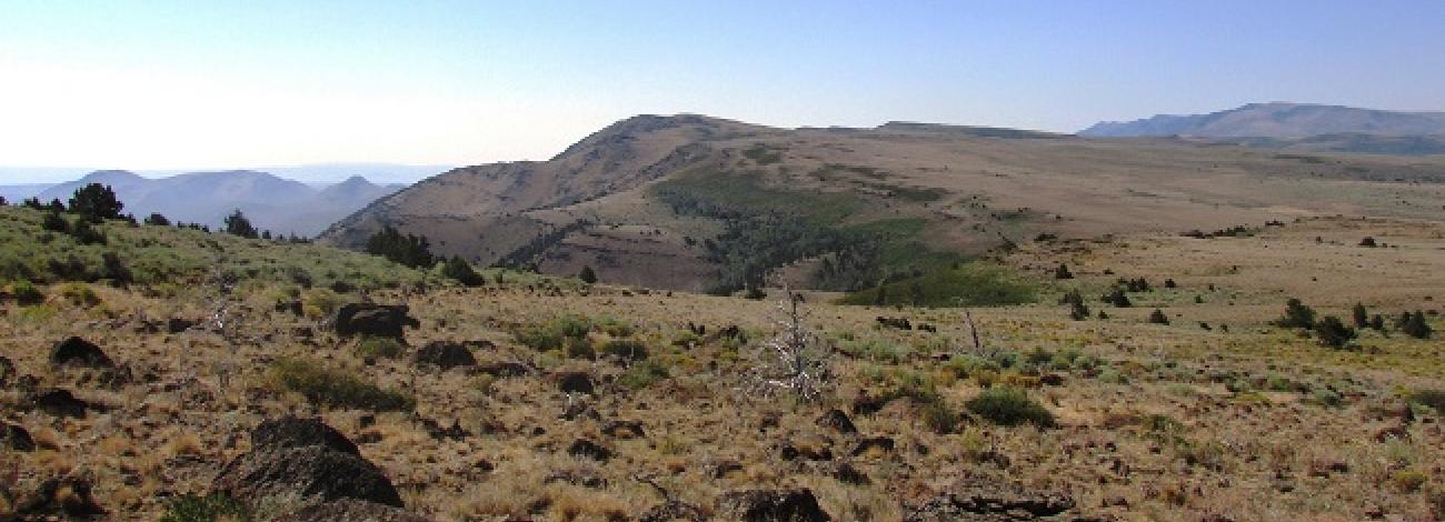
On all sides of the study area, the boundary is formed by a combination of private land and low standard dirt roads. In addition, a dead-end road which enters the WSA for 1.5 miles and a parcel of private land form part of the northwestern boundary. Topography in the Stonehouse WSA varies from very steep rock walls to wide, flat basins. The WSA is located on the northern end of the Steens Mountain fault block. The area has a high, steep-facing escarpment and gentle, open, west slopes. The highest elevation in the WSA is 7,200 feet at Stonehouse Peak. The lowest point is 4,100 feet at the base of the escarpment near the eastern boundary.
Steens Rim with its rise dominates the study area, running northeast along the eastern side of the WSA. The rim is cut by many shallow but steep east-flowing drainages. Stonehouse Creek is a other perennial stream that runs along the southern boundary. The other streams are spring-fed and intermittent.
The northwestern and central portions of the WSA contain gently-rolling hills and depressions, all sloping west. There are three shallow, intermittent lakes in the center of the area, partially surrounded and separated by rocky escarpments rising as high as 400 feet.
The northern quarter of the area is noticeable different from the rest. This part contains Oriana Flats (a wide, open valley) as well as numerous other flat areas and rolling hills.
Vegetation in the study area includes scattered dense juniper stands on the east-facing slopes and sides of the drainages. Some mountain mahogany is mixed with the juniper in the higher elevations and a few stands of aspen grow in the wetter locations near springs and drainages. Big and low sagebrush, as well as a variety of grasses, are found throughout the area.
The WSA was initially studied under Section 603 of the Federal Land Policy and Management Act (FLPMA). Lands added after the wilderness inventory were studied under Section 202, also of FLPMA. These areas were included in the final Oregon Wilderness Environmental Impact Statement (EIS) filed in February 1990.


