
North Fork Wilderness Study Area
The North Fork Wilderness Study Area (WSA) (OR-5-31) is located in Crook County, approximately 70 miles northeast of Bend, Oregon. It is about 200 miles southeast of Portland, Oregon and five miles north of the Prineville-Paulina Highway. The WSA is irregularly-shaped, curving along 12.5 miles of the North Fork of the Crooked River. It contains 10,985 acres of BLM land, 1,125 acres of U.S. Forest Service (USFS) land, and 240 acres of split-estate land on the BLM portion for a total of 12,350 acres. There are 480 acres of private inholdings located near the northern boundary on the BLM portion. The WSA is surrounded by public, private, and USFS land.
The western boundary of the WSA is formed by high standard gravel and bladed BLM and USFS maintained roads. The northern and eastern boundaries are formed by low standard or bladed dirt roads and private property. The southern boundary is formed by a road and private property. Two dead-end roads totaling one mile in length enter the study area, forming part of the boundary.
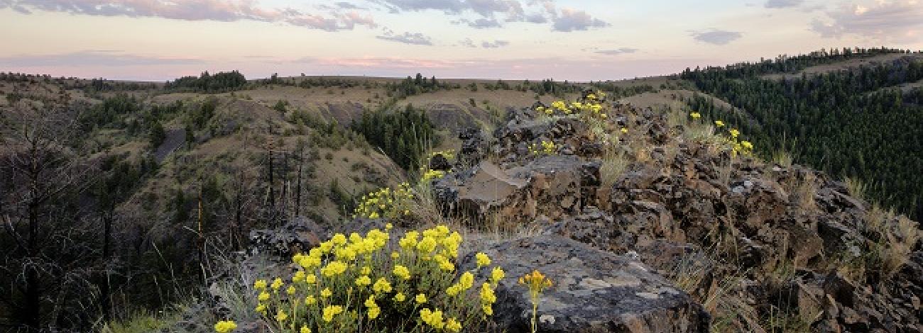
Basalt canyons walls in the WSA drop off the grassy plateaus into the river canyon below. Ponderosa pines and Douglas fir line the canyon bottoms. The North Fork of the Crooked River meanders for about 7 miles through the heart of this WSA and rainbow trout are found along its pools and riffles. Two small waterfalls are located along this stretch of the river. The upper plateaus are rolling and have scattered trees and large open areas. Vegetative communities range from ponderosa pine and grass in the drainages to low sagebrush and bunchgrass on the rockier areas. Numerous side canyons cut into the main canyon including Fox Canyon Creek and Committee Creek. Other water sources within the WSA include springs, seeps and smaller perennial streams.
The North Fork is a tributary of the Crooked River and has an average annual flow of 123 cubic feet per second and an average annual yield of 90,000 feet. Overall water quality meets State water quality standards. Designated as a National Wild and Scenic River in October 1988, an 11-mile river segment in the WSA is classified as wild and 1.4 miles are classified as scenic.
The WSA was studied under Section 603 of the Federal Land Policy and Management Act and was included in the Final Oregon Wilderness Environmental Impact Statement (EIS) filed in February of 1990.


