
Deschutes Canyon–Steelhead Falls Wilderness Study Area
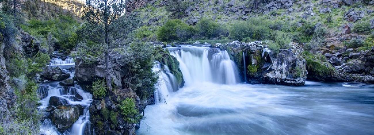
The Deschutes Canyon-Steelhead Falls Wilderness Study Area (WSA) (OR-5-14) is part of a larger study area that includes U.S. Forest Service lands. This WSA is located in a triangle formed by the towns of Madras, Redmond and Sisters, in Central Oregon. The Steelhead Falls study area is a long narrow area located along the upper Deschutes River, within and adjacent to the U.S. Forest Service-administered Crooked River National Grasslands.
This study area actually consists of two subunits separated by a 40-acre parcel of Forest Service land and a parcel of private land. For purposes of this report these two subunits will be discussed as one area. Its length is approximately 10 miles, and its width vanes from 0.25 mile to 2 miles.
The study area boundary is a combination of property lines and roads. The WSA is accessible from all directions: Crooked River Ranch on the east, Road 63 through Cove Palisades State Park to the north, USFS Road on the west, and Lower Bridge Road to the south. There is no public vehicle access to the river from within the WSA. Year-round hiking access is available to Steelhead Falls from a Crooked River Ranch road east of the Deschutes River.
The BLM inventoried the Steelhead Falls area (WSA OR-5-14) during the wilderness inventory in 1978. In 1982, a decision was made that the Deschutes Canyon area would be jointly studied by the USFS and BLM with the Forest Service being the lead agency.
The resulting information is the combined efforts of both agencies, focusing on the wilderness characteristics and potentials for wilderness manageability. Total area included in this further planning area is 18,402 acres (BLM 3,240 acres, State of Oregon 40 acres, private lands 4,891, and FS 10,231).
The beauty and wildness of the Deschutes River canyon increases with the change in elevation of the steep-sloped canyons as one proceeds north toward Lake Billy Chinook.
The geology of the Deschutes Canyon is characterized by intra-canyon Basalt and sedimentary layered rock formations of varying thicknesses, colors and textures. Truly interesting combinations of reddish brown, light tan, white, light and dark grey multicolored basalt and sedimentary textured formations captures one's attention. They leave the visitor with a lasting impression that these formations were bisected by the Deschutes River over several thousand years.
The area is surrounded by the Crooked River Ranch (a private subdivision) to the east, Lake Billy Chinook to the north, by low-density rural populations to the south and farmlands to the west.
The BLM lands were studied under Section 202 of the Federal Land Policy and Management Act as they have wilderness values only in conjunction with an adjoining agency’s area. They were included in the 1990 U.S. Forest Service Final Environmental Impact Statement/Land and Resource Management Plan for the Ochoco National Forest and Crooked River National Grassland.


