BLM New Mexico History
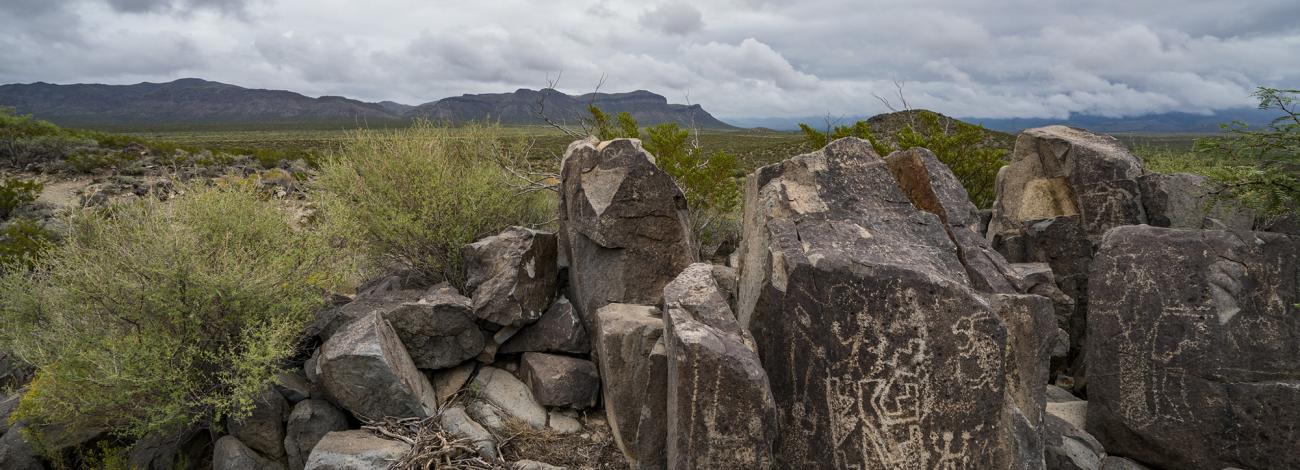
New Mexico is a treasure trove of public lands from ancient rock art to towering sandstone hoodoos. New Mexico has attracted human activity since prehistoric times. Evidence of ancient use can be found throughout New Mexico including rock art at the Three Rivers Petroglyphs Site.
The origins of the BLM’s New Mexico State Office date to July 22, 1854, when Congress established the offices of Surveyor General for the New Mexico Territory (September 9, 1950) and the Kansas Territory (May 30, 1854). The General Land Office (GLO), established April 25, 1812, appointed William Pelham as the first Surveyor General of New Mexico Territory on August 1, 1854 and John Calhoun was appointed as the first Surveyor General of Kansas Territory on August 4, 1854. One year later, the U.S. Army established Fort Stanton (now the Fort Stanton-Snowy River Cave National Conservation Area) as an Infantry and Cavalry post in the east-central New Mexico Territory to protect early settlers in the region in 1855.
The Surveyors General represented the GLO with the mandate to extend the Public Land Survey System to the territories of New Mexico and Kansas, and, in the case of the Surveyor General of New Mexico Territory, “to ascertain the origin, nature, character, and extent of all claims to lands under the laws, usages, and customs of Spain and Mexico.”
When Pelham took his post in Santa Fe, he arrived in a territory with a long history of established settlements including Native American and Hispanic settlements that had existed for centuries. Indigenous people have been in present‑day New Mexico for as long as 23,000 years as indicated by human footprints preserved in hardened mud at White Sands National Monument. Indigenous people settled throughout New Mexico from the Four Corners Region to the southern deserts creating vibrant communities with dwellings ranging from caves and rock shelters to pit houses to large structures such as the Chacoan outlier sites, several of which are administered by the BLM and open to visitors.
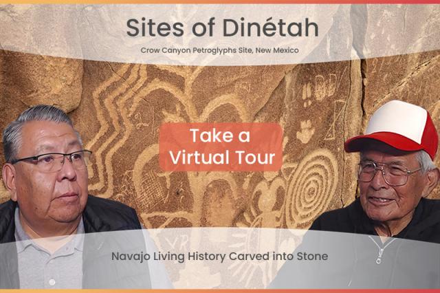
The descendants of these people, who created most of the rich archaeological record of New Mexico, are living here today — many in the communities established by their ancestors maintain sincere connections to their ancestral lands at sites such as Kasha-Katuwe Tent Rocks National Monument. These ancestral sites have long been used by Pueblo, Dine’ (Navajo) and ‘Nde (Apache) peoples as well as later arrivals such as the Comanche. Today, BLM continues to work with our tribal partners on activities and projects on public lands of interest.
Spanish conquistadors began to explore the New Mexico region in 1540. The artery of trade commerce during this period was the El Camino Real de Tierra Adentro National Historic Trail, the "Royal Road of the Interior." Spanish settlers created several towns in the province, mostly in the Rio Grande Valley and the northern portion of present‑day New Mexico. An organized rebellion in 1680 of the Pueblo nations, known as the Pueblo Revolt, expelled the Spanish from the area until the Spanish reasserted control in 1692. Spanish rule lasted until Mexican independence on September 16, 1821. The Mexican Government ruled the province until the Treaty of Guadalupe Hidalgo on February 2, 1848, when the United States assumed control of New Mexico.
During their rule, the Spanish and Mexican governments issued land grants to individuals as rewards for their service to their government and to groups who wished to establish settlements. After the United States assumed control of the Territory, the GLO has issued patents for 23 Pueblo land grants in New Mexico for existing communities (but not the greater traditional use areas) per the Treaty of Guadalupe Hidalgo.
The New Mexico Land Grant Council was created by the New Mexico State Legislature by New Mexico State Statute (§ 49-11-3).The State of New Mexico established the New Mexico Land Grant Council to provide advice and assistance to land grants and to serve as a liaison between land grants and the federal, state and local government. Today, the BLM continues to coordinate with the New Mexico Land Grant Council to provide notice of proposed activities on public land which might affect land grant communities so that the communities may provide input to the BLM regarding such activities.
BLM New Mexico also has a rich history in managing mining on public lands. The Lake Valley Back Country Byway offers a meandering 48-mile drive on paved roads which take visitors through ranching and mining country and passed the ruins of the 1880s mining town of Lake Valley.
When the GLO issued patents under a variety of land disposal laws such as the Homestead Act of May 20, 1862; the General Mining Act of May 10, 1872; and the Stock‑Raising Homestead Act of December 29, 1916 they reserved the mineral rights for the United States. In 1946, Congress merged the GLO and the U.S. Grazing service to create the Bureau of Land Management, which has continuously managed the federal lands and minerals for the public.
Today BLM administers 44.5 million acres of mineral estate in New Mexico (35.8 million acres), Texas (5.5 million acres), Oklahoma (2.2 million acres, and Kansas (1.0 million acres) where the commercial production of minerals dates to copper production in 1801 at what is now the Chino copper mine in Grant County, New Mexico.