
Recreation for all: improving accessibility information
The Bureau of Land Management is dedicated to ensuring that everyone has an opportunity to enjoy their public lands. We do this by providing access to facilities, programs, services, and activities for people with disabilities. We also do this by enhancing information available about these opportunities. For more than a year, a talented team of outdoor recreation planners, geospatial data experts, web content coordinators, communications staff, and writer-editors, led by former BLM Accessibility Program Lead Dave Jeppesen, have been doing just that.
The BLM launched an accessible recreation opportunities map in October 2023. The map shows some of our many recreation sites with accessibility amenities. When you select an accessibility icon on the map, details about the site appear in a pop-up box, along with a link to a “Visit” page that has more information.
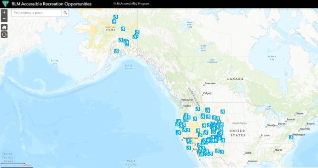
What is a “Visit” page? Most BLM recreation sites have a web page filled with useful information, including a map, directions, contact information, site description, fees, and more. BLM national monuments and visitor centers have other types of informational web pages. For simplicity, in this article we refer to them all as “Visit” pages.
“Visit pages are like a travel guide for public lands,” says Gavin Hoban, former Recreation Geographer for BLM Oregon/Washington. “People use them to learn about a location, including its purpose and history. Equally important, the public can use them to study the logistical nuts and bolts of visiting a site or facility.”
Providing accessibility information on Visit pages adds tremendous value, especially for people with limited mobility and other types of disabilities. Without that information, they would be left guessing. These details can help visitors with disabilities make informed decisions about their travel plans.
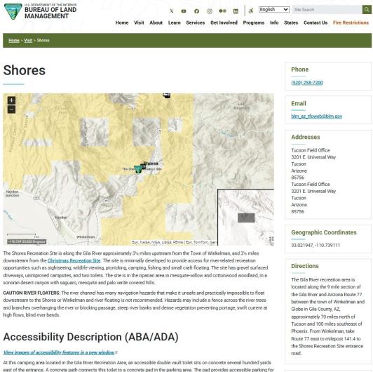
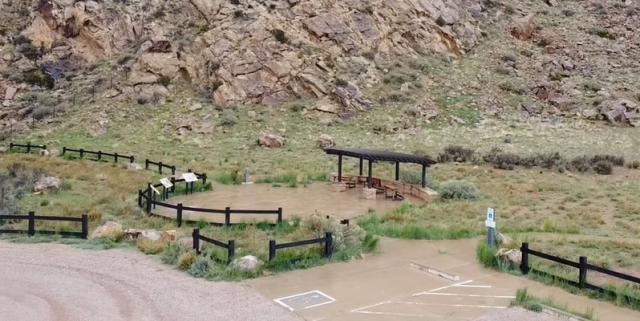
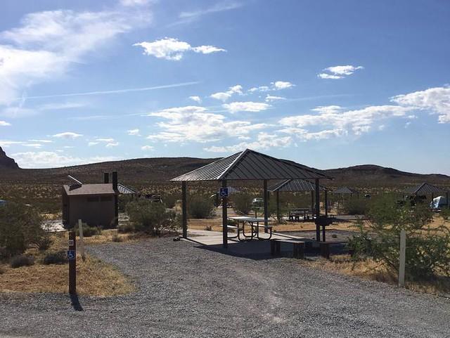
Enhanced Accessibility Descriptions. The accessibility information Hoban discusses includes written and photographic descriptions of accessibility features such as toilets, campsites, picnic tables, and trails. We also include other useful information, like whether the site has cell service or a camp host. The descriptions include cautions—for example, noting where a parking lot might be a distance from a recreation site or a water spigot that sits in gravel might pose challenges for someone using a wheelchair or a walker.
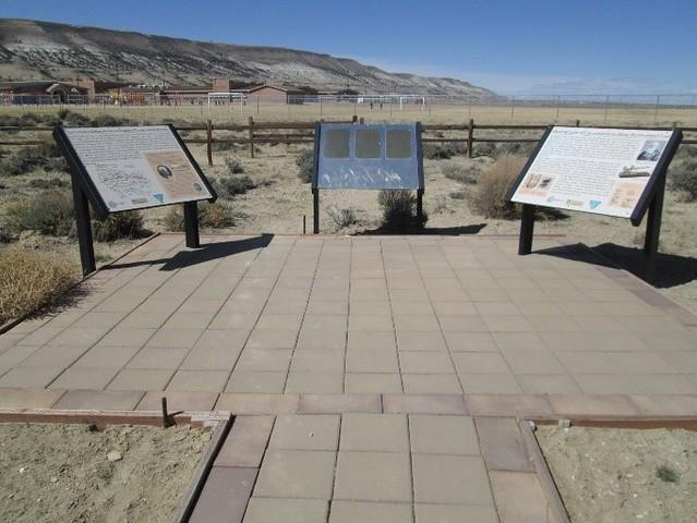
While many descriptions focus on amenities that support visitors with limited mobility, we also describe features for people with other disabilities, such as Braille interpretive signs at the Overland School Interpretive Site in southern Wyoming for people with low vision, and virtual tours at Piedras Blancas Light Station or Cosumnes River Preserve in California for neurodivergent visitors and others who want a preview before visiting a new place. We have added enhanced descriptions to more than 100 recreation sites, so far.
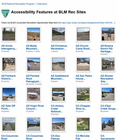
To complement the written descriptions, we also included photos of each site’s accessibility features, which can help visitors decide which sites they’re able to explore. The photos are in a Flickr album, linked on the site’s Visit page. These photo albums are in a Flickr Collection, called Accessibility Features at BLM Rec Sites, in alphabetical order by state, providing quick access to view the features of more than 76 sites, to date.
Phase 1 – The Set Up
During Phase 1 of this accessibility project, which began in late 2023, the Accessibility Team accomplished the following:
Conducted outreach. Met with accessibility specialists at the National Park Service and Bureau of Reclamation to learn from their accessibility efforts.
Selected sites. Selected a dozen campgrounds and visitor centers and surveyed field staff to gather and validate data and develop a process to scale up.
Interdisciplinary collaboration. Worked with geospatial experts, data stewards, and the BLM web team to capture and track the right data.
“Our goal has been to collect, store, and make available accurate, relevant, and credible data,” said Dennis Byrd, national recreation program data steward.
Phase 2 – The Implementation
Based on feedback from Phase 1, BLM states wanted to select their own sites to feature. Phase 2 began with a request to the field to send us the name of one site per district, or five sites per state.
Started with Utah. BLM Utah’s Evan Glenn, recreation program lead, and Jeremy Dyer, former public affairs specialist, volunteered to be first. With their help, we improved our process while updating nearly 25 Visit pages for recreation sites in the state.
Covered all recreation sites for some field offices. Working with enthusiastic recreation specialists, like David Byers in California’s Redding Field Office and Tony Johnson and Robert Walter in Arizona’s Tucson Field Office, we updated Visit pages for all the recreation sites within their field offices.
Received excellent state office support. Some BLM state office program leads, including Arizona’s Michelle Ailport, Idaho’s Shannon Bassista, and Oregon/Washington’s David Ballenger and Gavin Hoban, participated in all of the calls with local staff in their state.
As Phase 2 comes to an end, we will enhance Visit pages with written and photographic descriptions of accessibility features for more than 110 BLM recreation sites, in addition to updating the BLM Accessible Recreation Opportunities Map, with the assistance of Laura Golon, GIS Database Analyst.
Phase 3 – The Future
Phase 3 will tie to goals of the Expanding Public Lands Outdoor Recreation Experiences Act, known as the EXPLORE Act. Title II Access America addresses access of public lands for people with disabilities, Veterans and active military, and youth, as well as other public lands visitors. It directs agencies to assess and expand accessibility of recreation sites and to update public information about those sites.
Consistent with Phase 1 and 2 efforts, Title II provides a compass for Phase 3, during which the Accessibility Team will do the following:
Develop partnerships with other agencies and organizations.
Focus on gathering and sharing accessibility information on trails.
Implement new recreation data standard to provide more complete and consistent information on recreation maps and webpages.
Continue to assist field staff and encourage their participation in updating Visit pages.
Provide informal training on legal underpinnings of accessibility and other topics.
Jessica Jia, former public affairs web lead for BLM Nevada, wrote descriptions and took photos for several sites in Nevada during Phase 2.
“It was both rewarding and impactful,” said Jia. “Joining the accessibility team was one of the most encouraging and helpful connections I came across in the BLM. The benefits of this project are clear on so many levels.”
Related Content
Related Stories
- Reel Partners: BLM and Wyoming Game and Fish Cast a Line for Kemmerer’s Next Generation
- BLM law enforcement medical rescue team brings advanced care to public lands
- Great American Clean Up Brings Accessibility, Stewardship, and Community Together at the Jupiter Inlet Lighthouse ONA
- Boating Paradise: GAOA Funding Enhances Popular Recreation Site Along Montana’s Yellowstone River
- Discover kid- and family-friendly recreation on BLM-managed public lands in Arizona