
Recreation for all: Exploring accessibility on Idaho’s public lands
The EXPLORE Act, or the Expanding Public Lands Outdoor Recreation Experiences Act, is designed to improve access to outdoor spaces for people with disabilities, veterans, and children, among others. In support of that law, over the next year we will explore accessible public lands, state by state, managed by the Bureau of Land Management on behalf of the American people.
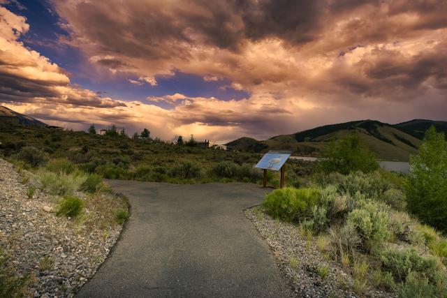
BLM Idaho manages nearly 12 million acres of public lands for the use and enjoyment of present and future generations. This month, we will discover sites on Idaho’s BLM-managed public lands where people of all abilities can view dark skies; fish, boat, camp, or picnic; bike, walk, or roll along trails and boardwalks; or drive scenic back roads, all with accessibility in mind.
Each visitor’s accessibility needs are different. Contact the local BLM office or refer to the BLM Visit page to learn about the accessibility features of a particular site. A Visit page is the webpage for a specific BLM site. All Visit pages have a map, directions, site description, and fees, if applicable; some Visit pages also have detailed descriptions and photos of the site’s accessibility features. Blackwell Island Recreation Site, mentioned below, is a good example of a descriptive Visit page.
Dark Skies/Quiet Recreation – Craters of the Moon National Monument and Preserve
Craters of the Moon National Monument and Preserve’s central feature is a 52-mile-long crack in the earth’s crust, known as the Great Rift, in south-central Idaho. The landscape was created by multiple volcanic eruptions that began 15,000 years ago and lasted for thousands of years. In addition to the well-preserved open rift cracks, the site showcases other volcanic features, such as flood basalts and spatter cones.
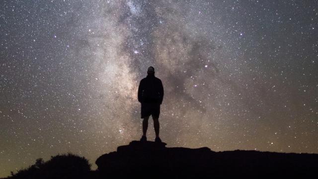
Located north of Interstates 84 and 86, west of Interstate 15, south of U.S. Route 26, and halfway between Twin Falls and Idaho Falls, Craters of the Moon was designated as an International Dark Sky Park in 2017. This is the perfect place to stargaze with a ceiling of stars above your head and a carpet of basalt beneath your feet, surrounded by stillness and quiet. Here is where many come to connect with the cosmos and find their peace.
In the United States, 80% of the population is unable to see the Milky Way from their homes, due to the glare from streetlights and other forms of light pollution. A full 99% of the population lives under light-polluted skies, according to DarkSky International. The BLM manages areas with some of the darkest night skies in the United States. As lighted skies continue to increase and spread, places like Craters of the Moon become more precious. To learn more about the values of night skies and darkness, refer to BLM Technical Note 457, Night Sky and Dark Environments: Best Management Practices for Artificial Light at Night on BLM-Managed Lands.
The Craters of the Moon National Monument and Preserve Travel Map shows that the area is jointly managed by the BLM and the National Park Service. The BLM Shoshone Field Office manages the more remote lands, providing dispersed camping and increased solitude. The NPS manages the Visitor Center, developed campgrounds, and trails. The entire monument and preserve stretch across 750,000 acres.
Visitors with limited mobility can get close to the volcanic landscape features on any of the three short accessible trails shown on this trail map. Devils Orchard Nature Trail is a one-half-mile loop; North Crater Flow Trail, closest to the Visitor Center, is one-third mile each way, out and back; and the shortest trail, Snow Cone Trail, takes you one-tenth mile each way to see spatter cones. More details can be found on the Visit Idaho’s Top Wheelchair-Accessible Experiences in Idaho page, written by Cory Lee, a well-known, wheelchair-using traveler.
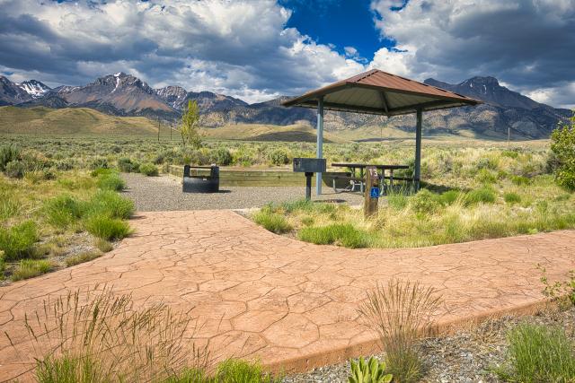
Accessible Fishing, Camping, and Trail – Joe T. Fallini Recreation Site
Beneath Idaho’s highest Lost River Range, and situated on the shores of Mackay Reservoir, the Joe T. Fallini Recreation Site provides opportunities for accessible recreation. Managed by the Challis Field Office in central Idaho, the site is designed to welcome visitors of all abilities with thoughtful infrastructure and a relaxed atmosphere. It was named after a dedicated public servant who grew up nearby. Joe T. Fallini worked for the BLM for more than 30 years, much of it in Idaho, before retiring in 1974, as the BLM Arizona State Director.
This recreation site has an accessible fishing pier, which provides a stable platform for anglers hoping to catch rainbow trout or kokanee salmon. Whether fishing is a regular pastime or a new hobby, the pier allows easy access to the water with plenty of space for visitors.
Just beyond the fishing pier, a paved interpretive trail winds through the site, offering an easy, graded route for visitors using wheelchairs, pushing strollers, or looking for a smooth walk. The trail has interpretive signs highlighting the local environment, wildlife, and geology of the Lost River Range.
The recreation site has 26 campsites with full RV hookups, five of which are accessible. There is also a dump station, restrooms, drinking water, day-use pavilion, and a boat ramp. The Joe T. Fallini Recreation Site is a beautiful place for visitors looking to camp, fish, or enjoy the quiet and the scenery with accessibility in mind.
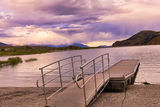
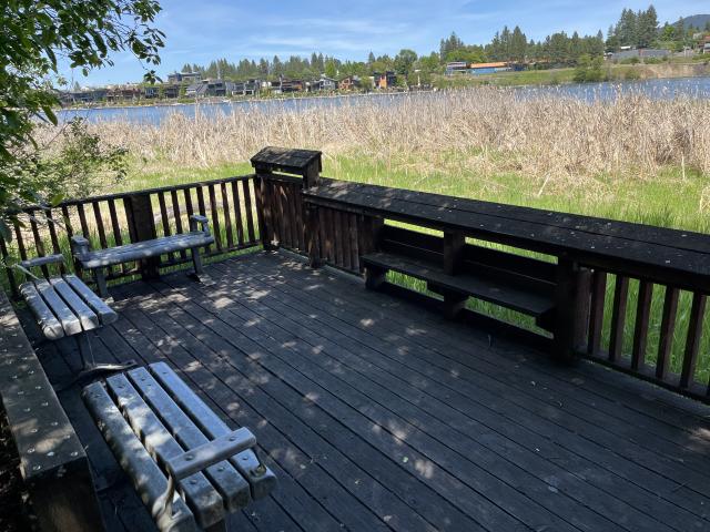
Accessible Day Use, Boating, and Fishing – Blackwell Island Recreation Site
The BLM Coeur d’Alene Field Office manages the popular Blackwell Island Recreation Site that provides boat access to Lake Coeur d’Alene and the Spokane River. This day use area has 15 developed picnic table pads, six of which are next to water along a canal, and a large reservable pavilion with power and lighting designed for group use. The pavilion and most of the individual picnic pads are next to the large parking lot, connected with concrete sidewalks, providing easy access for people with limited mobility.
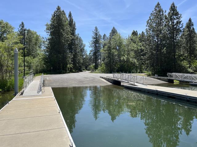
The sidewalks flow from the parking area and picnic sites to the boat launch, which has three accessible mooring docks and four launch lanes. One boat dock extends out into the Spokane River, providing accessible fishing opportunities as well as additional temporary mooring space.
If you prefer birdwatching or wetlands exploration, an accessible boardwalk with interpretive signs, benches, and viewing platforms ventures one-quarter mile into the riparian area along the Spokane River. Access to the boardwalk is at the northeast and northwest corners of the parking lot.
Accessible Nature Trail – Cress Creek Nature Trail
Northeast of the town of Idaho Falls, along the South Fork of the Snake River, is a self-guided, one and three-quarters-mile interpretive trail called the Cress Creek Nature Trail. The first one-half mile of the trail, which heads to the creek, is wheelchair accessible.
The rest of the trail is a gravel loop that becomes narrower and steeper as it climbs up the hillside. The loop trail follows and crosses the creek as it meanders through the cottonwood trees. It then loops down through juniper trees and bunchgrass vegetation, back to the creek and the wheelchair-accessible portion of the trail.
Learn about the plants, animals, and geology of the area before you go by reviewing BLM’s beautifully illustrated two-page brochure or 20-page interpretive guide. For example, it will tell you to keep a look out for moose, which love the watercress that grows in Cress Creek.
The site has accessible restrooms and ample parking. Tables and benches can be found along the trail.
Adaptive Bike Trail – Hang Tight and Hang Loose Trail System
For a little more action and adventure, check out the recently completed 3.5-mile Hang Tight and Hang Loose loop trail, which is part of the Croy Creek Trail System near the town of Hailey, Idaho. This multi-use trail was built with adaptive bicyclists in mind.
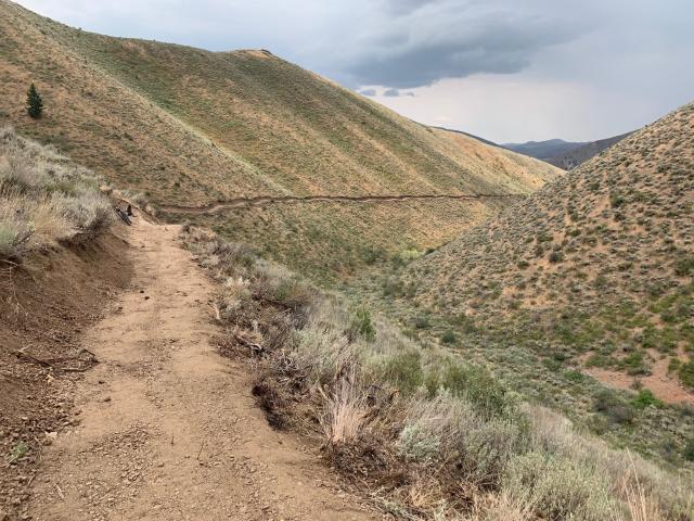
The trail is open to Class 1 e-bikes, traditional mountain bikes, and foot and horse traffic. Class 1 e-bikes are pedal-assisted with no throttle and a maximum assisted speed of 20 miles per hour. The Americans with Disabilities Act recognizes them as “Other Power-Driven Mobility Devices,” which means they can be used by individuals with disabilities to enhance mobility and accessibility.
The BLM Shoshone Field Office is partnering with the Wood River Trails Coalition to build 30 to 40 miles of new trail in the next few years around Bellevue and Hailey in south-central Idaho.
Shoshone Field Office Outdoor Recreation Planner John Kurtz said, “We’re getting ready to do some more trail construction later this summer. We worked with the Wood River Trails Coalition, the City of Hailey, and Blaine County Recreation District on the Hang Tight and Hang Loose trails and are anxious to get back out there and build more trails for people of all abilities to enjoy!”
To hear first-hand from a trail user, adaptive rider and Blaine County Commissioner, Muffy Davis, talks with John Kurtz about her experiences and perspectives riding the Hang Tight and Hang Loose Trail in this 7-minute YouTube video.
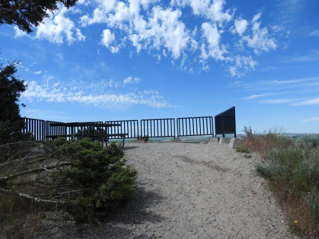
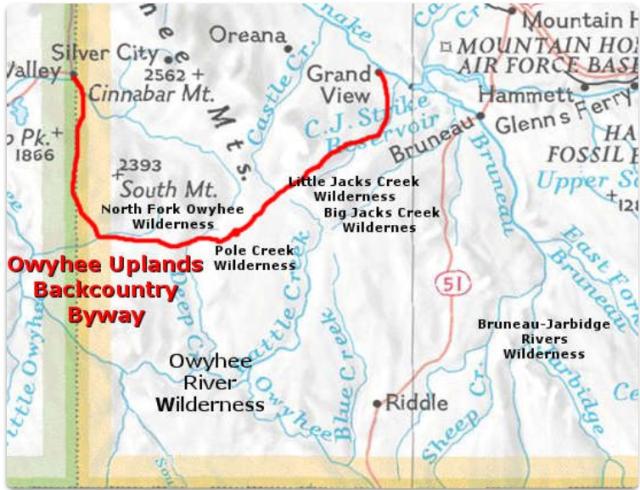
Accessible Driving Recreation – Back Country Byways
The BLM has a national network of 54 designated Back Country Byways, as shown on the BLM Back Country Byways System Brochure. These scenic, less-traveled roads take you on an adventure to explore the beauty of the western landscape without the crowds of more developed recreation sites. While BLM Back Country Byways can take you to outdoor recreation opportunities at campgrounds and trails, they also provide a perfect way to experience public lands from the comfort of your own vehicle.
The three BLM Back Country Byways in Idaho are all Type 1 roads, which means they can accommodate “normal touring cars,” including most wheelchair-accessible vehicles. The BLM manages scenic pullouts, trailheads, and campgrounds along these routes. Interpretive kiosks, brochures, and signage along the way can provide you with a deeper understanding of the area’s natural and cultural history.
Each BLM Backcountry Byway has a corresponding guidebook with detailed maps, safety considerations, and information about scenic, historic, cultural, and other attractions, mile-by-mile. The guidebooks, linked below for each Byway, may be useful to neurodivergent visitors, that is; people whose brains process, learn, or behave differently, including people on the autism spectrum; as well as others who like to know what to expect before traveling to a new place.
The guidebooks identify where to find scenic or historic pullouts and campgrounds, each of which have some level of accessibility. The local BLM office or Visit page for these sites can provide more information.
The Owyhee Uplands Back Country Byway, known locally as the Mud Flat Road, traverses 92 miles in Idaho and 12 miles in Oregon. This primarily gravel road travels across the Owyhee Plateau and Canyonlands showcasing high-desert scenery. As with most gravel roads, travel is best during dry months; portions may be impassable in wet weather. To learn more, download the Owyhee Uplands Back Country Byway Guide.
The Lewis and Clark Back Country Byway and Adventure Road is a single-lane gravel road with pull outs that is best traveled in good weather. This 36-mile loop road follows the Lewis and Clark National Historic Trail and the Continental Divide National Scenic Trail. Today’s landscape has not changed much since 1805, when the Lewis and Clark Expedition passed through. To learn more, download the Lewis and Clark Back Country Byway Guide or visit the Lewis and Clark National Historic Trail webpage.
The Main Oregon Trail Back Country Byway is 102 miles, following the main Oregon Trail from crossing the Snake River near Glenns Ferry to Bonneville Point, southeast of the town of Boise. It begins as a loop drive then along country roads where you can see Oregon covered wagon trail ruts. To learn more, download the Main Oregon Trail Back Country Byway Guide.
KC Craven, national program lead for Recreation and Tourism Benefits, said, “the BLM is partnering with Scenic America to modernize and revitalize its Back Country Byways Program. This includes updating signs, mapping tools, interpretive materials, and data collection, all across the entire BLM Byways network.”
These are just a few of the amazing areas the BLM manages in Idaho on behalf of the American people. The BLM is dedicated to ensuring that everyone has an opportunity to use their public lands by providing access to facilities, programs, services, and activities for people with disabilities. The BLM Accessibility Program provides details on opportunities, resources, laws, policies, and guidelines.
Useful Links
EXPLORE Act – to improve recreation opportunities on and facilitate greater access to federal public land.
Access Pass – free lifetime pass for United States citizens or permanent residents with permanent disabilities.
Military Lifetime Pass – free pass for Gold Star Families and Veterans.
Every Kid Outdoors – free pass for fourth graders and their families.
Accessible Activities in Idaho – Idaho Department of Commerce’s Tourism Development has a Visit Idaho website full of maps, resources, and ideas for recreation, including a section on accessible activities in Idaho.
Idaho Access Project – Part of Idaho Access Project’s mission is to facilitate accessible recreation outings.
Related Stories
- Birding Aravaipa Canyon: A morning of songs, color, and creekside adventure
- BLM, Partners Enhance Public Access at Popular Recreation Area
- Framed for Freedom: Bureau of Land Management Eastern States and the Legacy of National Historic Trails
- Volunteers and Partners Retrace 250 Years of History on the Anza Trail
- Reel Partners: BLM and Wyoming Game and Fish Cast a Line for Kemmerer’s Next Generation
Office
1387 S. Vinnell Way
Boise, ID 83709
United States