
Cottonwood Creek Trailhead | Wyoming
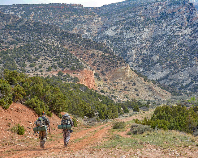
Located near the Cottonwood Canyon Campground and Day-Use site, this highly scenic trail is suitable for hiking and horseback riding (advanced riders). Cottonwood Canyon has steep, vertical cliffs. The elevation at the mouth of the canyon is 4,800 feet with the top of the canyon wall at 7,200 feet. At the upper end of the trail, the elevation at the creek is 7,000 feet and the top of the canyon wall is 7,900 feet.
The trail is about 4 1/2 miles long and winds through BLM-managed public land, Bighorn National Forest land and State of Wyoming land. The trail accesses the Bighorn National Forest where one can continue hiking or horseback riding on primitive roads and trails.
Vegetation in Cottonwood Canyon include narrowleaf cottonwood, willow, waterbirch, red osier dogwood, big sagebrush, juniper, mountain mahogany, Rocky Mountain maple, Indian ricegrass, ninebark, limber pine, Douglas-fir, aspen, and bluebunch wheatgrass.
Things to note: Bring drinking water as Cottonwood Creek disappears underground at times. If using water from the creek, filter it or otherwise treat before drinking.
COTTONWOOD CREEK TRAIL PHOTOS
BLM WYOMING KNOW BEFORE YOU GO
GEOREFERENCED MAPS
Contact Us
This site is managed by Cody Field Office; visit their page for office hours and directions.

Activities


Addresses
Cody Field Office
1002 Blackburn Street
Cody
Wyoming
82414
Geographic Coordinates
44.86783, -108.071024
Directions
Take Highway 14A until about 10 miles east of Lovell. Immediately on the east side of Bighorn Lake, after the causeway, turn left onto the John Blue Canyon Road (#1122). Take the first road on the right, travel this road for approximately 5 miles until you reach the campground and trailhead.