
Range Creek HMA
Overview
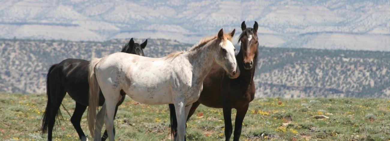
Horses have been a part of the Range Creek area at least since contemporary livestock use began. The origin of the wild horse herd is believed to be from horses once owned by the Preston Nutter Ranch. The stout, compact conformation and limited variation in color in the population support this theory of origin. Branded horses were allowed to run free in a semi-wild state and were periodically captured to obtain working stock and to brand the young horses. The herds were last officially gathered by the ranchers for branding in the early 1930s.
The dominant color in the herd is black, followed by bay and brown, with a few sorrels, chestnuts, pintos and palominos. Pintos have visibly increased in frequency on Flat Iron since 1997, with an increase in sorrels and chestnuts on Cedar Ridge. The horses on the herd management area (HMA) are average in size ranging from 700 to 1000 pounds.
The appropriate management level for the Range Creek HMA is 75-125.
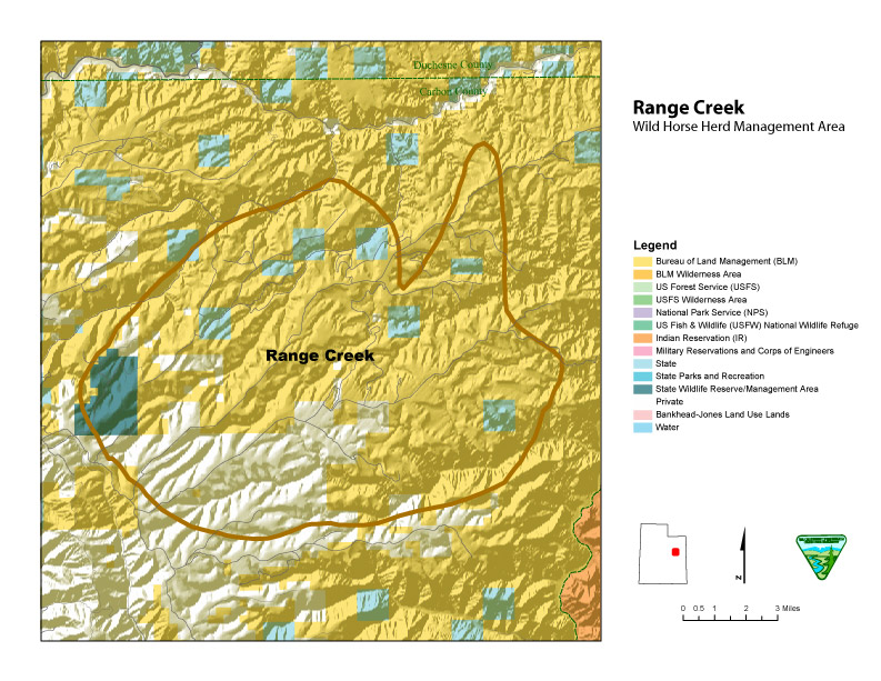
Location and Size
The Range Creek HMA is located on the West Tavaputs Plateau, 28 miles east of Price, Utah, in Carbon County. Access to the HMA is through Nine Mile Canyon and then up Cottonwood Canyon. It may also be reached by traveling through Water Canyon and over Bruin Point. Parts of this HMA are not accessible to the public due to private lands.: The HMA contains 43,235 acres of BLM land and 11,788 acres of Federal, State, and privately owned land for a total of 55,023 acres.
Topography/Vegetation
The HMA ranges from 5,600 to 8,900 feet in elevation and is typical of the Tavaputs Plateau area, varying from extremely rough to smooth terrain on sandstone benches. The steep-sided mesas and deeply incised drainages throughout the HMA could potentially create problems gathering horses. The wild horses primarily use the open benches and parks but do use wooded areas occasionally.
Annual precipitation is approximately 16 inches in the higher elevations with an average of 9.3 inches coming during the summer (May through September). Precipitation as of May 2019 was 26.70 inches or 107 percent of normal (water-year) at the Timberline weather station, according to data collected since 2007. Temperatures at the Timberline weather station range from an average monthly high of 74 degrees Fahrenheit in July to 28 degrees in December.
The HMA has several undeveloped springs and seeps that are used as water sources by the wild horses, as well as reservoirs and developed springs. Most of the developed water sources are in fair condition, with most in need of repair or general maintenance.
Wildlife
The HMA is within crucial winter range for rocky mountain elk and mule deer. Bighorn sheep substantial year-round habitat is adjacent to but outside the HMA. Several migratory species also utilize the HMA. They include, but are not limited to: Bald Eagle, Blue Grouse, Mexican Spotted Owl, Yellow Billed Cuckoo, and Sage Grouse.
Viewing Opportunities
Head north on Highway 123 from the Sunnyside Junction on Highway 10, ten miles east of Wellington. Follow the paved road up through East Carbon and Sunnyside to Water Canyon. Drive up Water Canyon to Bruin Point. Caution should be taken on this section of road. Due to the steepness of the terrain, four-wheel drive is required. Upon reaching Bruin Point, drive east approximately one mile to an unmarked open gate to access Twin Hollow. Drive down the ridge to Twin Hollow (a green Utah Division of Wildlife Resources gate should direct you to the right, if not, you will end up in Cold Springs with no access out but the way you went in). Upon leaving the trees, there is a chance of seeing horses all the way across the ridgetop until dropping into Cottonwood Canyon. Binoculars will most likely be needed to see more than just a few horses, as well as deer, elk, bear, and other wildlife.
Visitors must plan on a full-day trip to visit the HMA, with most visitors driving either up Water Canyon and down Nine Mile Canyon to town or up Nine Mile Canyon and down Water Canyon. Other options include going up Water Canyon and down Twin Hollow to Nine Mile Canyon and up Dry Canyon and back down Water Hollow to town.
Special Travel Conditions
The main road through Nine Mile Canyon is a maintained paved road, traversable in dry weather with care, by passenger cars. However, once you reach the top of the ridges, the roads are too rough for cars to pass easily. The road up Water Canyon and all other roads require high-clearance vehicles. Summer storms and flash floods tend to damage even the well-maintained roads, so it is suggested that only four-wheel drive/high-clearance vehicles travel through the HMA. When wet, the roads in this area are very slick and muddy, and very dusty during extended dry periods. Due to these conditions, the roads remain rough and should be traveled with care. This HMA is also within a developing gas field and extra caution should be taken due to the work crew traffic and narrow roads with blind corners. Wilderness Study Areas occur adjacent to and within this HMA and at the end of many access roads. These Wilderness Study Areas are marked and have special travel restrictions not allowing motorized vehicles. Hiking and horseback riding in these areas are allowed.
Wild Horses and Burros of Utah
