
Sinbad HMA
Overview
Wild burros have occupied the San Rafael Swell area since the beginning of the Old Spanish Trail in the early 1800s. Early travelers would lose animals or have them run off by early native American tribes or transient livestock rustlers. Many of these animals were headed for California to be traded or sold and were of good sound stock lineage. The herd was also augmented through the release of domestic burros from local ranches.The HMA contains 89,465 acres of BLM lands and 9,776 acres of Federal, State, and privately owned land for a total of 99,241 acres. The appropriate management level for Sinbad HMA is between 50-70 animals.
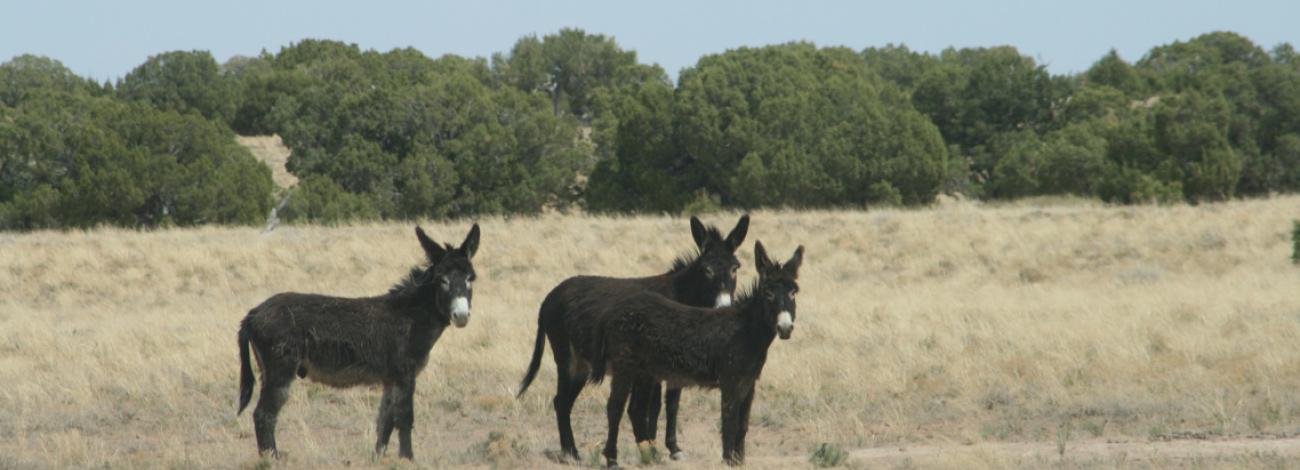
The dominant colors of the burros within the herd management area are black and grey. The burros on this HMA are average in size ranging from 400 to 500 pounds.
Location
The Sinbad Herd Management Area (HMA} is located 30 miles west of Green River. It extends up to 18 miles on both sides of l-70 from the San Rafael Reef to Eagle Canyon.
Topography/Vegetation
The topography of the HMA is typical of the San Rafael Swell area, varying from extremely rough to level terrain on limestone benches. The steep sided mesas and deeply incised drainages in the northern and southeastern portions on the HMA create difficulties when gathering and removing excess burros. The wild burros primarily use the open benches and parks but do use wooded areas occasionally during inclement weather.
The HMA ranges from 4,400 to 7,000 feet in elevation and supports vegetation types ranging from pinyon and juniper woodland to desert shrub. The Pinion/Juniper vegetation type dominates the HMA and can be dense with minimal under story forage. Open grass parks have an understory of needle-and-thread grass and Indian ricegrass as the primary forage species.
The HMA has several undeveloped springs and seeps that are used as water sources by the wild burros, as well as 7 reservoirs, and multiple natural rock tanks across the area. The San Rafael River, itself, is accessible in some locations.
Annual precipitation is approximately 8.5 inches, with an average 5 inches coming during the summer (May through September). Temperatures in the nearest town of Emery, Utah range from an average monthly high of 78 degrees Fahrenheit in the summer to 10 degrees in the winter.
Wildlife
Antelope, bighorn sheep, kit fox and many other wildlife species can be found within the HMA as well.
Viewing Opportunities
For burro viewing, head northeast for approximately 4 miles on a graveled road from 1-70 exit 129 to the BLM Sagebrush Flat sign. Continue east 1/2 mile to a narrow freeway underpass. Go through the underpass and continue east on any one of several dirt roads. Burros may be seen from any one of the roads in this area. Also, watch along 1-70 from the rest stop (exit 141) 17 miles west of Green River to exit 129. Burros are commonly spotted from the interstate highway.
Special Travel Conditions
The loop around Reds Canyon and all other roads used to view burros require high-clearance vehicles. When wet, the roads in this area are very slick and muddy, and very dusty during extended dry periods. Due to these conditions, the roads remain rough and should be traveled with care. Wilderness Study Areas (WSA) occur within this HMA and at the end of many access roads. These WSA’s are marked and have special travel restrictions not allowing motorized vehicles. Hiking and horseback riding in these areas are allowed.