Grand Gulch Instant Study Area Complex
Values
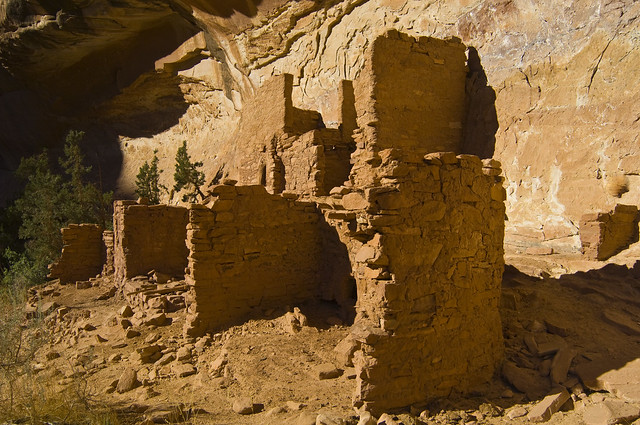
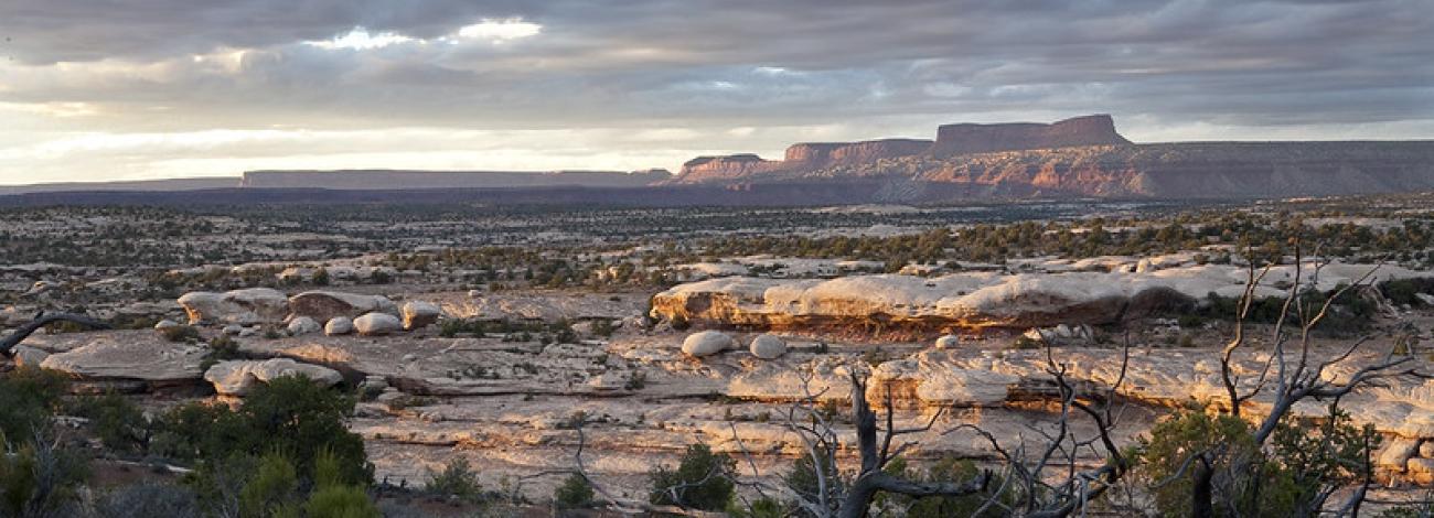
This WSA is in the Canyonlands Section of the Colorado Plateau Physiographic Province. This WSA is predominantly a network of sinuous canyons, totaling more than 190 miles in length, that are tributary to the San Juan River. Pinyon-juniper woodland, sagebrush, and blackbrush are the predominant types of vegetation. Canyons, pinnacles, pedestals, knobs, arches, and alcoves offer unique and dramatic and colorful views in nearly every part of the area. The area contains extensive remains of Ancestral Puebloan dwellers occupation from about 200 A.D. to 1300 A.D including lithic scatters, walled fireplaces, pictographs, petroglyphs, pithouses, pottery shards, towers, cliff dwellings, and kivas. The Grand Gulch Archaeological District (4,240 acres) was placed on the National Register of Historic Places in 1982. A portion of the northern boundary follows the Hole in the Rock Trail.
Visitation Information
Located in San Juan County, about 45 miles west of Blanding, UT and southwest of the Kane Gulch Ranger Station. From Blanding, head south on Highway 191 and turn right (west) onto Highway 95, continuing west for 28.4 miles. Turn left (south) onto Highway 261 and travel past the Kane Gulch Ranger Station. Multiple trailheads (Todie Flat, Bullet Canyon, Slickhorn Complex and Government trailheads) are located to the west of Highway 261 between the Kane Gulch Ranger Station and the Moki Dugway.
Visitor Advisory
Visitors should come prepared for backcountry conditions and adequately prepare for their trip. Knowledge of weather, terrain, and physical conditions can help ensure safety.
Flickr Album