
Unified Interior Regional Boundaries
Background
- The reorganization of DOI from 49 regions across 8 bureaus to 12 unified Interior Regions is complete. Unified Interior Region boundaries - based on watersheds but generally drawn along state lines to simplify coordination with external partners - became final on August 22, 2018
- Bureaus have amended their Department Manual chapters to officially align their regional/office boundaries with the Interior Region boundaries
- This crosswalk of bureau regions with Interior Regions will help you identify which Interior Region you are in, and who your bureau regional executive (e.g., regional or state director) is
- Reorganizing from 49 regions across 8 bureaus to 12 Unified Regions adds greater efficiency, accountability, collaboration and consistency across our bureaus
- Reorganization will make joint problem-solving and improved coordination between our bureaus and local partners easier, improving the experience for the customer, whether that is a government agency, permit seeker, or landowner
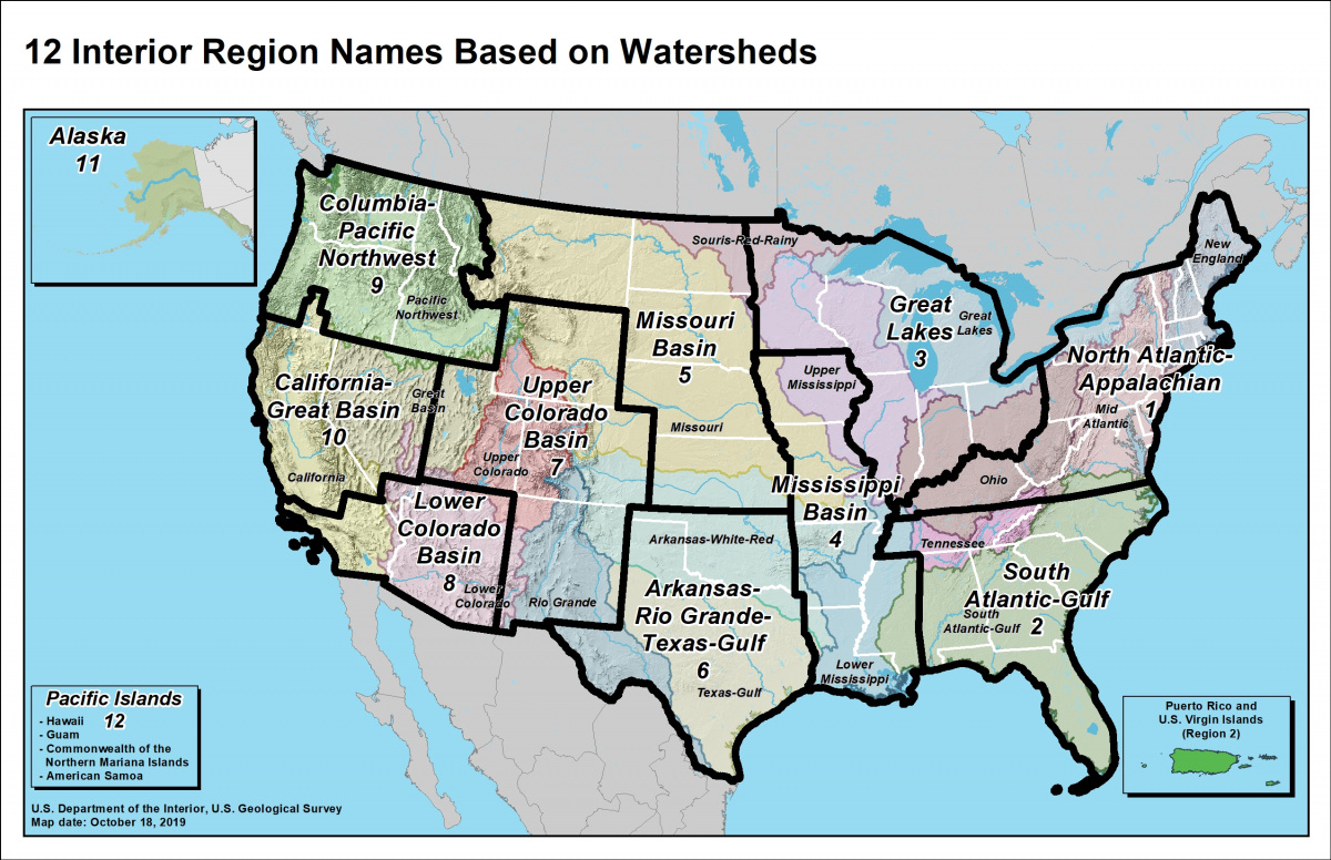
Unified Interior Regions
- Region 1: North Atlantic-Appalachian
- Region 2: South Atlantic-Gulf (Includes Puerto Rico and the U.S. Virgin Islands)
- Region 3: Great Lakes
- Region 4: Mississippi Basin
- Region 5: Missouri Basin
- Region 6: Arkansas-Rio Grande-Texas-Gulf
- Region 7: Upper Colorado Basin
- Region 8: Lower Colorado Basin
- Region 9: Columbia-Pacific Northwest
- Region 10: California-Great Basin
- Region 11: Alaska
- Region 12: Pacific Islands (American Samoa, Hawaii. Guam, Commonwealth of the Northern Mariana Islands)
For more information about the boundaries, the objectives, rationale and even downloadable maps, visit the Department of the Interior page.