
Steele Creek Townsite
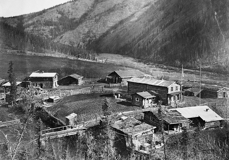
In its day, the small settlement at Steele Creek served vital needs along the chief overland trail between the historic towns of Eagle, along the Yukon River, and Chicken in the Fortymile drainage. The settlement provided basic services for traders, freighters, and other travelers throughout the first half of the 20th century. The roadhouse at the settlement served as an important social gathering place for locals during holiday festivities up until around World War II. Along with the roadhouse, the site also had a store and the necessary facilities to handle the travelers’ sled dogs and horse teams. A post office operated at the site from 1907 until 1951.
The construction of the Taylor Highway, finished in 1951, bypassed the site and signaled the final demise of the roadhouse and what was left of the small community. By the mid-1960s, the roadhouse and other remaining buildings were occupied by a placer gold miner who filed a mineral claim on the lands.
After passage of the Alaska National Interest Lands Conservation Act in 1980, the lands along the main stem of the Fortymile River became part of the Fortymile National Wild and Scenic River corridor. The Steele Creek mining claim was relinquished to the federal government in 2002 when the last contemporary miners left the site. Today, it sits on BLM-managed public lands for all to enjoy.
Location
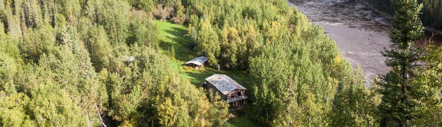
Alaska’s historic Steele Creek community is at the confluence of Steele Creek and the Fortymile River, inside of the Fortymile National Wild and Scenic River corridor. The site is found in the eastern interior part of Alaska, about 160 miles south of the Arctic Circle. It lies approximately six miles downstream from the main bridge over the Fortymile River, which is located on Alaska’s Taylor Highway at MP 112.7. This site is managed by the BLM Eastern Interior Office.
Site Layout
Steele Creek Roadhouse
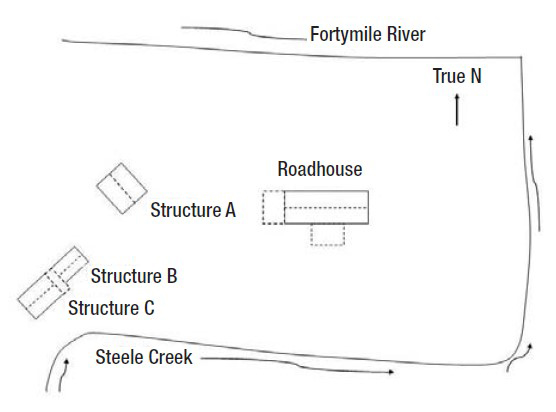
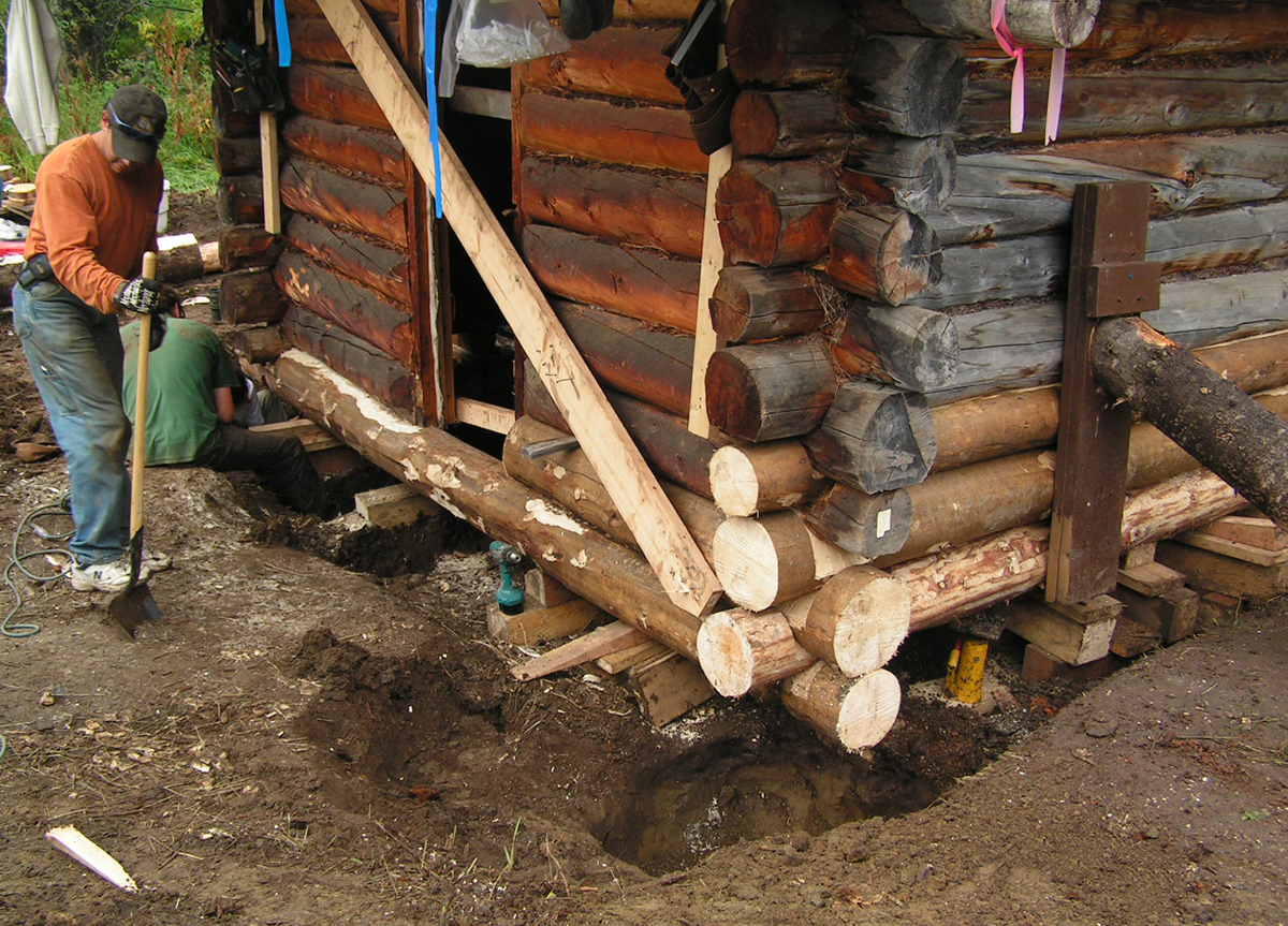
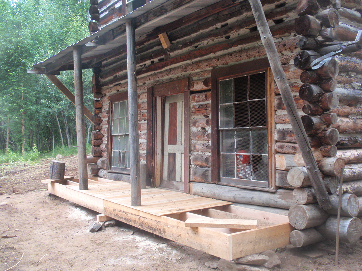
The Steele Creek Roadhouse, a site on the U.S. National Register of Historic Places, is the largest building remaining at the site. It is two full stories high, and measures 21 x 52 ft (~6.40 x 15.85 m). A 13 ft single-story shed on the western end of the building brings its total length to 65 ft. The building started out as a one-room, single-story log cabin with a gable roof, originally built in 1898. Historic photographs indicate that an additional ground floor room had been built, end-to-end, onto the original cabin by 1905, and that by 1911 a full second story of logs had been added along the whole length of the building. A gabled domestic cabin and single-story sheds with sloping roofs appear adjoining the south and west sides of the roadhouse in subsequent historic photos through the late-1930s. The roadhouse is the only historic, two-story log building remaining in the Fortymile drainage, and is certainly one of the oldest still standing anywhere in the interior of Alaska.
Other Structures
In addition to the roadhouse itself, three other log buildings are found at the site: “Structure A,” “Structure B,” and “Structure C,” all single-room, single-story log cabins with gable-style roofs.
- Structure A measures 20 x 24.5 ft (~6.10 x 7.50 m).
- Structure B is slightly smaller, measuring 13 x 21 ft (~4.00 x 6.40 m).
- Structure C is situated immediately south of Structure B, and measures 17 x 22.5 ft (~5.20 x 6.85 m). Architectural data suggest that Structure C was built much later than the others at the site, probably after the late-1960s. The builder intentionally placed Structure C close to and in line with Structure B and enclosed the 5 ft space between the two buildings as a shared entryway.
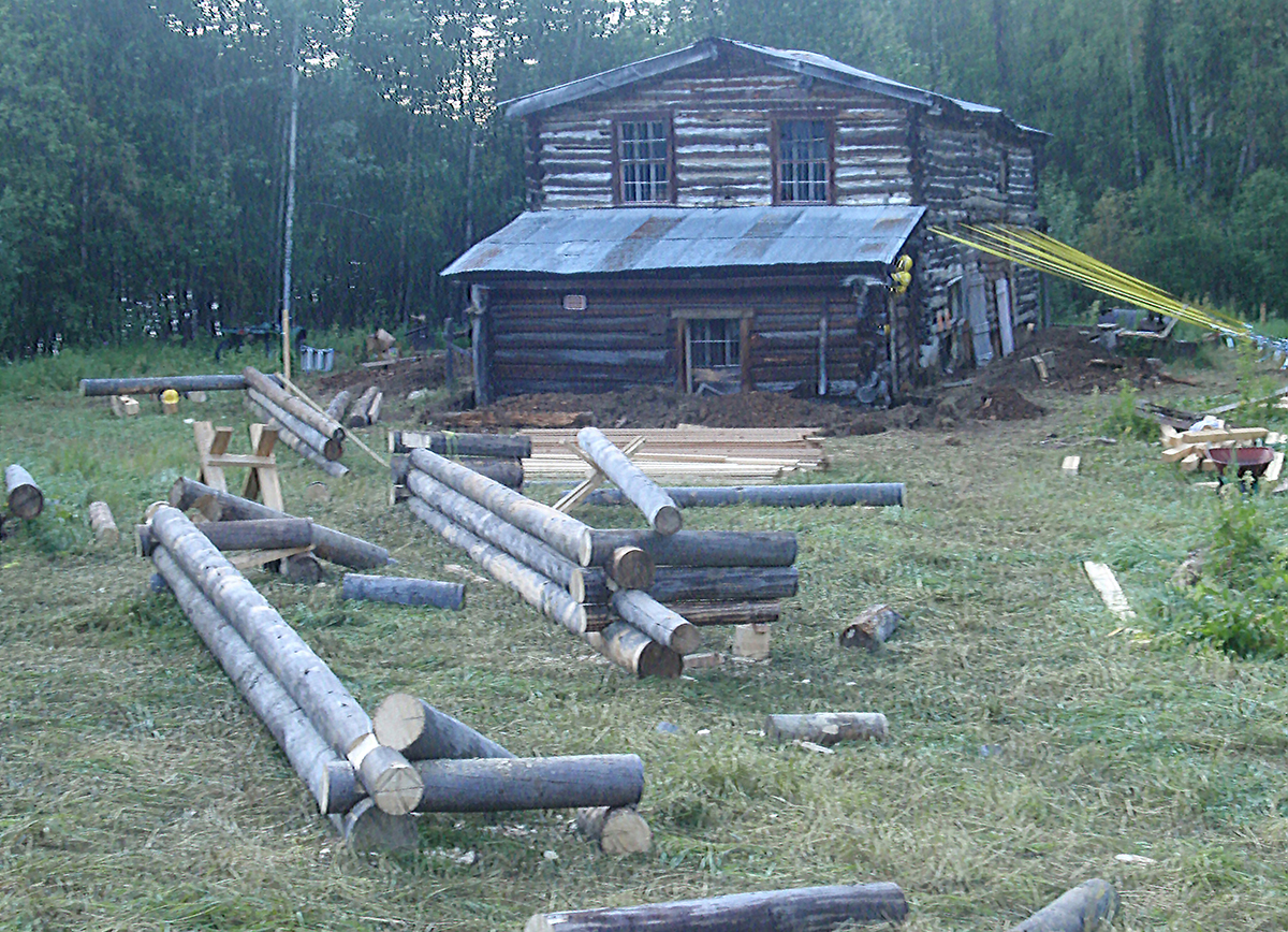
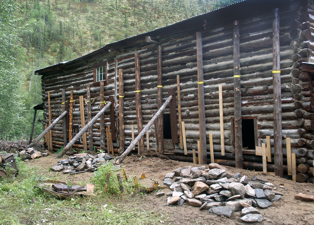
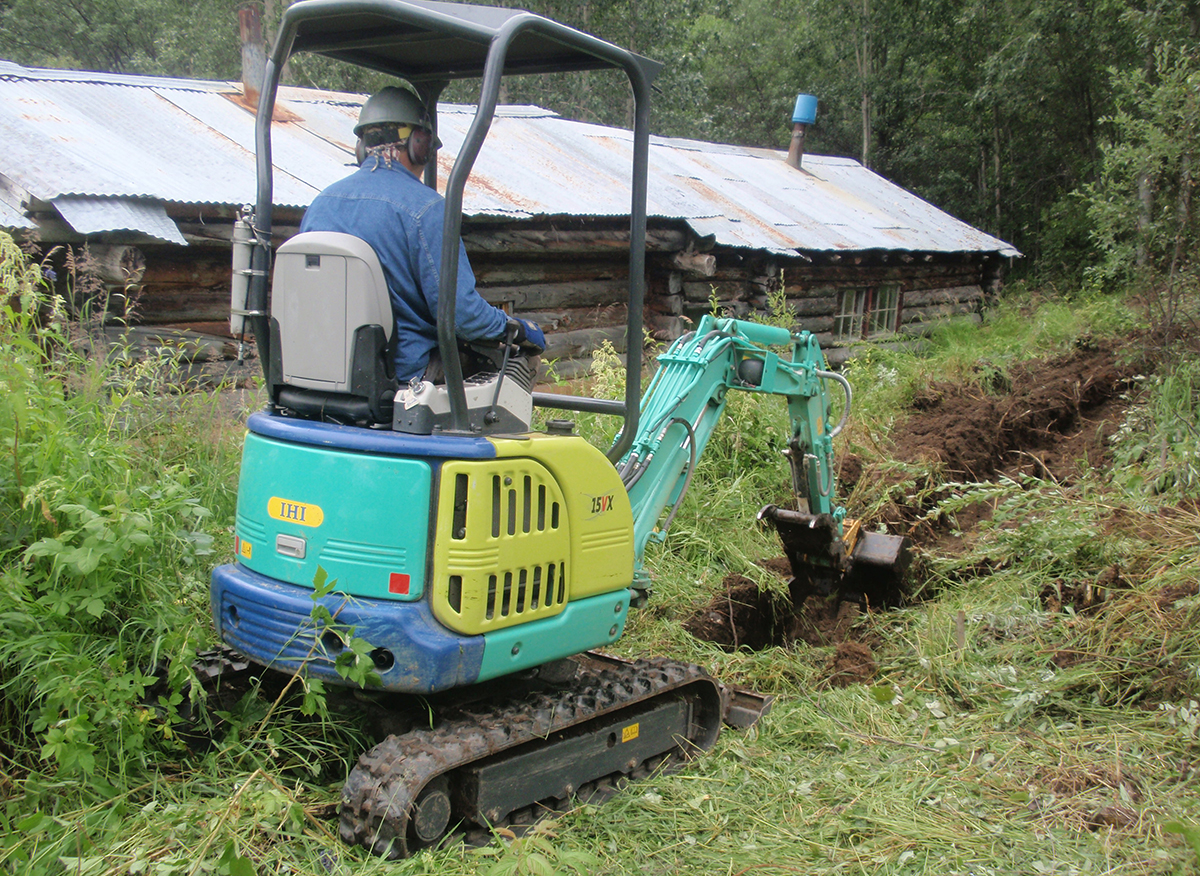
Site Rehabilitation Efforts
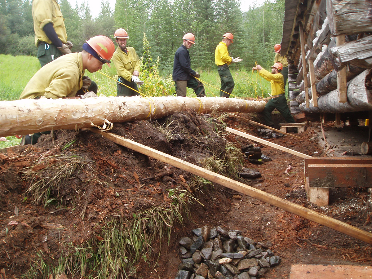
The BLM has funded and coordinated a multi-year project with Alaska’s State Historic Preservation Office to rehabilitate the site and make it safe to visit. Between 2002 and 2012, all four remaining standing buildings at the site have undergone varying degrees of restoration to preserve them for future generations.
All photos by Robin Mills (BLM).
Point of Contact
Robin Mills
Archaeologist
rmills@blm.gov
907-474-2359
Visiting the site today

The overland trail to Steele Creek starts at Milepost 105 of the Taylor Highway, and is ~5.8 miles long. Of that, the first ~3.8 miles cross State land before entering the Fortymile Wild and Scenic River corridor for the final ~2 miles. Things to know before you go:
- ATV and UTV traffic inside the Fortymile Wild & Scenic corridor is only allowed with vehicles up to 1500 lb. curb weight, and must keep to the existing trail to Steel Creek once inside the corridor.
- Prepare accordingly for the ~12 mile round trip hike with food, water, and proper gear for any changes in the weather and remote camping.
- Be bear aware, you are hiking in bear country.
Laws and Rules for Site
Three of the buildings are unsafe and closed to the public, only Structure B is open. For your safety and the safety of others, do not enter these locked and secured structures.
Preserve the site for later generations and leave it as you found it — the buildings and all other artifacts and ruins found at the site should not be disturbed or removed. Please report any vandalism to 907-474-2200.
Stories from the past
The spelling “Steele Creek” is accepted today for this community and is used for the Steele Creek Roadhouse, but it wasn't always so. Archaeologist Robert King explores how far back that goes.