
BLM New Mexico State Office Cadastral crew locates survey monument missing for 101 years
The passage of Public Law 116-92 established White Sands National Park in 2019 and directed the Secretary of the Interior to perform an official survey of the park’s boundaries. Bureau of Land Management (BLM) Cadastral provides surveying services to all federal agencies and the BLM New Mexico State Office Cadastral crews were tasked with locating and marking the boundary of the park. Portions of the boundary are defined by metes and bounds and the remainder is defined by townships, ranges, and sections (PLSS) established during surveys dating back to 1882. The park’s western boundary required following in the footsteps of the original General Land Office surveyors and locating marked stones used to monument the section corners.
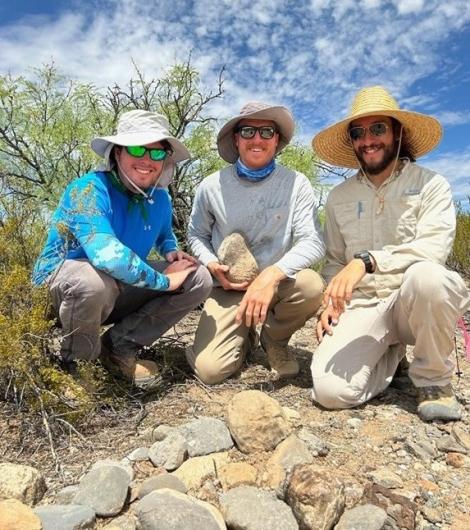
Without the benefit of GPS corner coordinates, survey crews based their searches on topographic maps, the original surveyor’s field notes, and an 1882 survey plat. Over the course of the survey, recovery of the 1882 stone monuments was proving difficult and daunting. As the desert’s temperatures were rising, hope for locating any of these corners was dwindling. In July 2023, Tanner Ireland, a BLM surveying student trainee, and Francisco Mendoza and Evan Renshaw, BLM surveying technicians, were continuing these fruitless searches when they made a discovery. Within their initial 400-foot search radius, they found what appeared to be rocks organized into a mound. This caused them to pause and re-read the surveyor’s notes from 1934, 1922, and 1882. The General Land Office surveyors from 1934 and 1922 noted that they could not find this corner. The 1882 surveyor’s notes stated that the surveyor had placed a mound of stones alongside the stone marked for a 1/4 section corner. Further searching near the mound of stone revealed a single stone placed a few feet west of the mound. Upon closer examination, the trio found the single stone had faint marks that read 1/4.
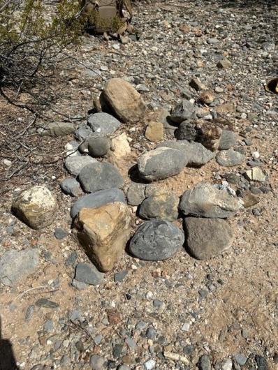
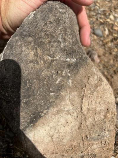
Celebration ensued as Tanner, Francisco, and Evan all congratulated one another on their discovery. They had successfully found the 141-year-old stone monument that had eluded their predecessors and had been deemed lost for 101 years.
While important for locating the White Sands National Park boundary, locating this and other stone monumented corners allows BLM Cadastral to record a precise location which can then be used to update the CADNSDI parcel fabric for PLSS line work utilized in GIS maps used by the National Park Service and Department of Defense.
Related Stories
- Sharing the Spirit of America: A Celebration on the Snake River Canyon Rim
- BLM Launches a Modernized General Land Office Records System
- Volunteers and Partners Retrace 250 Years of History on the Anza Trail
- Framed for Freedom: Bureau of Land Management Eastern States and the Legacy of National Historic Trails
- BLM Celebrates America’s 250th Anniversary in Oregon
Office
301 Dinosaur Trail
Santa Fe, NM 87508
United States