
MOUNT HILLERS WILDERNESS STUDY AREA
Values
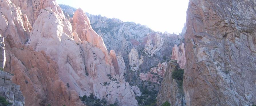
Mt. Hillers is a rugged peak with steep slopes carved by narrow canyons. Mt. Hillers is 5 to 6 miles across, and is cut by several radial narrow, steep, v-shaped valleys separated by elongated, jagged ridges. Hogbacks formed from upturned sedimentary rocks flank the mountain, and are vertical in the Pink Cliffs area. Vegetation is predominantly sagebrush and pinyon-juniper woodlands on the southern slopes. Ponderosa pine, Douglas fir, and bristlecone pine grow on the northern and the higher slopes. The WSA has geological and scenic special features, including scenic views and geologic formations of stocks and laccoliths. Portions of the WSA are used by the Henry Mountains bison herd. Bald eagles and peregrine falcons may occur in the WSA.
Visitation Information
Located in northeastern Garfield County, about 60 miles south of Hanksville, UT on the south end of the Henry Mountains.
Visitor Advisory
Mount Hillers WSA is on the Henry Mountains. Access to the Henry Mountains, including this WSA, is limited and requires four wheel drive. Roads are generally steep, rocky, narrow, and are of natural surface. Cell service is unreliable. Be prepared for such conditions.