
Montana/Dakotas Pilot Project Completed: It just got easier to find access to public lands
Story by Adam Carr, Public Access Project Manager; and Cyndi Eide, Realty Specialist, Montana/Dakotas State Office
Finding ways to get to public lands in Montana, North Dakota and South Dakota just got a little easier! BLM Montana/Dakotas is pleased to announce the release of a new GIS layer that shows public access routes to BLM lands in Montana, North Dakota and South Dakota.
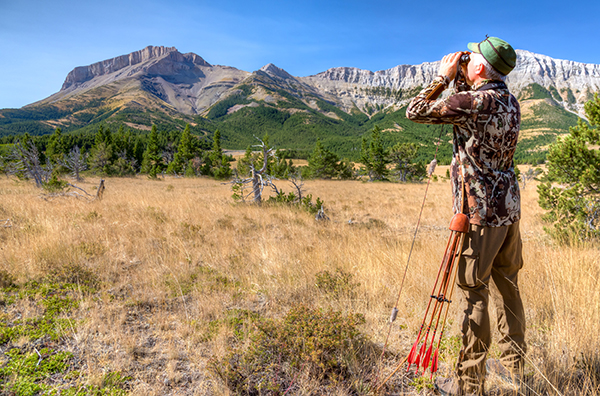
the Ear Mountain Conservation Management
Area. Photo by Bob Wick.
The project was sparked out of a desire to pace with modern/mobile technology and improve access information to BLM public lands.
With BLM Headquarters leadership in full support of a pilot effort, BLM Montana/Dakotas went to work to modernize the data that will help hunters and recreationist with access to public lands and enjoy the 8.3 million acres of BLM-managed lands within Montana, North and South Dakota.
Most recently, Secretarial Orders 3347, 3356, 3366 and 3373, Section 4105 of the John D. Dingell, Jr. Conservation Act and the Great American Outdoors Act have shed new light on the critical need to improve public access and generated this call for action. Support of the effort to modernize access information came from several partner groups including the Rocky Mountain Elk Foundation (RMEF), the Theodore Roosevelt Conservation Partnership (TRCP) and onXmaps.
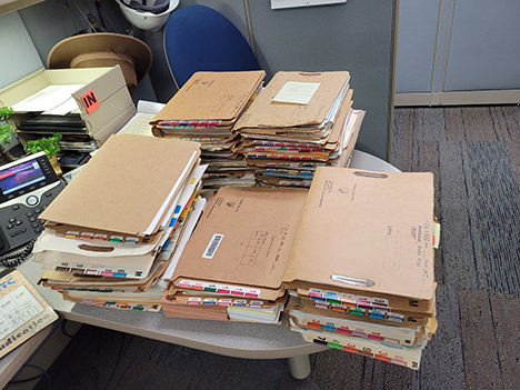
easements were digitized
as part of the pilot project.
BLM photo.
TRCP and onXmaps published a report in 2018 on landlocked (inaccessible) federally managed lands. The analysis identified 1.8 million acres of landlocked BLM lands in Montana and the Dakotas.
“By digitizing its records of permanent easements providing access across private land, the BLM is making it easier for sportsmen and women to identify new opportunities for hunting and fishing on our public lands,” said Joel Webster, Senior Director of Western Programs.
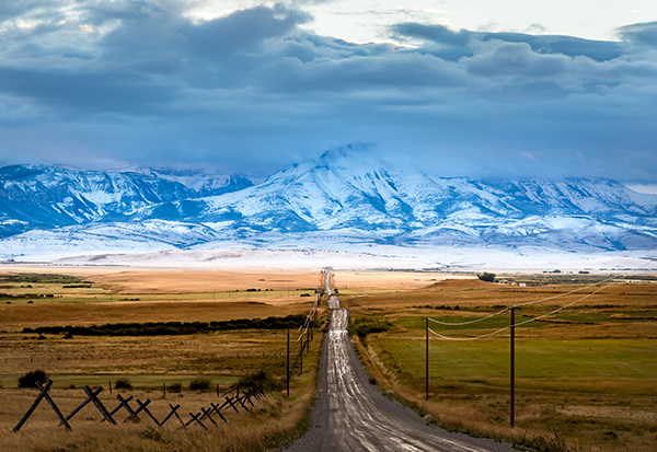
Dakotas just got easier with the completion of the
Public Lands Access Data Delivery Pilot Project.
Ear Mountain Conservation Management Area.
Photo by Bob Wick.
An incredible amount of research went into this effort over the past year. Jim Ledger, Realty Specialist/Land Tenure Lead, working with Headquarters and field office realty specialists set out to digitize 378 legally perfected easement deeds and patent reservations found in casefiles and on General Land Office (GLO) Records. In all, the easements negotiated over time provide public access to over 2.8 million acres of BLM-managed lands in our three-state area. This new GIS data layer will have many uses and provide relational benefits to both the public and land managers when considering public land access and management decisions in the future.
Easements and reservations that provide administrative access will be included in the data layer that will be available for BLM use, which will provide additional decision support opportunities. The location of the data layer will be provided once it is published for internal use.
Now that the Montana/Dakotas pilot project is winding down, efforts have shifted to convert lands and realty records related to legally perfected easements and reservations to GIS data for other BLM State Offices across the west. Adam Carr, the Project Manager and Cyndi Eide, the Project Realty Specialist, are busy planning for the roll-out of the national effort.
If you have questions about the new layer or the larger access effort, feel free to contact one of them. Stay tuned for a future Story of the Week highlighting one of these easement deeds granting access through private land to access over 12,000 acres of BLM lands.
“RMEF applauds the recent efforts by BLM to modernize mapping data. The display of this work will benefit countless hunters this season and beyond,” said RMEF’s Director of Lands Jennifer Doherty. “As RMEF continues to lead quality public access improvement projects across the west, we see this as a model to improve hunt planning and navigation.”
Related Stories
- Preserving a Legacy in Stone: The Race to Save Pompeys Pillar
- BLM Billings Field Office Completes Dilworth Creek Riparian Restoration Project
- Boating Paradise: GAOA Funding Enhances Popular Recreation Site Along Montana’s Yellowstone River
- Commemorating 150 Years: The St. Patrick’s Day Fight Along the Powder River
- Snapped enamel and crushed bone: A Moment Frozen in Time