
AIM Resources
AIM Resources include a variety of documents, tools, and workflows, this page focuses on:
- AIM Desk Guide which describes the process to implement the six principles of the AIM Strategy
- AIM Protocols and Manuals to accomplish data collection
- AIM data collection tools
AIM Desk Guide
To learn more and access the AIM Desk Guide, follow this link:
AIM Protocols and Manuals
Monitoring protocols, design management protocols, data management protocols and more can be found for each resource on their library page found below:
-
Local or Small-Scale Examples of AIM Data Use
-
Effectiveness Monitoring - Treatment, Reclamation, and Restoration
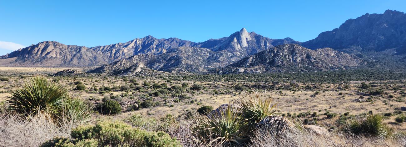
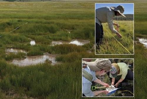
Land treatments, including restoration, reclamation, and rehabilitation, are important land management tools. The goal of treatment and restoration effectiveness monitoring is answering the question, "Were treatment and restoration projects effective?”. Collecting AIM data as part of effectiveness monitoring enables the BLM to measure ecosystem response to vegetation treatments so that we can understand the consequences of management actions and to share this knowledge in a scientifically sound manner. Monitoring is the critical feedback loop that allows land managers to constantly improve land rehabilitation and restoration plans based on the new knowledge gained from field measurements. In the BLM, this local level effectiveness monitoring is commonly used to evaluate post-fire rehabilitation treatments, restoration projects (e.g., stream restoration, wildlife habitat restoration, etc.), and fuel reduction treatments.
Examples:
- Long Term Trends in Vegetation on Bureau of Land Management Rangelands
- Stream Reclamation Effectiveness Following Placer Mining in Eastern Interior, Alaska
- Hands-On Restoration: The Hawley Creek Story
- Rush Fire, Emergency Stabilization & Rehabilitation (ESR) Treatments, and Utilizing AIM for Monitoring Treatment Effectiveness
- Fuels Monitoring with SageSTEP: Sagebrush Steppe Treatment Evaluation Project
Grazing Permit Authorizations and Renewals
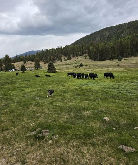
A key question for authorizing or renewing grazing permits is whether the condition of the allotment meets management objectives, such as Land Health Standards (LHS). AIM core indicator data can be used along with other data to address this question. Additional information used along side AIM data may include use-based monitoring or condition monitoring for a specific area of the allotment (such as special status species habitat).
Examples:
How to:
-
Regional Scale Examples of AIM Data Use
-
Greater Sage-grouse Habitat Assessment Framework (HAF)
BLM’s management of Greater sage-grouse (GRSG) habitats requires information across large populations as well as in specific habitat types. Working with the Natural Resources Conservation Service (NRCS), the BLM has increased the sampling density of the Landscape Monitoring Framework (LMF) that utilizes the AIM terrestrial core indicators across the range of the Greater sage-grouse to increase our understanding of the status and condition of these habitats. Importantly, data collection is being driven by sage-grouse management questions, but these data are not limited to sage-grouse applications in the future. These same data can be used for other wildlife habitat questions and also for recreation, grazing, and reclamation success. AIM terrestrial core indicator data is also being collected to complete the Habitat Assessment Framework (HAF) and inform local decision-making.
Examples:
- Habitat Assessment Summary Report for the Beatys Butte Fine-Scale Assessment Area, Southern OR and Northern NV
- Jim Sage Allotment Livestock Grazing Permit Renewal EA
- A Statewide Assessment of BLM-Managed Streams and Rivers in Idaho (Full Report) (Summary Report)
- Application of AIM Data to a GRSG Habitat Assessment in Oregon
- Lakeview, OR HAF Analysis Example
How to:
Land Use Planning and Effectiveness Evaluation
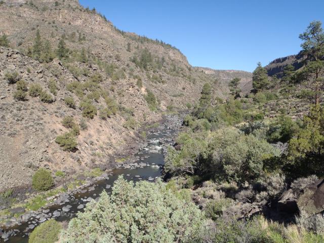
Land use plans ensure that the public lands are managed in accordance with the intent of Congress as stated in Federal Land Policy and Management Act (FLPMA, 43 U.S.C. 1701 et seq.), under the principles of multiple use and sustained yield. As required by FLPMA and BLM policy, the public lands must be managed in a manner that “protects the quality of scientific, scenic, historical, ecological, environmental, air and atmospheric, water resource, and archaeological values; that, where appropriate, will preserve and protect certain public lands in their natural condition; that will provide food and habitat for fish and wildlife and domestic animals; that will provide for outdoor recreation and human occupancy and use; and that recognizes the Nation’s need for domestic sources of minerals, food, timber, and fiber from the public lands by encouraging collaboration and public participation throughout the planning process” (Land Use Planning Handbook). Land use plans are one of the primary mechanisms for guiding BLM activities to achieve our mission and goals. AIM terrestrial and aquatics core indicators provide information about many land use plan objectives and thus whether land use plans are effective.
Examples:
- Developing Management Objectives for Wadeable Streams (Open File Report #129) (Open File Report #169)
- Lotic AIM in the National Petroleum Reserve in Alaska (BLM Access Only)
- Land Use Plan Effectiveness Monitoring for Utah Rivers and Streams
- Monitoring to Assess Attainment of Land Health Standards related to Water Quality in the Green River District, Utah
- A Statewide Assessment of BLM-Managed Streams and Rivers in Idaho (Full Report) (Summary Report)
-
National Scale Examples of AIM Data Use
-
Rangeland Resource Assessment/Western Rivers and Streams Assessment
Due to the cross-program, cross-ecosystem relevance of AIM core indicators and methods, AIM is a useful tool for nationwide monitoring efforts. The public lands are facing increasingly complex and widespread environmental challenges that transcend traditional management boundaries. These challenges include managing wildfire; controlling weeds and insect outbreaks; providing for energy development and urban growth; and addressing pervasive impacts from the effects of climate change. In partnership with other agencies, including the Natural Resources Conservation Service (NRCS) and Environmental Protection Agency (EPA), AIM is providing information to better address these challenges.
Examples:
- Greater Sage-Grouse Plan Implementation: Rangewide Monitoring Report for 2015-2020
- BLM 2011 Rangeland Resource Assessment
- National Lotic AIM Fact Sheet
- NRCS National Resources Inventory
Society for Rangeland Management Presentations
AIM Symposia at SRM annual meetings
Two full-day AIM symposia have occurred during the annual meeting of the Society for Range Management (SRM), in 2015 and 2018. During the symposia, monitoring leads and partners spoke about their AIM efforts and how they inform management decisions. Topics also included underpinning concepts of AIM, such as maintaining information quality and integration with remote sensing.
- Additional Information on AIM Data Use Examples
-
Can be found featured in our AIM Data Use Webinar section. This page will show some of the recent examples of AIM applied across natural resource specialists.
Monitoring protocols, design management protocols, data management protocols and more can be found for each resource on their library page.
Local
Effectiveness Monitoring - Treatment, Reclamation, and Restoration
Land treatments, including restoration, reclamation, and rehabilitation, are important land management tools. The goal of treatment and restoration effectiveness monitoring is answering the question, "Were treatment and restoration projects effective?”. Collecting AIM data as part of effectiveness monitoring enables the BLM to measure ecosystem response to vegetation treatments so that we can understand the consequences of management actions and to share this knowledge in a scientifically sound manner. Monitoring is the critical feedback loop that allows land managers to constantly improve land rehabilitation and restoration plans based on the new knowledge gained from field measurements. In the BLM, this local level effectiveness monitoring is commonly used to evaluate post-fire rehabilitation treatments, restoration projects (e.g., stream restoration, wildlife habitat restoration, etc.), and fuel reduction treatments.
Examples:
Long Term Trends in Vegetation on Bureau of Land Management Rangelands
Stream Reclamation Effectiveness Following Placer Mining in Eastern Interior, Alaska
Hands-On Restoration: The Hawley Creek Story
Fuels Monitoring with SageSTEP: Sagebrush Steppe Treatment Evaluation Project
Grazing Permit Authorizations and Renewals
A key question for authorizing or renewing grazing permits is whether the condition of the allotment meets management objectives, such as Land Health Standards (LHS). AIM core indicator data can be used along with other data to address this question. Additional information used along side AIM data may include use-based monitoring or condition monitoring for a specific area of the allotment (such as special status species habitat).
Examples:
Three Creeks Land Health Assessment and Evaluation
How to:
Regional
Greater Sage-grouse Habitat Assessment Framework (HAF)
BLM’s management of Greater sage-grouse (GRSG) habitats requires information across large populations as well as in specific habitat types. Working with the Natural Resources Conservation Service (NRCS), the BLM has increased the sampling density of the Landscape Monitoring Framework (LMF) that utilizes the AIM terrestrial core indicators across the range of the Greater sage-grouse to increase our understanding of the status and condition of these habitats. Importantly, data collection is being driven by sage-grouse management questions, but these data are not limited to sage-grouse applications in the future. These same data can be used for other wildlife habitat questions and also for recreation, grazing, and reclamation success. AIM terrestrial core indicator data is also being collected to complete the Habitat Assessment Framework (HAF) and inform local decision-making.
Examples:
Jim Sage Allotment Livestock Grazing Permit Renewal EA
- (Appendix F - Habitat Assessment Summary Report)
- (Appendix G - Management Unit Supplement to GRSG Habitat Summary Report)
Application of AIM Data to a GRSG Habitat Assessment in Oregon
Lakeview, OR HAF Analysis Example
How to:
Land Use Planning and Effectiveness Evaluation
Land use plans ensure that the public lands are managed in accordance with the intent of Congress as stated in Federal Land Policy and Management Act (FLPMA, 43 U.S.C. 1701 et seq.), under the principles of multiple use and sustained yield. As required by FLPMA and BLM policy, the public lands must be managed in a manner that “protects the quality of scientific, scenic, historical, ecological, environmental, air and atmospheric, water resource, and archaeological values; that, where appropriate, will preserve and protect certain public lands in their natural condition; that will provide food and habitat for fish and wildlife and domestic animals; that will provide for outdoor recreation and human occupancy and use; and that recognizes the Nation’s need for domestic sources of minerals, food, timber, and fiber from the public lands by encouraging collaboration and public participation throughout the planning process” (Land Use Planning Handbook). Land use plans are one of the primary mechanisms for guiding BLM activities to achieve our mission and goals. AIM terrestrial and aquatics core indicators provide information about many land use plan objectives and thus whether land use plans are effective.
Examples:
Developing Management Objectives for Wadeable Streams (Open File Report #129) (Open File Report #169)
Lotic AIM in the National Petroleum Reserve in Alaska (BLM Access Only)
Land Use Plan Effectiveness Monitoring for Utah Rivers and Streams
Monitoring to Assess Attainment of Land Health Standards related to Water Quality in the Green River District, Utah
A Statewide Assessment of BLM-Managed Streams and Rivers in Idaho (Full Report) (Summary Report)
National
Rangeland Resource Assessment/Western Rivers and Streams Assessment
Due to the cross-program, cross-ecosystem relevance of AIM core indicators and methods, AIM is a useful tool for nationwide monitoring efforts. The public lands are facing increasingly complex and widespread environmental challenges that transcend traditional management boundaries. These challenges include managing wildfire; controlling weeds and insect outbreaks; providing for energy development and urban growth; and addressing pervasive impacts from the effects of climate change. In partnership with other agencies, including the Natural Resources Conservation Service (NRCS) and Environmental Protection Agency (EPA), AIM is providing information to better address these challenges.
Examples:
Greater Sage-Grouse Plan Implementation: Rangewide Monitoring Report for 2015-2020
BLM 2011 Rangeland Resource Assessment
NRCS National Resources Inventory
Society for Rangeland Management Presentations
AIM Symposia at SRM annual meetings
Two full-day AIM symposia have occurred during the annual meeting of the Society for Range Management (SRM), in 2015 and 2018. During the symposia, monitoring leads and partners spoke about their AIM efforts and how they inform management decisions. Topics also included underpinning concepts of AIM, such as maintaining information quality and integration with remote sensing.
Watch AIM symposia video recordings.
- SRM 2018: Symposia
- SRM 2020: Symposia
- SRM 2021: USDA-NRCS Grazingland Rational Resource Inventory: History and Current Applications
- SRM 2021: Adaptive Management for Adaptive Monitoring
- SRM 2022: Applying Long-Term Monitoring Data to Rangeland Science.
•Eval and Design Mgmt Protocol
•Data Mgmt & QA & QC Protocol
•Technology Manual
•Gear, tech, and forms
•Macro & WQ Submission Protocol
•Eval and Design Mgmt Protocol
•Data Mgmt & QA & QC Protocol
•Technology Manual
•Gear, tech, and forms
•Macro & WQ Submission Protocol
• Supplemental Protocol Volume 2
• Data Management Protocol
• Reclamation Monitoring
• FAQ & Equipment list
• Supplemental Protocol Volume 2
• Data Management Protocol
• Reclamation Monitoring
• FAQ & Equipment list

• AIM Monitoring Design Worksheet
• Data Management, QA/QC Protocol
• Design and Site Evaluation Protocol
• AIM Monitoring Design Worksheet
• Data Management, QA/QC Protocol
• Design and Site Evaluation Protocol
AIM Data Collection Tools
The AIM Program uses readily available data collection software including Field Maps and Survey 123. AIM forms are available per request and can be used whether or not data will be submitted to the BLM for incorporation into the AIM Data Portals. If data collection partners will be submitting data to the BLM, they will need to create a Geoplatform account following the Geoplatform Account Setup: External Partners and also submit a DOI Information Security Rules of Behavior: For External Partners following resource specific guidance. Terrestrial AIM contacts provide this information during training registration information. Lotic and R&W information is posted on the BLM library webpages (linked above). All data collectors are encouraged to complete an AIM Implementation Summary Template at the end of every field season.
| 
| 
| 
|