
Bobcat-Houlihan Trail | Wyoming
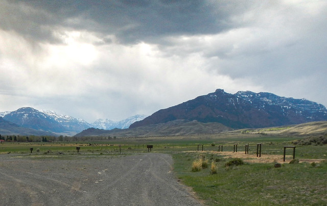
The picturesque Bobcat/Houlihan Trailhead is a popular trailhead surrounded by the magnificent Absaroka Mountains located deep in the South Fork Shoshone River Valley. The trail features a moderately steep hike to the Shoshone National Forest boundary, suitable for horseback riding and hiking.
The trail begins near the South Fork of the Shoshone River and provides access to trails along both Bobcat and Houlihan Creeks. Facilities at the trailhead include an information kiosk, horse trailer parking, horse hitching rails, and toilet facilities. Fishing access to the South Fork of the Shoshone River is also available adjacent to the trailhead.
Elevations ranging from 6,020 feet to 6,280 feet provide views of the South Fork Shoshone River valley and Carter Mountain. Deer, moose, grizzly and black bear, elk, antelope, bald eagles, and predators such as bobcats, coyotes, and mountain lions may be seen throughout the area.
Please note: Although there are no camping facilities here, camping is allowed at the trailhead. This is grizzly bear country, so be bear aware and maintain a clean campsite.
BOBCAT-HOULIHAN TRAIL PHOTOS
BLM WYOMING KNOW BEFORE YOU GO
GEOREFERENCED MAPS
Contact Us

Activities


Addresses
Cody Field Office
1002 Blackburn?Street
Cody
Wyoming
82414
Directions
The trailhead is located 28 miles southwest of Cody. Travel on Wyoming State Highway 291 (the South Fork Highway) 28 miles. Turn right onto Park County Road 6EH and travel approximately three miles to the trailhead.