Merced Wild and Scenic River
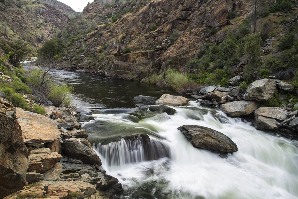
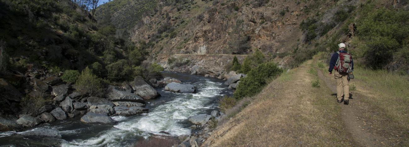
From Yosemite National Park, the Merced River tumbles through glacially carved canyons, rugged mountains, and foothills on its way to the San Joaquin Valley. The BLM manages 12 miles of this Wild and Scenic River. Ample access points allow rafters to experience class III and IV rapids at their own pace. Visitors can camp at nearby Willow Placer, Railroad Flat, and McCabe Flat campgrounds, explore the river along the Merced River Trail, or stop at the Briceburg Visitor Center.
- Outstandingly Remarkable Values


Cultural & Historic
Historical artifacts create an area of historic and cultural significance along the river. The continuum of human use along the Merced River and South Fork of the Merced River encompasses millennia of diverse peoples, cultures and uses. American Indian and late 19th-century American cultures flourished along these rivers, because they provided reliable, year-round water. Evidence that reflects trade, travel and settlement patterns abounds in an intricate and interconnected landscape of archeological sites representing this cultural history.
The Wawona historic resources includes one of the few covered bridges in the region. The National Historic Landmark Wawona Hotel Complex includes one of the largest existing Victorian hotel complexes in a national park and one of the few remaining that remains largely representative of its original configuration.
Geologic
The Merced River is the product of geologic and hydrologic processes that continue to shape the landscape. Glaciation and river erosion, coupled with the influence of bedrock fractures, carved pathways that the Merced River continues to follow and create the river's variable gradients and dramatic changes in water speed and volume. The river flows through glacially carved canyons, over sheer cliffs and stair-step river morphology, through an alluvial landscape in Yosemite Valley and past a classic boulder bar in El Portal.
Recreational
From the high country of Yosemite National Park, the Merced River pursues its headlong rush through glacially carved canyons, rugged mountains and foothills to the San Joaquin Valley. The river flows in a series of rapids to Lake McClure at approximately 900 feet elevation. Outstanding whitewater rafting, camping and hiking opportunities contribute to the Merced's outstandingly remarkable recreation, made special against uniquely dramatic, picturesque backdrops or wilderness, high granite cliffs, and towering waterfalls.
Vegetation
Riparian and meadow ecosystems within the river corridor include alpine and subalpine meadows along the river stretches. Dependent on these habitats are a variety of native, endemic and/or rare plant and animal species, such as the threatened limestone salamander. The Merced River sustains numerous small meadows and riparian habitat with high biological integrity.
Wildlife
Designated in 1986 as the Limestone Salamander Area of Critical Environmental Concern (ACEC), BLM-administered lands encompass 1,600 acres of confirmed and potential limestone salamander habitat, including adjacent BLM lands along the Merced River and its tributaries in western Mariposa County. A state-listed threatened species and former Federal Category 2 candidate, the limestone salamander's home is restricted to 15 population sites along a 20-mile stretch of the Merced River between the headwaters of Lake McClure, near the community of Bagby, and the mouth of Sweetwater Creek, near Briceburg. This species occurs nowhere else in the world.
- California Wild and Scenic Rivers
Facts
Length:
BLM - 12 miles
Total - 122.5 miles
Classification:
Wild, Scenic, Recreational
Designation Dates:
November 2, 1987
October 23, 1992
Designating Legislation:
Public Law 100-149
Public Law 102-432
Quick Links
Plan Your Visit
Contact Us
Bureau of Land Management
Mother Lode Field Office
5152 Hillsdale Circle
El Dorado Hills, CA 95762
Phone: 916-941-3101
Email: [email protected]
Flickr Album