
Something for everyone: The National Conservation Lands Program
Story by Jaime Tompkins, Program Lead for National Conservation Lands, Montana/Dakotas State Office
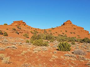
Montana and managed by the Billings FO.
Photo by Jaime Tompkins.
The BLM Montana-Dakotas National Conservation Lands Program encompasses two National Monuments with Interpretive Centers, 150 miles of designated Wild & Scenic River, and portions of the Lewis & Clark National Historic Trail, the Nez Perce National Historic Trail, and the Continental Divide National Scenic Trail. In addition, there are 37 Wilderness Study Areas and BLM’s first designated Wilderness, the Bear Trap Canyon -- part of the Lee Metcalf Wilderness!
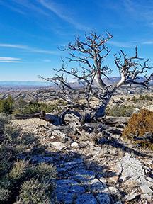
encompasses more than 12,000
acres in Montana and 4,000
acres in Wyoming.
Photo by Jaime Tompkins
These areas provide abundant recreational opportunities, important scientific research grounds, and outstanding ecological and cultural resources. National Conservation Lands also work as a unifying and essential link for critical habitat, animal migrations, and public access across the West--pathways that are crucial to the nation’s efforts to conserve our critical natural resources. While many of the National Conservation Lands are remote, others are easily accessible and part of an active, vibrant landscape near communities where people live, work, and recreate.
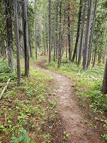
Scenic Trail runs through the
Centennial Mountains WSA in
southwestern Montana.
BLM photo
The National Monument interpretive centers host public events throughout the summer months that are free to the public. Information on upcoming events can be found at Montana-Dakotas | Bureau of Land Management (blm.gov)
To learn more about the history of the National Conservation Program Lands, check out the online training on the ProValens website at https://provalenslearning.com. Some of the training modules offered there include National Scenic & Historic Trails, Wild & Scenic Rivers, National Monuments and Conservation Areas and Wilderness Management. The Carhart Center in Missoula, Montana is another great source for other online training opportunities and resources https://carhart.wilderness.net/.
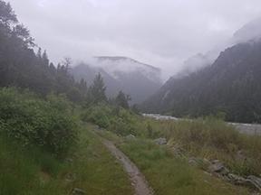
the first wilderness area to be managed
by the BLM. BLM photos
Related Stories
- Birding Aravaipa Canyon: A morning of songs, color, and creekside adventure
- Preserving a Legacy in Stone: The Race to Save Pompeys Pillar
- BLM Billings Field Office Completes Dilworth Creek Riparian Restoration Project
- Boating Paradise: GAOA Funding Enhances Popular Recreation Site Along Montana’s Yellowstone River
- More time travel for the nation’s 250th: Exploring BLM back country byways in Oregon and California
Office
5001 Southgate Drive
Billings, MT 59101
United States