
Values
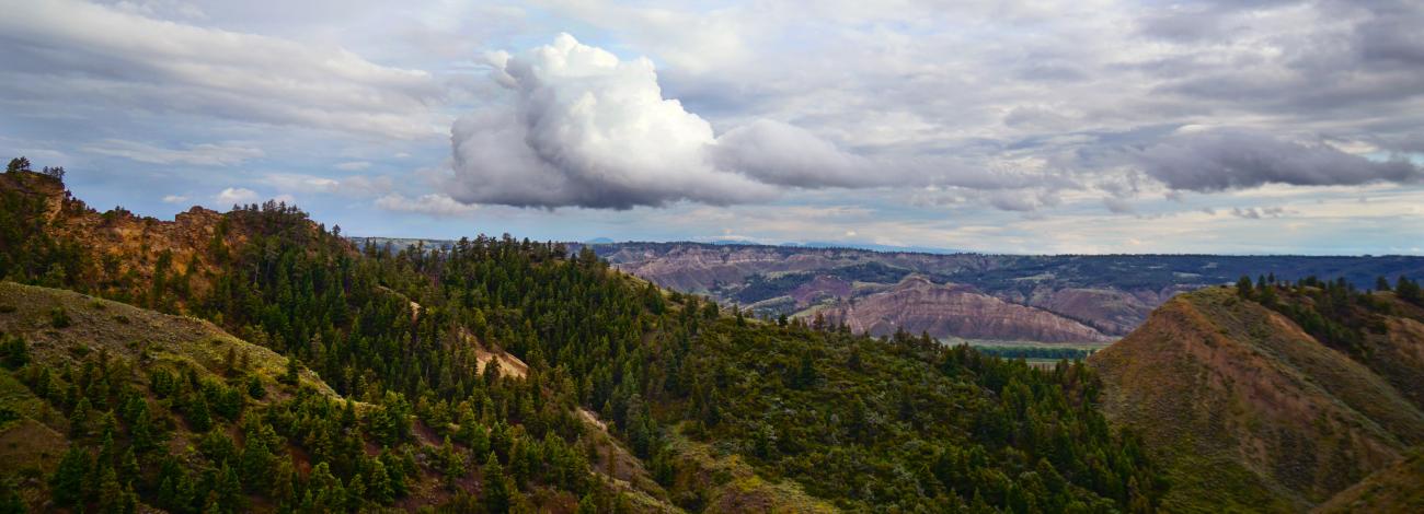
The Antelope Creek WSA is a river breaks topography with steep, highly eroded coulees formed by tributaries that drop toward the Missouri River. The Missouri River cut deeply into soft shales and sandstones forming numerous steep hills and deep coulees of sparsely vegetated exposed rock. Vegetation includes sagebrush, greasewood, and short prairie grasses. Juniper, ponderosa pine, lodgepole pine, Douglas fir and cottonwood grow along the coulees. This WSA offers outstanding opportunities for solitude and provides a diversity of primitive recreational opportunities such as hiking, photography, hunting, and rock climbing. The area is rich in historical significance, including Kid Curry's outlaw hideaway.
Visitation
From the town of Grass Range, Montana, follow Highway 19 until it turns into Highway 191. Continue approximately 40 miles, turn on Montana 66 north for approximately 1 ½ miles and turn west on an unmarked gravel road known as Bull Creek Road. Bull Creek Road is gravel for approximately 2 ¼ miles, and drive an additional 9 miles and you will be at the northwest portion of the Antelope Creek WSA. This WSA can also be accessed from the Missouri River.
Visitor Advisory
The un-graveled part of Bull Creek Road, as well as other roads and trails in the area, can be very muddy when wet. Travel is not recommended during wet condition.