
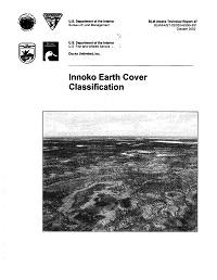
Innoko Earth Cover Classification
The Bureau of Land Management (BLM) - Alaska and Ducks Unlimited, Inc. (DU) have been cooperatively mapping wetlands and associated uplands in Alaska using remote sensing and geographic information system (GJS) technologies since 1988. The goal of this project was to continue the mapping effort by mapping the Innoko National Wildlife Refuge (INWR) and surrounding BLM, Native, and State lands-hence called the Innoko Earth Cover Mapping Project (approximately 22 million acres). Because the entire project area was so large, three subproject areas were defined: the lnnoko National Wildlife Refuge (INWR), the Unalakleet area, and the Aniak area. Sub-project boundaries were delineated using several factors, including acquisition dates of available Landsat images, limitations in field logistics, geographic features, and political boundaries (i.e. - mapping the entire INWR in one sub-project area). Fieldwork, image classification, and accuracy assessment were completed independently for each of the subproject areas. The digital maps produced for the three areas were mosaicked post-classification to produce an earth cover map for the entire Innoko project area. A total of six Landsat Thematic Mapper (TM) satellite scenes (two for INWR: Path 76, Rows 15 and 16, acquired August 26, 1991; three for the Unalakleet area: Path 77 Rows 15-17, acquired August 8, 1995; and one for the Aniak portion: Path 76 Row 17, acquired August 26, 1991) were used to classify the project area into 34 earth cover categories. An unsupervised clustering or seeding technique was used to determine the location of field sites and a custom field data collection card and digital database were used to record field information. Helicopters were utilized to gain access to field sites throughout the project area. Global positioning system (GPS) technology was used both to navigate to pre-selected sites and to record locations of new sites selected in the field. Data were collected on 1,544 field sites during a 17-day field season from July 17, 1998 through August 2, 1998. A modified supervised/unsupervised classification technique was performed to classify the satellite imagery. The classification scheme for the earth cover inventory was based on Viereck et al. (1992) and revised through a series of meetings coordinated by the BLM - Alaska and DU. The overall accuracy at the +/-5% level of variation for each project area was 86%, 80%, and 84% for the Aniak, Unalakleet, and INWR areas, respectively. The cooperators in this project were the Bureau of Land Management-Alaska, the U.S. Fish and Wildlife Service, and Ducks Unlimited, Inc.