
Footsteps That Built a Nation: Surveying the American West at 250
BLM Idaho has partnered with the Idaho State Historical Society, Idaho Public Television, Idaho Department of Education, National Society of Professional Surveyors (NSPS), Idaho Society of Professional Surveyors (ISPLS), the Idaho Transportation Department, and Ada County Highway District for an event celebrating America’s 250th anniversary: the Boise Meridian Initial Point Celebration, scheduled for May 1st and 2nd, 2026.
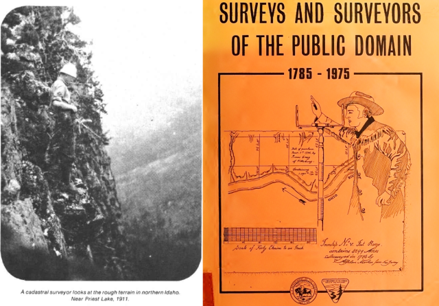
As the nation prepares to honor two and a half centuries of freedom, BLM Idaho proudly spotlights the dedicated cadastral surveyors who have defined, protected, and preserved the very boundaries of our public lands – the invisible lines that make liberty, property rights, and self-governance possible. This profile is the fourth in a series celebrating these unsung heroes in the lead-up to the Freedom 250 event in May.
Surveying sounds straightforward—go locate the corner, verify the position, and document the result. But on the ground, it’s anything but simple. As BLM Coeur d’Alene District surveyor Chris L. Johnson often reminds people, “Corners are where you find them, exactly where they were originally placed.” And those corners were placed long before roads existed, long before brush swallowed the landscape, and long before anyone imagined a UTV might someday rumble across a mountain trying to reach them.
Our district spans a wide stretch of the Northwest—from the 45th to the 49th parallel—and it shows. Southern Idaho gives you pine and open slopes. Farther north, the work slows to a crawl beneath thick timber: ponderosa pine, lodgepole pine, white pine, Douglas fir, grand fir, alpine fir, western larch, western red cedar, Engelmann spruce, and hemlock. It’s a place where a “short” hike can become an all‑day push.
As Chris puts it, “Honestly, most hikes are a ¼ mile. But 2 miles is not out of the question either.”
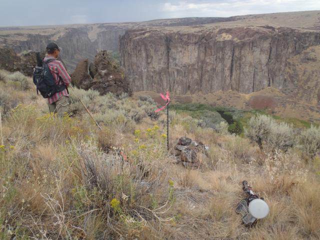
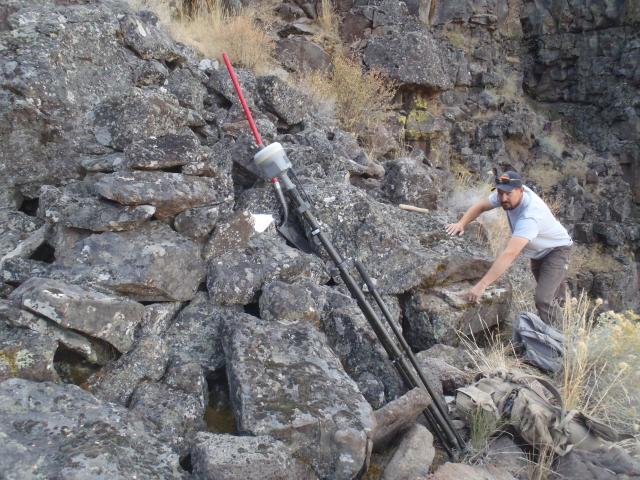
In northern country, “getting from point A to point B just takes twice as long.” Brush becomes its own terrain—waist‑high nine‑bark and serviceberry in the south turning into head‑high ocean spray and mountain maple farther north. Cliffs—basalt in Salmon River country, granite in Coeur d’Alene—make you question whether the corner you're seeking is even reachable. Deadfall forces over‑under‑around‑through gymnastics across tangle after tangle. Wildlife trails become navigation aids. And sometimes, as Chris jokes, you jump off a log only to find yourself “trapped in a log jam in the middle of a hornet’s nest.”
But surveying is more than physical effort. It is also a walk-through American history and the very foundations of freedom itself.
Chris grew up in Ola, Idaho, where the Boise National Forest met his backyard. His early years were shaped by a two‑room schoolhouse and a 45‑mile commute to high school—long enough to memorize every bend, ridge, and shadow of the land. To him, the forest wasn’t scenery; it was company. It taught him early that the lines on federal maps weren’t abstractions. They were real boundaries with real meaning for the people who lived on either side.
His fascination with mapping began in fourth grade when Lewis and Clark captured his imagination—not with their adventure, but with their maps. The idea that a wilderness could be made knowable through lines, notes, and bearings pulled him in. He didn’t know then that he would eventually follow in their footsteps—literally and professionally—through the work of the Public Land Survey System (PLSS), the same system that helped transform a young republic into a vast, opportunity-rich nation.
Today, much of the work involves dependent resurveys—retracing the paths of the original surveyors and verifying the corners they placed. Chris explains one of the core principles this way: the modern surveyor must “follow in the footsteps of the original surveyor—seeing what they saw and doing what they did.” It is a kind of historical stewardship, ensuring that the framework that helped shape the American West remains consistent, accurate, and grounded in its original intent.
And sometimes, history reveals itself in unforgettable ways that remind us why these lines matter to every American.
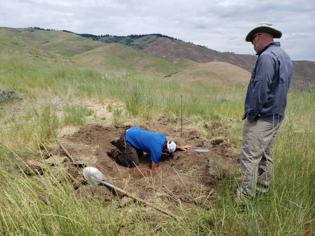
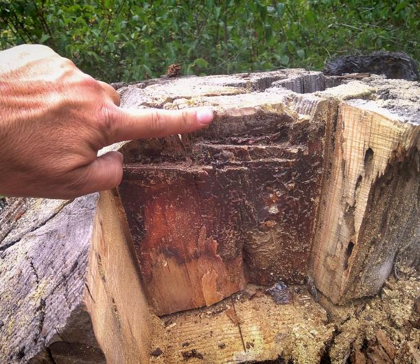
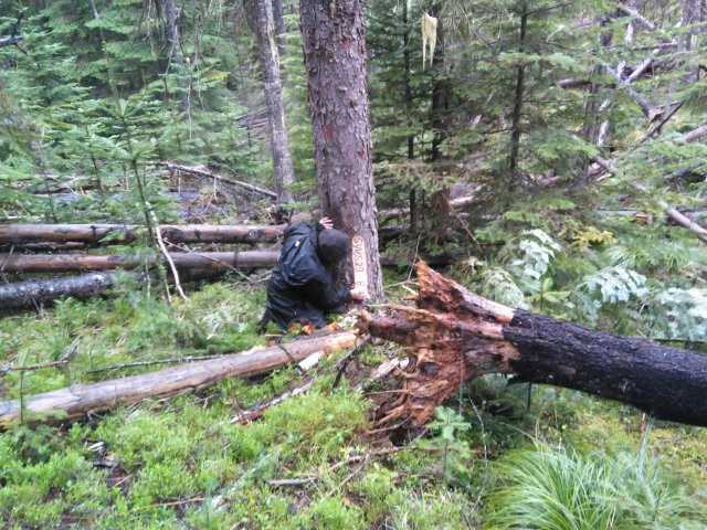
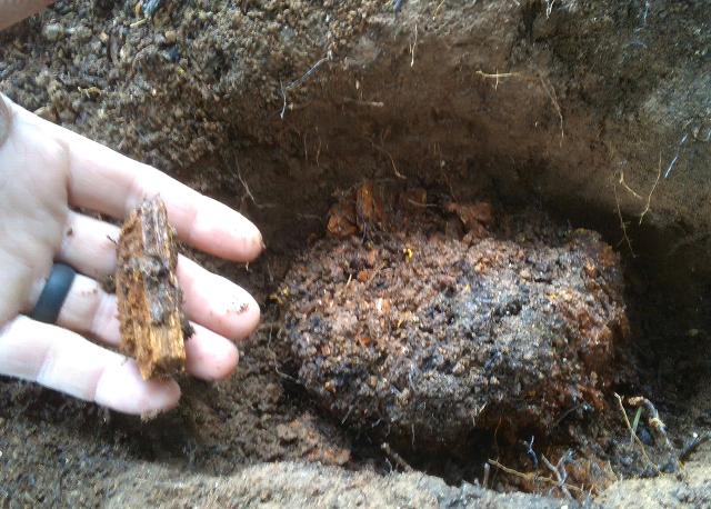
Chris recalls the day he unearthed a small slab of pitch‑wood from the remains of a downed, nearly rotted log. The “treasure map”—the original plat—had shown a corner should be there, but over a century of weathering threatened to erase it. Yet the slab bore unmistakable man‑made marks. That tiny remnant preserved not just a point, but miles of certainty—BLM, Forest Service, and private boundaries that would have otherwise fallen into dispute. A century‑old decision had survived, waiting for someone to find it. In that moment, Chris wasn’t just finding a corner—he was reconnecting the present to the bold vision of America’s founders.
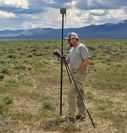
Before moments like these come the logistics. A typical day for the BLM Coeur d’Alene District cadastral crew starts with driving into the project area, setting up the GNSS base station, erecting radio repeaters, testing the rover, and loading the UTV with monuments, chainsaws, axes, shovels, tapes, scribes, and packs that always seem to gain weight. Then comes the planning: studying the original plat, reviewing field notes, checking older surveys, and analyzing topo maps for routes that avoid brush fields, cliffs, and deadfall. Weather matters. Water matters. And yes, Chris is the one who usually says, “My pack only weighs 30 pounds—might as well throw in another quart of water.”
Sometimes the team parks the truck, drives the UTV 15 miles around a mountain, hikes two miles and 2,000 vertical feet down—collecting three corners on the descent—then drives back around to retrieve the UTV. And when the day stretches long, and you’re nine hours in, a mile from the truck, with one more corner to find before dark, Chris sums up the logic simply: you finish the job, because tomorrow that mile will be twice as far.
Surveying is difficult. It’s time‑consuming. It’s uncertain.
But in this work, uncertainty is terrain, and the job is to bring clarity to it—one corner at a time. Every corner recovered is a reaffirmation of the ordered liberty that has defined America for 250 years.
And as the United States approaches its 250th anniversary – Freedom 250 – the work of Chris Johnson and his fellow BLM cadastral surveyors takes on even deeper meaning. Every corner recovered, every line retraced, every century‑old mark confirmed is part of maintaining the framework that has guided American land stewardship since the earliest days of the republic. The footsteps of the original surveyors—stretching across forests, canyons, ridges, and rivers—are part of the nation’s story. By following them, today’s surveyors ensure that history remains anchored to the ground, precise and enduring, just as it was intended.
Chris likes to say that maps always gave him a sense of place—of understanding where he stood in relation to the land. Today, through his work and the work of the BLM cadastral crews, those maps continue to do exactly that for the country: grounding a growing nation in the certainty of lines placed long ago, still holding true as America celebrates two and a half centuries.
Join us in honoring these quiet heroes of the American story at the Boise Meridian Initial Point Celebration, May 2, 2026. Come celebrate the surveyors who helped build the map of freedom—and the enduring legacy that continues to define our nation. America 250 is more than a birthday. It’s a moment to remember how the lines were drawn… and why they still matter.
Event Information:
- BLM Idaho Events Page
- Boise Meridian Initial Point Celebration: Surveying the Past, Mapping the Future
- ID America 250
- Initial Point Location
- Bureau of Land Management Official Federal Land Records
Cadastral Surveyor Profiles & Podcasts:
Related Content
Related Stories
- Birding Aravaipa Canyon: A morning of songs, color, and creekside adventure
- Framed for Freedom: Bureau of Land Management Eastern States and the Legacy of National Historic Trails
- Nine Miles of Prevention: The Fuel Break that turned the Fire
- Choosing Service: Fort Ord National Monument Celebrates 250 Years of American Legacy
- Community, Fire, and Enforcement
Office
1387 S. Vinnell Way
Boise, ID 83709
United States