
Tracing freedom’s lines: How a BLM surveyor honors America’s 250-year legacy
BLM Idaho has partnered with the Idaho State Historical Society and the Idaho Society of Professional Land Surveyors for an event celebrating America’s 250th anniversary: the Boise Meridian Initial Point Celebration, scheduled for May 1st and 2nd, 2026. BLM Idaho is proud to celebrate America’s 250th anniversary by honoring cadastral surveyors—the professionals who have defined and preserved the boundaries of our public lands for generations. This profile is the second in a series celebrating BLM cadastral surveyors in the lead-up to the anniversary event in May.
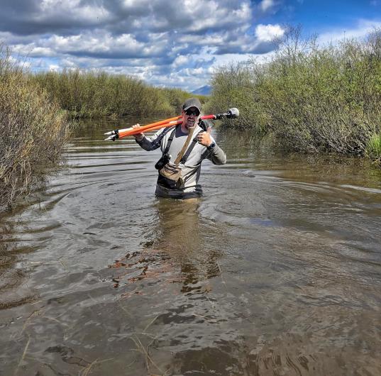
Shielded by a ballcap and sunglasses from the relentless Idaho sun, Gregory Hoskins pauses to survey the rugged hillside before him. Beneath the vast sky, this BLM cadastral surveyor measures more than land—he traces the enduring lines of a nation’s legacy.
As America nears its 250th anniversary, his work reminds us that our nation’s history is written in books and etched on the contours of the land.
“Every stone we uncover, every line we retrace, is a thread in the fabric of America’s freedom. Surveying isn’t just about land—it’s about preserving the promise that began 250 years ago,” says Hoskins.
A System that Built a Nation
The Public Land Survey System (PLSS), created in 1785 by Thomas Jefferson, laid the foundation for private land ownership. It created the grid that shaped settlement, commerce and public lands Americans enjoy today. By protecting original survey monuments and boundaries, Gregory continues the work begun by America’s earliest surveyors – including George Washington, who started his career in surveying before leading a revolution.
Explaining Cadastral Surveying
Gregory’s passion starts with the basics. “Maps are fascinating,” he says. Before family adventures, he studied them to know where they were going and where they had been—a curiosity that led to a land surveying career.
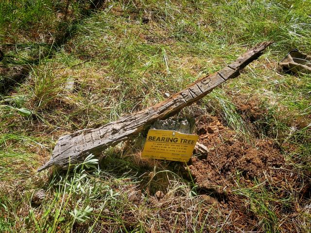
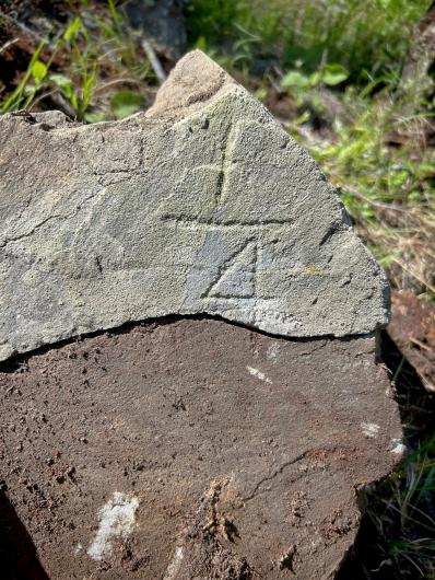
Gregory admits, “It’s hard to describe what my day-to-day job entails: gathering a pile of equipment, hiking up a mountain, and digging up and wire-brushing stones all day.” Yet, he enjoys explaining how the western United States was mapped 66 feet at a time—the length of a survey chain—and how original surveyors set stones or wooden posts as monuments at section corners.
“The location of these original monuments is paramount to the land tenure system,” he says. “You see these grids from roads you drive to the checkerboard pattern visible from an airplane window.”
What is Land Surveying
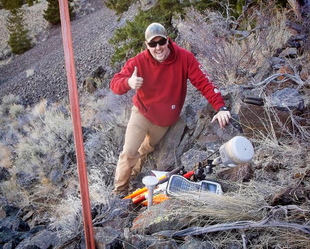
Land surveying is the measurement and mapping of the land's surface to establish boundaries. BLM employees in the Cadastral Survey Program use math, theodolites (telescope on a tripod), GPS receivers, and other tools to measure distances, angles and elevations of public lands.
The work touches nearly everything the public cares about on BLM-managed public lands: forestry and wildfire response, recreation access, minerals and energy, realty transactions, and law enforcement. Clear boundaries help the BLM make management decisions.
Roots in the Land
Gregory’s love for maps and open spaces began in Idaho Falls, where family values of hard work and land ethics guided him outdoors—building forts, snowmachining, skiing, and riding motorcycles. One grandfather, a farmer and rancher, taught him the value of cultivating and owning land; the other, a Forest Service ranger, instilled the importance of public lands and conservation. Those lessons endure in his practice today.
“Land surveying is an imperfect science, but it’s vital. We follow the evidence, not opinions. Our job is to protect the integrity of the Public Land Survey System so future generations can enjoy the same freedoms,” he says.
Carrying the Legacy Forward
Gregory’s bond with the outdoors echoes that of Abraham Lincoln and George Washington, who worked as surveyors before becoming American presidents. In much the same way, Geogory’s field notes and corner stone markings will become tomorrow’s references — enduring marks that BLM uses to conduct land management.
Every project feels meaningful. Each stone monument or scribed tree connects him to surveyors who ventured into the unknown centuries ago. “You feel their marks under your fingers,” Gregory says. “It’s like shaking hands with history.”
Be on the lookout for more insight from other surveyors across BLM Idaho as we mark America’s 250 years of independence.
- Come out to our Freedom 250 Boise Meridian Initial Point Celebration.
- As a teaser for the event, BLM Cadastral Surveyor John Zink recently joined The Ranch Podcast to share insights on Idaho's Initial Point - the starting mark for all public land surveys in the state.
- Check out The Greatest Career You've Never Heard Of - Land Surveying with Michael Hart
Check out other profiles celebrating BLM cadastral surveyors in the lead-up to the anniversary event in May.
- Wilderness to boundaries: How a BLM surveyor keeps America’s 250-year legacy alive | Bureau of Land Management
- Bradley Dillon: The Man Who Measures America
Related Content
Related Stories
- Framed for Freedom: Bureau of Land Management Eastern States and the Legacy of National Historic Trails
- Dino-Mite Story Time in Pinedale
- Nine Miles of Prevention: The Fuel Break that turned the Fire
- Choosing Service: Fort Ord National Monument Celebrates 250 Years of American Legacy
- Desert Strong cleanup partners with BLM to bring volunteers together
Office
1387 S. Vinnell Way
Boise, ID 83709
United States