
Wilderness to boundaries: How a BLM surveyor keeps America’s 250-year legacy alive
BLM Idaho has partnered with the Idaho State Historical Society and the Idaho Society of Professional Land Surveyors for an event celebrating America’s 250th anniversary: the Boise Meridian Initial Point Celebration, scheduled for May 2nd, 2026. BLM Idaho is proud to celebrate America’s 250th anniversary by honoring cadastral surveyors—the professionals who have defined and preserved the boundaries of our public lands for generations. This profile is the first in a series celebrating BLM cadastral surveyors in the lead-up to the anniversary event in May.
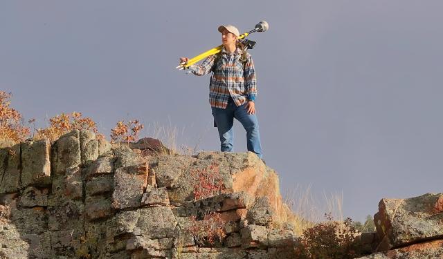
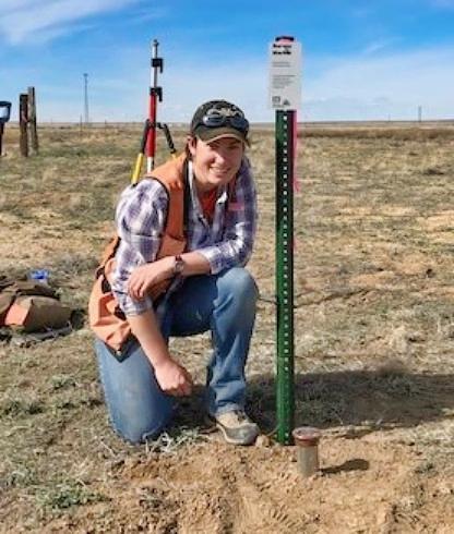
When Katharine Singleton laces up her boots and heads into the backcountry, she’s retracing history. As America celebrates 250 years, Katharine—a Bureau of Land Management (BLM) cadastral surveyor—carries on a tradition that helped shape the nation and still matters today. Surveying was key to westward expansion and remains essential for managing public lands.
What is Cadastral Surveying?
Every land record in the General Land Office begins with a cadastral survey—the process of establishing and documenting boundaries of federal lands. These surveys define property lines, restore original monuments, and provide the foundation for land management decisions. Without accurate surveys, it’s impossible to know where land ownership begins and ends, making them critical for everything from resource management to resolving disputes.
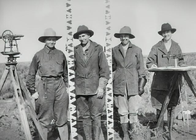
Surveying has a rich tradition in the United States. Many of the Founding Fathers and signers of the Declaration of Independence and Constitution were practicing surveyors. Today, that legacy continues through professionals like Katharine, who sees her work as a bridge between past and future.
“Each boundary I mark and monument I restore builds on the work of those who came before,” she says.
“As surveyors, we don’t decide how land is used, but the information we provide is essential to decision-makers,” Katharine explains. “You can’t effectively manage land if you don’t know where it is, physically, on the ground.”
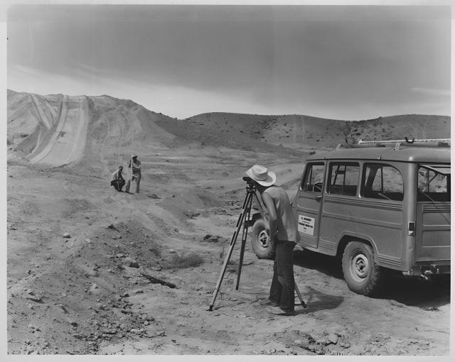
BLM employees in the Cadastral Survey Program incorporate math, science and specialized tools to determine land boundaries and dimensions. They use theodolites (telescope on a tripod), GPS receivers and other tools and techniques to measure distances, angles and elevations of public lands.
For her, the job feels like detective work—piecing together field measurements with clues from old maps, records, and monuments to ensure boundaries remain stable for generations.
Roots in the Outdoors
Katharine grew up in Oregon, where forests, rivers, and rugged coastlines were never far away. Childhood meant camping trips and creek explorations. “Some of my fondest memories are of my older brother and I building dams and seeing how far upstream we could bushwhack,” she says. “Spending time outside for BLM feels like a natural extension of those formative years.”
Ironically, maps weren’t her thing. “Maps were my brother’s thing—so naturally, I avoided them,” she laughs. Today, he’s a transportation engineering professor, and she surveys land. “Funny how different paths can lead to similar places.” With encouragement from her mom and time shadowing crews, Katharine found her fit outdoors. “Turns out, I needed a different kind of map.”
Moments That Matter
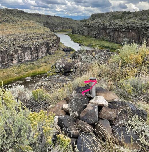
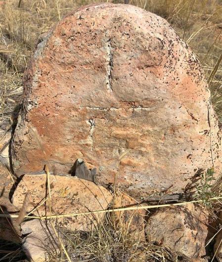
Katharine’s favorite days in the field are when history comes alive. “Nothing compares to uncovering an original stone corner monument that no one else has seen or touched in 150 years,” she says. “It’s the closest I’ll ever come to finding buried treasure.”
“The biggest change in my perspective on land since joining BLM has been losing my romanticized notion of the woods as an ‘untrampled wilderness,’” she says. “Most of the land in the country encompassed by the Public Land Survey System has been crawled over by surveyors at some point in the last 250 years.”
For Katharine, America’s 250th celebration is about continuity. “Surveying ties the past to the future,” she says. It’s her way of keeping history alive.
And if she could share one message with the public? “Good fences make good neighbors—and good surveys make good fences.” For Katharine, that simple truth sums up why her work matters: clear boundaries create trust, stability, and a foundation for the future.
Check out another profile the series celebrating BLM cadastral surveyors in the lead-up to the anniversary event in May.
- Tracing freedom’s lines: How a BLM surveyor honors America’s 250-year legacy
- Bradley Dillon: The Man Who Measures America
Come out to our Freedom 250 Boise Meridian Initial Point Celebration.
- As a teaser for the event, BLM Cadastral Surveyor John Zink recently joined The Ranch Podcast to share insights on Idaho's Initial Point - the starting mark for all public land surveys in the state.
- Check out The Greatest Career You've Never Heard Of - Land Surveying with Michael Hart
Related Content
Related Stories
- Freedom and Liberty Bring the Spirit of the West to Northern Virginia
- BLM-authorized rights of way on public lands connect Arizona’s economy, communities
- Sharing the Spirit of America: A Celebration on the Snake River Canyon Rim
- BLM Launches a Modernized General Land Office Records System
- Birding Aravaipa Canyon: A morning of songs, color, and creekside adventure
Office
1387 S. Vinnell Way
Boise, ID 83709
United States