



Voyages of discovery for the nation’s 250th: Exploring America’s landscapes on BLM back country byways
As the Bureau of Land Management (BLM) commemorates the 250th anniversary of the nation’s founding, it also celebrates the public lands that are the shared legacy of all Americans. These lands tell the story of our nation, chapter by chapter.
There are many ways to read that story through a BLM lens—by visiting the Bureau’s campgrounds and day-use sites; stopping in at one of its interpretive, visitor, or educational centers; or exploring the wilderness areas, national scenic and historic trails, national monuments, and other units included among the agency’s National Conservation Lands. Yet another way is by making voyages of discovery on the back country byways that pass through public lands managed by the BLM.
A brief history of America’s scenic roadways
The agency launched its byways program in 1989 in response to recommendations in the report from the President’s Commission on Americans Outdoors, formed by President Reagan in 1985. Although inspired in part by the National Scenic Byways initiative that grew out of this report, the Bureau’s Back Country Byways Program was tailored to BLM-managed lands, emphasizing access to remote, rugged, and culturally significant routes not typically included in other federal designations.
The Commission’s report called for the creation of a network of scenic byways “to ensure that the character of our nation’s land and water remains more than a memory,” as development spread outward from cities into surrounding landscapes.
The authors foresaw that in addition to “protecting the countryside, through designation, conservation easements, and junkyard and billboard control,” such roadways could bring local economic benefits by keeping travelers in-state longer.
The report, along with the passage of the Intermodal Surface Transportation Efficiency Act of 1991, gave rise to a network of scenic roads recognized at national, state, and agency levels.
The BLM co-manages some of these roadways. We collaborate with the U.S. Department of Agriculture Forest Service on the Palms to Pines Scenic Byway, near the Santa Rosa and San Jacinto Mountains National Monument; partner with Utah’s Garfield County on The Burr Trail Scenic Byway; and, as documented previously, help preserve one of the most celebrated All-American Roads by assisting with the 178-mile-long California Historic Route 66 Needles to Barstow Scenic Byway.
BLM back country byways as windows into American history
From its inception, the BLM’s Back Country Byways Program prioritized partnerships with local communities, visitor safety, support for rural economies, and route classifications that balanced access with resource protection. The routes are organized into four distinct types based on road condition and vehicle suitability:
Type 1 – roads that are paved or have an all-weather surface and can accommodate normal touring cars.
Type 2 – roads that are generally not paved but have a surface that can be negotiated by two-wheel-drive vehicles with high ground clearance.
Type 3 – unsurfaced roads that require a four-wheel-drive or other specialized vehicle, such as an all-terrain vehicle or off-road motorcycle.
Type 4 – generally, single-track trails appropriate for vehicles such as mountain bikes, ATVs, off-road motorcycles, and snowmobiles.
All four types of roads provide not only views of breathtaking scenery but also glimpses of America’s past, etched into some of our nation’s most iconic landscapes.
As KC Craven, the BLM’s National Lead for Recreation and Tourism Benefits, put it, “the agency’s back country byways are a great lens for exploring how public lands connect people to place, history, and the American experience.”
A prime example is the Lewis and Clark Back Country Byway and Adventure Road in Idaho. This 36-mile loop drive, a Type 1 single-lane gravel road with pullouts, follows the Lewis and Clark National Historic Trail and the Continental Divide National Scenic Trail, passing through the river valleys, sagebrush grasslands, mountain forests and meadows, and high desert canyons explored by Meriwether Lewis and William Clark more than 200 years ago.
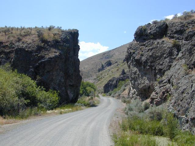
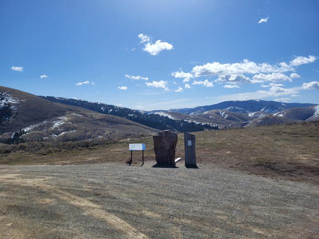
Members of the 1805 expedition had in turn followed trails established by the Shoshone, and the namesake of the Byway’s starting-point, Tendoy, was the Tribe’s head chief from 1863 to 1907. This roadway provides access to beautiful landscapes that bear traces of the nation’s early decades, allowing visitors to experience sites of cross-cultural encounters and to imagine settlement patterns where they unfolded.
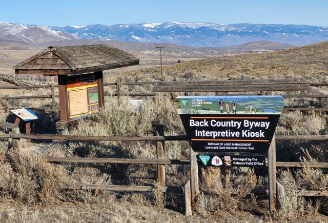
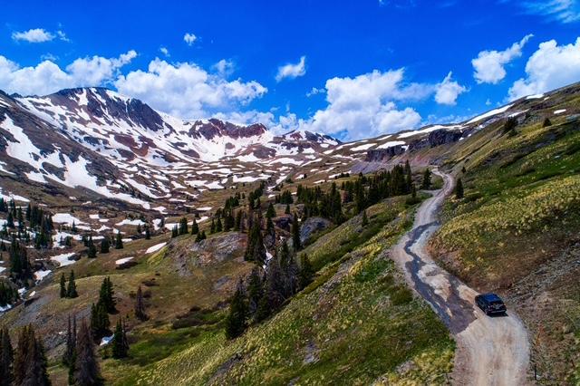
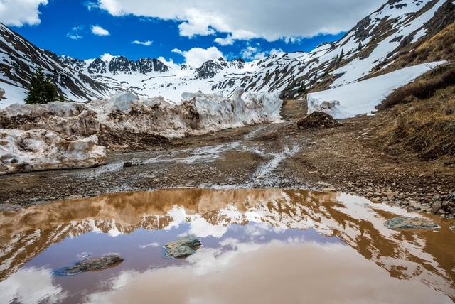
More rugged is the 65-mile Alpine Loop Back Country Byway in Colorado. This road has been classified as Type 3; significant portions of it require, at a minimum, vehicles with four-wheel drive and high clearance, as the road winds through the San Juan Mountains and across passes that are up to 12,800 feet in elevation.
Here, too, visitors can experience scenic landscapes that provide a portal to times past. Now-dormant mines, where workers processed minerals that included copper, gold, lead, silver, tungsten, and zinc, are surrounded by the ghost towns that once supported them. These abandoned mining towns include Howardsville, an early mining camp established in 1874, and Animas Forks, listed on the National Register of Historic Places because of its many ruined structures.
Another window into American history is provided by the BLM’s Transcontinental Railroad Grade National Back Country Byway, located in Utah’s West Desert and managed by the agency’s Salt Lake Field Office.
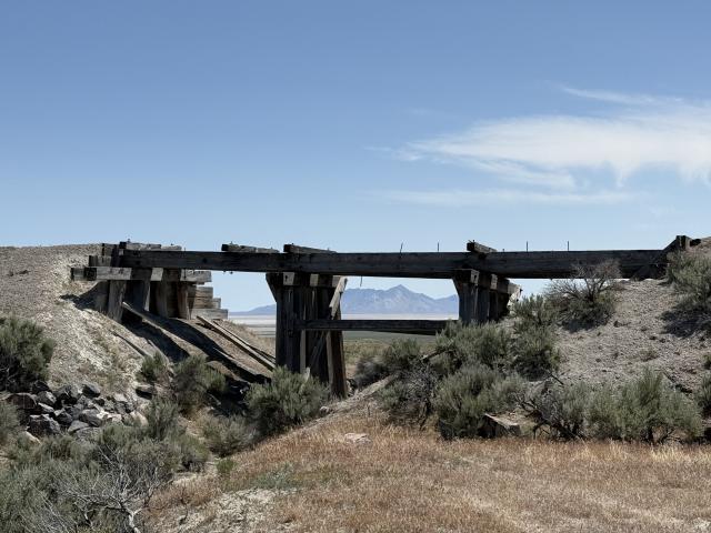
Almost 90 miles long, this Type 2 byway passes through austere desert landscapes as it follows the longest contiguous stretch of original railroad grade remaining in the United States. This stretch was built by the Central Pacific Railroad Company as it worked its way eastward from Sacramento, California, to join up with the stretch being built by the Union Pacific Railroad Company westward from Omaha, Nebraska.
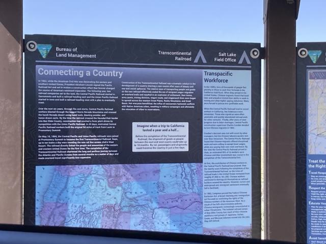
Interpretive signs along the byway provide information about the history of the Railroad’s construction and the communities, now ghost towns, that once supported it. Other stops along the route feature artifacts from the personal and working lives of the Chinese, Irish, and Mormon laborers who played such an indispensable role in completing this historic, nation-changing project in May 1869.
Looking ahead
Serendipitously, the 250th anniversary of the nation comes at a time when the BLM is revitalizing its Back Country Byways Program, with a view to providing even more opportunities for visitors to explore America’s history through its public lands.
KC Craven has spearheaded the agency’s efforts to advance digital storytelling and mapping, so that the public has a clearer sense of where these byways are and what stories they hold. His team is updating information about the byways on its website, aligning them with the BLM’s broader recreation and tourism goals, and connecting them more closely to surrounding communities and their economies.

“As we honor the nation’s 250th anniversary,” Craven said, “it is fitting to spotlight BLM Back Country Byways. These routes allow visitors to travel through time as well as space, enabling Americans to engage with their shared history by accessing their public lands.”
Related Stories
- Celebrating 30 Years of California Condor Recovery at Vermilion Cliffs National Monument
- Postcards Become Monthly Creative Tradition at Red Rock Canyon National Conservation Area in Nevada
- BLM Showcases Local Recreation Treasures Ahead of National Hunting and Fishing Day
- Healing Hooves: How a Once‑Wild Burro is Bringing Joy Across Pennsylvania and Competing Nationally
- Gallant: A BLM mustang with a bright future