
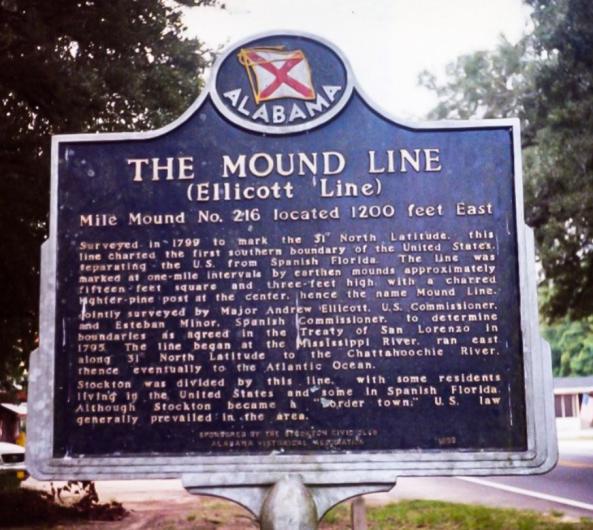
The Mound Line
This week, we are heading south to the Alabama-Florida state line to learn about the United States boundaries and Andrew Ellicott, a prolific surveyor involved in establishing the first southern boundary! In 1790, Ellicott was commissioned by President George Washington to survey the lands surrounding the Potomac River - what famous city do you think he helped establish? After completing this work, Ellicott went on to lead the Line of Demarcation survey between the United States and Spanish Florida, and much more. Read more about this fascinating history in this GLO Record.
The GLO website provides live access to Federal land conveyance records for the Public Land States, including image access to more than 12 million federal land title records issued between 1788 and the present.
The site also hosts images of survey plats and field notes, land status records, and control document index records, and is one of the most visited websites in the Department of the Interior. Visit glorecords.blm.gov for more information.
Related Stories
- Freedom and Liberty Bring the Spirit of the West to Northern Virginia
- BLM Launches a Modernized General Land Office Records System
- Framed for Freedom: Bureau of Land Management Eastern States and the Legacy of National Historic Trails
- Safety Week 2026: Building Skills, Confidence, and a Stronger Safety Culture
- Strengthening Partnerships: BLM Connects with Industry at Key Oil and Gas Meetings in Ohio and Pennsylvania
Office
5275 Leesburg Pike
Falls Church, VA 22041
United States