
Acton | Montana
Located approximately 18 miles north of Billings, the Acton Recreation Area consists of an extremely diverse landscape. With Cretaceous Age upland bluffs of Eagle sandstone, minor badlands, steep drainages, weathered shale, and scattered ponderosa pine, this 3,800-acre parcel of land allows for many wildlife-viewing opportunities. Open to camping, hiking, horseback riding, mountain biking, and hunting (during season), Acton provides multiple possibilities for use year-round. About 6.6 miles of mapped roads are open for motorized use.
The Acton Recreation Area is located within the Hoskins Basin Archaeological District, an area containing the remains of both conical and cribbed aboriginal wooden dwellings. Both types are increasing rarities on the northwest plains, as are sites where both sorts of structures are represented. Reports of early explorers indicated that dwellings of this type were once common. Due to loss through natural causes (weathering, floods, and fire), many of the structures have been lost. Their use for firewood and fence posts accounts for other losses.
Distribution of the both the cribbed and conical dwellings is quite limited. The cribbed type is reported to have been spotted only from south-central Montana to northern Wyoming. The conical type has a wider range but is not as common in south-central Montana as the cribbed type. No off-road motorized vehicle use is permitted to protect the archaeological sites and wildlife habitat.
Accessibility Description (ABA/ADA)

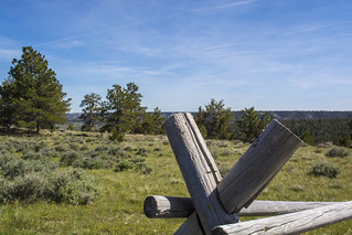
Click on the image above to view more photos of accessibility features at this site.
The site has a parking loop consisting of loose gravel. The loop is delineated with large rocks indicating parking areas. The site has no running water or hook ups. However, cell phone reception is good throughout the recreation area.
An accessible double vault toilet sits next to the parking area. Two shaded information kiosks and a notice board are also located here.
A gravel path leads to a picnic pavilion northwest of the toilet. This shelter covers a picnic table with an extended end to accommodate wheelchair users that sits on a concrete pad. There is a grill at the pavilion, though it does not meet accessibility standards.
Visitors access the main campground with 12 designated campsites by a flat gravel road heading south. Each campsite has its own gravel parking spur. The first 2 campsites in the main campground have accessible picnic tables with an extended top to accommodate wheelchair users. These campsites, like the others throughout the recreation area, have single-walled fire rings with a grill attachment not designed with accessibility in mind. One campsite is walk-in only and is not accessible.
Further south along the road are 3 additional designated campsites with fire rings and picnic tables. Two of these sites have accessible picnic tables. To reach these sites along with other, dispersed camping opportunities along this road, visitors will require a high-clearance vehicle.
Although the mountain bike trails in the area are not wide enough for adaptive bikes, the nearby 1-mile Hoskins Loop trail is wider and could be used for adaptive bikes. There is also an 8-mile-long fire road in the area that could be used by riders with adaptive bikes.
The BLM has an agreement with the local chapter of the International Mountain Bicycling Association to install a pump track at this site in 2025. Featuring hills and berms that allow riders to propel themselves around the track without pedaling or pushing their bikes, this new feature will provide further opportunities for accessible recreation at the site.
NOTE: Descriptions and photos uploaded November 2024. Please note that actual on-the-ground conditions may vary due to natural events (e.g., weather, wildfires, erosion), normal wear and tear, or site improvements.
Flickr
Contact Us

Activities


Geographic Coordinates
Directions
Take Highway 3 north past the town of Acton. Take a right onto Oswald Road, which is located between mile marker 18 and 19. Continue 6.5 miles until Haeg Road and take a right. About 2.5 miles farther is the parking lot and entrance to the Acton Recreation Area.
Fees
No fees.