
Sleeping Giant/Sheep Creek
Values
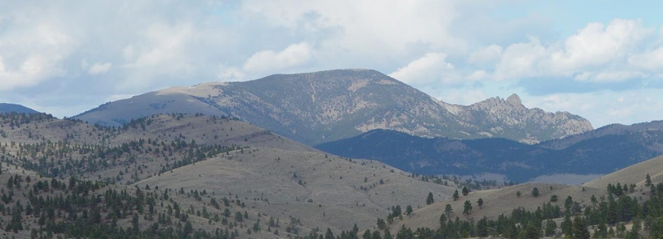
The Sleeping Giant/Sheep Creek WSA are two units separated by a powerline Corridor. The Sleeping Giant unit is named for a profile of Beartooth Mountain and lower elevation rock outcroppings that resemble a reclining human figure as visible from Helena. It is a well-known landmark. Topography of the area is irregular, with numerous steep and narrow drainages dissecting the area. Sedimentary rock ledges and talus slopes provide further relief. Perennial streams are found in Sheep Creek and Rose and Falls Gulches in the Sheep Creek unit. About half the area is forested with ponderosa, limber and lodgepole pine, cottonwoods, and Douglas fir trees. Vegetation in the remainder is native grasslands consisting primarily of bluebunch wheatgrass, Idaho fescue and forbs. A diversity of wildlife species live here, including a thriving population of mountain goats that occupies the high outcroppings. Other wildlife include elk, black bear, bighorn sheep, mule deer, osprey, and golden eagles. Recreation opportunities include hiking, sightseeing, wildlife viewing, primitive camping, and fishing. Seven miles of ridge-line hiking trails offer spectacular panoramic views.
Visitation
The Sheep Creek and Sleeping Giant WSAs are Located about 30 miles north of Helena, Montana. From the south (Helena), take exit 219 off Interstate 15 (Recreation Road). Drive north about 3/4 mile on Recreation Road to Woodsiding Road. Turn east on Woodsiding Road, a dirt road suitable for most vehicles, and drive about 2 ¾ miles to an equestrian trailhead. Park here if you are pulling a trailer, the road is wet, or you don’t have a vehicle with clearance and traction. Otherwise, drive 2 miles on a rough and progressively steeper road to the upper Sleeping Giant Trailhead (at a saddle between two highpoints of 6,482 feet and 6,771 feet). From the trailhead, hike upslope on a steep two-track closed to vehicles, which transitions to a single track. The trail stays on the top of ridgelines, and ideally ends at Beartooth Mountain. However, where the trail enters grassy balds it becomes indistinct, and consequently, you will have to rely on your own good navigation skills to hike the trail to its end. If you are coming from the north (Great Falls), take exit 226 off Interstate 15. Drive east off the freeway exit, passing under the bridge about .1 mile. Drive south at the "T" on Recreation Road and travel approximately 6.5 miles to Woodsiding Road. Follow the remainder of the directions above.