
Mobile GIS
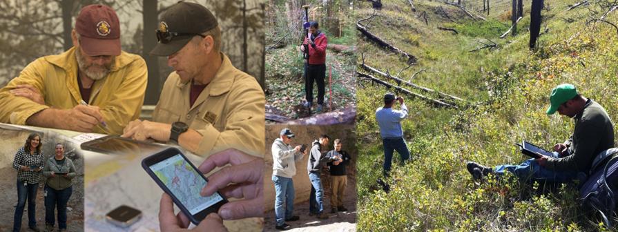
The BLM uses geospatial data to manage public lands for various resources and multiple uses. Accurate field data collection is essential in making informed land management decisions. Every day, staff collect and sync geospatial data with BLM's GIS databases using Mobile GIS hardware and software products, which provide tools for data workflows and integration.
Across the nation, the BLM has adopted user-friendly mobile data collection apps that streamline fieldwork. These apps improve data accuracy, reduce manual entry, reduce errors, and integrate field data into national datasets, saving time and money.
In the field, BLM staff use mobile apps like ArcGIS Field Maps, Survey123, and QuickCapture from the international leader in GIS software, Esri. BLM has an internally developed app named S1 Mobile Mapper and other projects in the works to make mapping data freely available to the public. These apps sync with GIS databases via BLM ArcGIS Online. Once downloaded, staff can collect data offline in remote areas and sync it when reconnected.
The BLM’s Mobile GIS strategy is a collaborative effort across the Bureau. It provides recommendations for hardware and software to ensure field data collection meets staff needs. Devices are tested annually for accuracy, battery life, and security. Training courses are held virtually and in person around the country to engage with our users in their offices and give them real world experience in usage.
The BLM values geospatial information and is committed to using the latest technology to support successful and accurate data collection as part of its geospatial strategy.
Latest News
The Bureau of Land Management is excited to announce the release of our new National Mobile Recreation MMPK (Mobile Map Package) system for public use. Our MMPK’s allow you to have a large amount of mapping data in a GPS enabled application for your use for recreational purposes. These packages are free to download and use via the ArcGIS Field Maps app for Android and for Apple iOS. You can also download these via our new Geospatial Business Platform Mobile Hub page for use in ArcGIS Pro (ESRI license required) for desktop PC use.
Included in these packages are multiple datasets managed by the BLM to help you identify lands near you and points of interest for recreation in your area. More datasets are in the works to be included, in future versions.
Visit BLM’s National Recreation Mobile Map Packages (MMPK’s) for more information on the program, download instructions, and frequently asked questions.