
Dow Canyon Tract
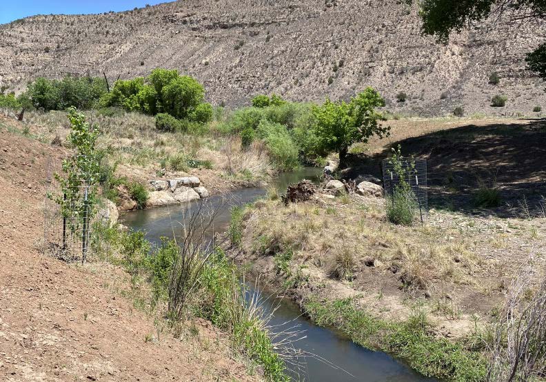 This tract of land has the riparian area along the Rio Bonito with grassy upland benches, interspersed with pinyon and juniper groves stretching up to the highway. The trail system starts at the parking lot, heads north and south and connects with a two track that parallels the river. Because there is not a lot of elevation change, the area is perfect for easy hiking, biking and equestrian use. BLM has completed a two-mile-long river restoration project on this tract, creating pools, mitigating erosion, and creating a cold-water fishery. This section of the Rio Bonito is stocked periodically by the New Mexico Department of Game and Fish. The access point for the Dow Canyon Tract is on US Highway 380 at mile marker 100.9. There is a parking lot and an informational kiosk with a map at the trail head.
Latitude/Longitude: 33.46312, -105.34461
The following acts are prohibited:
- Overnight camping
- Discharge of firearms
- Motorized vehicle use anywhere on the Rio Bonito tract (except for authorized users)
- Removing or attempting to remove any plants or vegetation
- Excavating, damaging, removing, altering or defacing any archaeological or cave resources
Please be aware and respectful of:
- Private property boundaries
- Current fire restriction status
- Noise level and trash management – Leave No Trace