
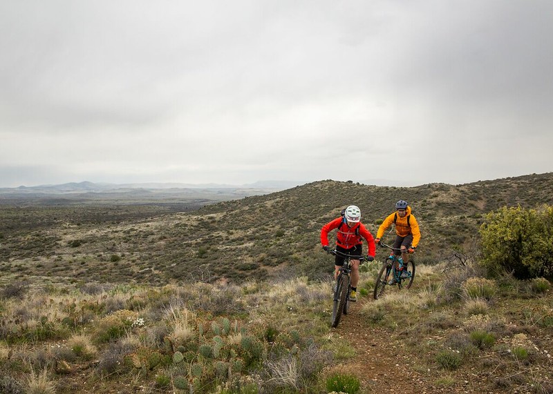
Black Canyon Trail, AZ
The 80-mile Black Canyon Trail provides mountain bikers with a long-range backcountry trail riding opportunity. This historic National Recreation Trail is of national significance, following a route used since the times of prehistoric Native American travelers and traders. This trail provides a challenging ride experience characterized by rough, unstable soils and rocks, with various trail grades and numerous elevation changes within a harsh desert climate. The trail meanders through the Sonoran Desert landscape, including saguaro forests and rugged canyons.
One of the Bureau of Land Management's "Backyard to Backcountry" treasures, information on the Black Canyon Trail was developed between IMBA and the Hassayampa, AZ, BLM office to provide world-class riding experiences. IMBA's data on the trail includes elevations, ratings, current conditions, photos, and comments.
Photo Album
Featured Video
Need to Know
![]()
![]()
![]()
![]()
![]()
Plan Your Visit
- Season Dates: The trail is recommended for use from November through April. At other times of the year, the trail is seldom used.
- Fee: None
- Size: 80+ miles
- Elevation Gain/Loss: 4,500 feet ascent, 7,500 feet descent
- Difficulty: Intermediate
Quick Links
Directions
Emery Henderson Trailhead — From Phoenix, take Interstate 17 north and exit at New River Road, Exit 233. Head west (left) and continue approximately three miles. The Trailhead is on the north (right) side of the road. From Prescott, take Highway 69 to Interstate 17, and head south. Take the New River Exit 233. Head west (right). Travel about three miles on the New River Road and turn right at the developed area.
Table Mesa Trailhead — From Phoenix, take Interstate 17 to the Table Mesa Road Exit 236, turn west (left), then right on the frontage road. Drive approximately 1.65 miles to the "Y" and bear left, drive approximately 1.4 miles and look for the side road on the right. Turn onto this road and the trailhead is immediately to the left. From Prescott, take highway 69 to Interstate 17, head south. Take the Table Mesa Road Exit 236, turn west (right), then right on the frontage road. Drive approximately 1.65 miles to the "Y" and bear left, drive approximately 1.4 miles and look for the side road on the right. Turn onto this road and the trailhead is immediately to the left.
Black Canyon City Trailhead — From Phoenix, take Interstate 17 north and exit at Rock Springs/Black Canyon City Exit 242. Head west (left). At the stop sign turn right then a quick left onto Warner Road. Follow the road to the white tank which marks the Black Canyon City Trailhead. From Prescott, take highway 69 to Interstate 17, head south. Take the Black Canyon City/Cold Water Road Exit 244. Drive through town and turn west (right) onto Werner Road. Follow road to the white tank.
Glorianna Trailhead — From Phoenix, take Interstate 17 north. Take the Bumble Bee/Crown King Exit 247 and turn right on the frontage road then proceed approximately ½ mile to the trailhead on the left. From Prescott, take Interstate 17 south. Take the Bumble Bee Exit 247 and proceed approximately ½ mile to the trailhead on the left.
Big Bug Trailhead--From north or south, on Interstate 17, take the Prescott (Highway 69)/Cordes Lakes Road exit 262. Proceed approximately 4.2 miles to the entrance on the west (left) side of the highway. There is no signage identifying the trailhead, so be sure to watch your odometer
Contact Information
Connecting with Communities

The BLM and MTB Project are Connecting with Communities through a National partnership to provide an interactive ride experience. MTB project hosts the next generation of mountain bike trail maps. Click the MTB Project icon to access all the information you'll need to plan your next ride.