
Oregon Mountain Biking Opportunities: Alsea Falls
The Alsea Falls Trail System offers a connected network of roads and trails that currently provides a range of opportunities for mountain bikers. All trails are located between 800' and 1900' elevation, in a second growth forest surrounding Fall Creek, a tributary of the South Fork Alsea River.
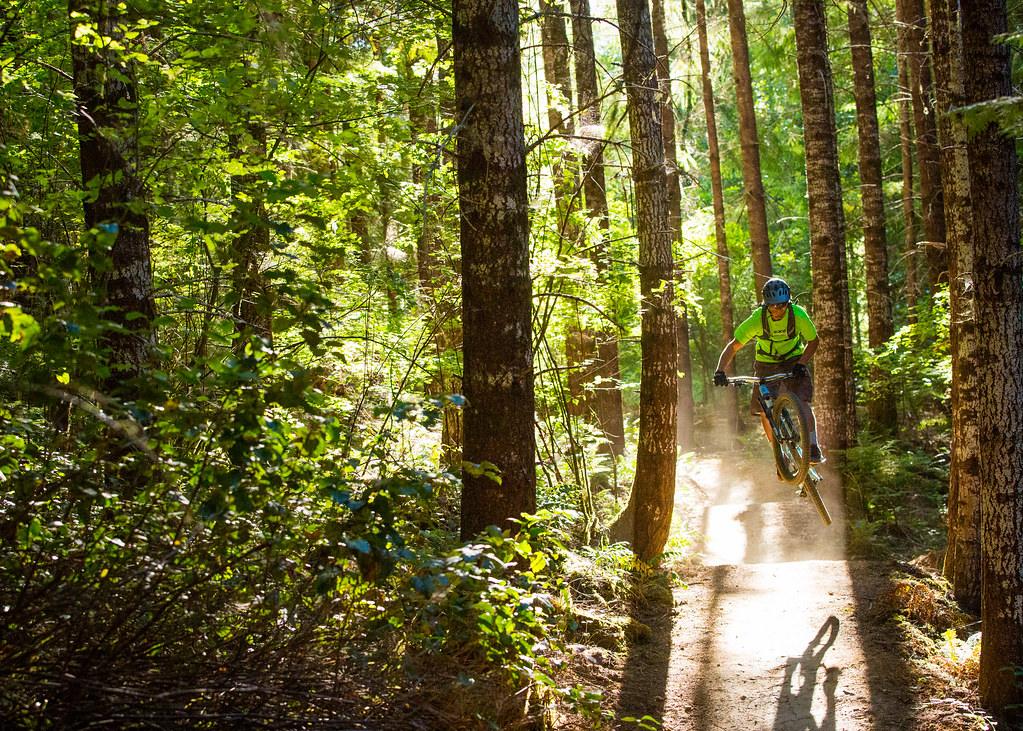
The system includes several mountain bike "flow" trails that incorporate progressive trail design and construction techniques. Flow trails within the system maximize the fun of mountain biking by combining features like rolling terrain and banked turns. Upper trails within the system have been designed to provide challenging features such as steep rock chutes and plenty of trail texture achieved through the placement of technical rock features.
One of the Bureau of Land Management's "Backyard to Backcountry" treasures, information on the Alsea Falls Trail System was developed between IMBA and the Northwest Oregon BLM District office to provide world-class riding experiences. IMBA's data on the trail includes elevations, ratings, current conditions, photos, and comments.
Need to Know
![]()
![]()
![]()
Plan Your Visit
- Season Dates: January 1 - December 31
- Fee: $5-$20 daily depending on vehicle capacity or $30 annual at all day use sites, except Yaquina Head
- Size: 12.5 miles
- Elevation Gain/Loss: 1,850+ feet
- Difficulty: Trails range from beginner to advanced
Quick Links
Directions
- There are two ways to access the Alsea Falls trailhead. East access: From Corvallis, take Hwy 99W south 15 miles. Turn west on Alpine Road and drive to the town of Alpine. Continue along Alpine Road 9 miles to Alsea Falls Campground. Just past campground, turn left on Fall Creek Road. West access: Travel Hwy 34 south from Philomath to the town Alsea. Turn south, travel on Alsea Deadwood Hwy 1 mile to the South Fork Road which then connects with the South Fork Alsea Access Road. Just past the Alsea Falls picnic area, turn right on paved Fall Creek Road.
Contact Information
Northwest Oregon District Office
1717 Fabry Road, SE
Salem, OR 97306
503-375-5646
Connecting with Communities

The BLM and MTB Project are Connecting with Communities through a National partnership to provide an interactive ride experience. MTB project hosts the next generation of mountain bike trail maps. Click the MTB Project icon to access all the information you'll need to plan your next ride.