
Seven Blackfoot WSA
Values
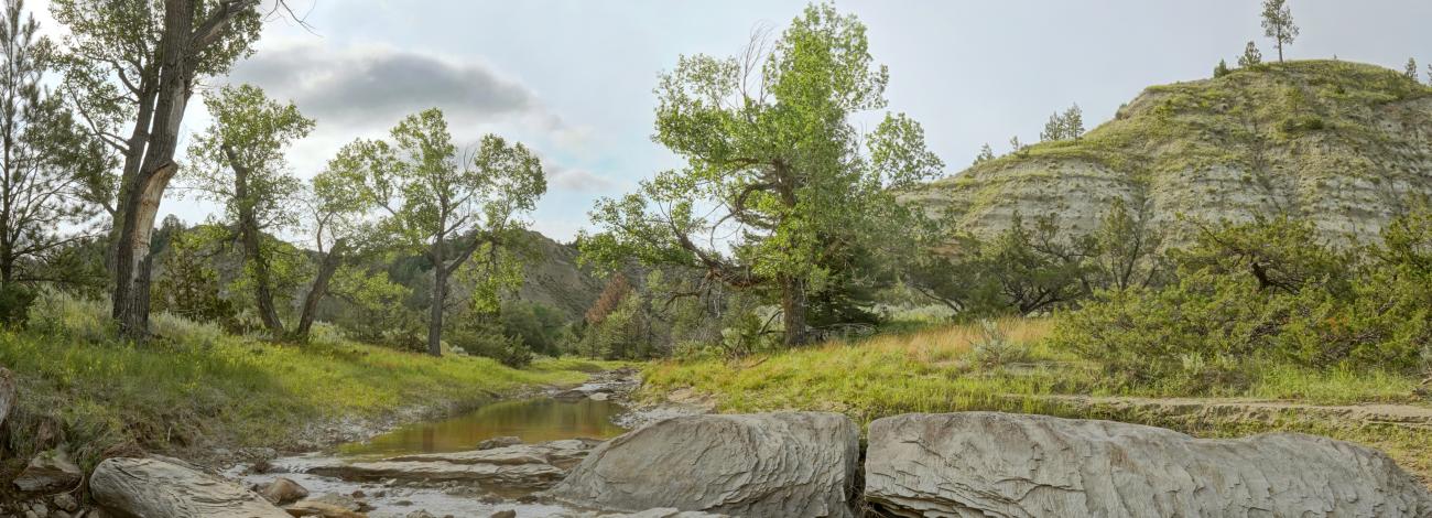
The Seven Blackfoot WSA consists of terrain highly dissected by coulees and a single creek, Seven Blackfoot Creek, partially lined by cottonwood trees. It is a broken landscape formed by erosion through shales and sandstones that has left steep grey slopes cut into rolling grassy prairie and offset by pockets of juniper, ponderosa pine and Douglas fir. It is a rugged area with vistas of breathtaking beauty. The presence of Douglas fir is unusual this far east. Plant and flower enthusiasts can find many species of grass, flowering forbs, and brush. Wildlife within the WSA includes elk, deer, coyotes, mountain lions, porcupines, hawks, owls, badgers, horned lizards, rattlesnakes, and many song birds. The fossil bearing Hell Creek and Tullock formations are exposed in places. Recreational opportunities in this WSA include hiking, hunting, backpacking, nature photography and sightseeing.
Visitation
The Seven Blackfoot Wilderness Study Area (WSA) is approximately 30 miles northwest of Jordan, Montana in Garfield County. The only available public access is at Chalk Butte where the Chalk Butte Coulee can be entered to the west. From Jordan, go towards the Jordan airport (west of Jordan) on the Brusett Road. Travel on the Brusett Road (which is initially paved and then turns into a gravel road) approximately 20 miles to the four way intersection with Edwards Rd (south) and W Snow Creek Rd (north); turn right on W Snow Creek Rd and drive 6 miles. Chalk Butte is on the right and a walk through gate is on the left, providing access to Chalk Butte Coulee.
Visitor Advisory
Hiking in and out of Chalk Butte Coulee is difficult. There are no developed trails; though wildlife trails may be found, it is difficult to keep on the one leading to your desired goal (especially on your return), and so this should be approached as a cross country hike requiring route finding. The terrain includes boggy areas which can be difficult to avoid. Potable water (treatment being required) is scarce at best. The road system leading to the WSA is not signed/labeled, and so visitors are advised to stop at the Miles City Field Office and obtain a BLM map.