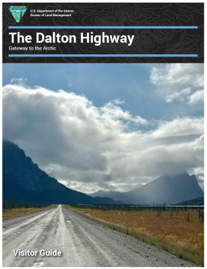
Dalton Highway Recreation
Ultimate Road Adventure
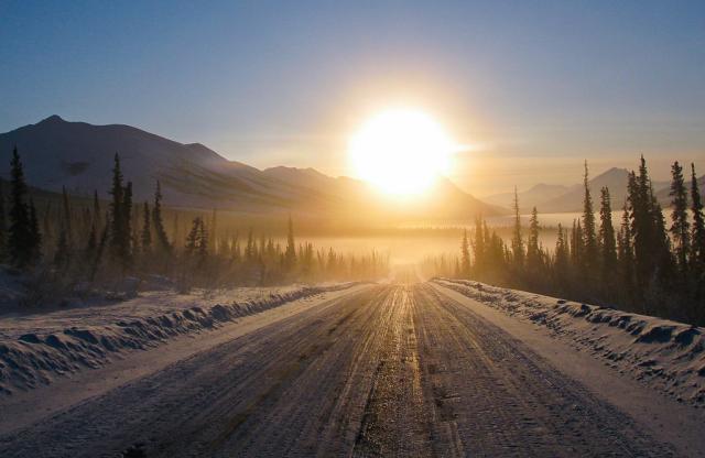
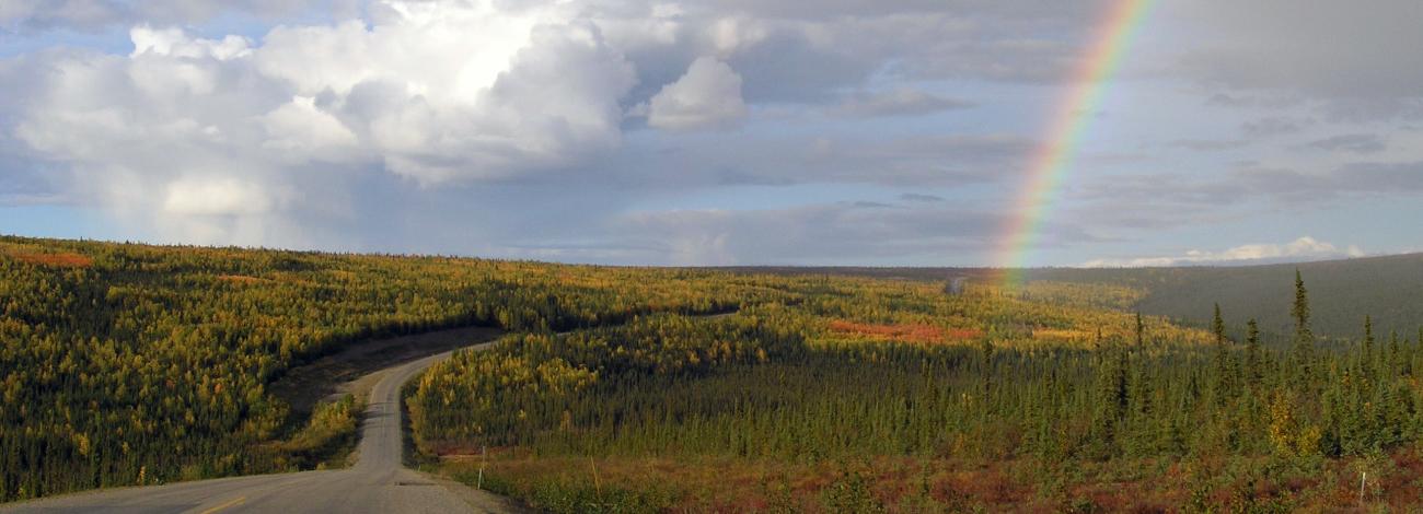
The 414-mile Dalton Highway is one of the most isolated roads in the United States. Built during construction of the trans-Alaska oil pipeline in the 1970s, this mostly gravel highway travels through rolling, forested hills, across the Yukon River and Arctic Circle, through the rugged Brooks Range and across the North Slope to the Arctic Ocean.
You'll find few services along the way — just forest, tundra and mountains, crossed by a ribbon of road and pipe. For those seeking the ultimate road adventure, Dalton Highway offers world-class recreation opportunities. The BLM manages public lands and maintains several recreational facilities along the highway from the Yukon River to the north side of the Brooks Range.
Know Before You Go
Review the safety information in the Visitor Guide (PDF) or on the Dalton Highway Visit webpage to be sure that you're adequately prepared.
Pack it In – Pack it Out
The BLM hauls approximately 20 tons of litter from the Dalton Highway back to Fairbanks (the nearest landfill) each year. Please help reduce waste and litter by packing out everything you pack in.
- Hiking
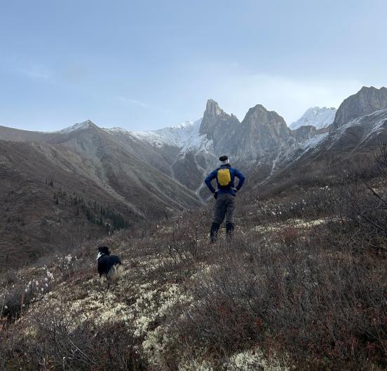
Throughout much of the Arctic, wetlands and bogs make walking challenging. Unstable tussocks – basketball-sized clumps of sedge grass surrounded by watery moss – are particularly aggravating to try to navigate through. Alongside the Dalton Highway, the best hiking is in the mountains and foothills of the Brooks Range, where the forest thins to low-growing tundra and firm footing can be found on ridges and riverbeds.
In the Brooks Range, hiking east from the highway leads to the Arctic National Wildlife Refuge. Hiking west leads to Gates of the Arctic National Park and Preserve. There are no trails, signs, cell service or facilities in either land unit. These are truly wild places, full of dynamic rivers, snowy passes, unpredictable weather, rockfalls and wildlife. You must choose and navigate your route carefully and be fully self-sufficient. You may only cover up to 5 miles in the course of a full day of hard hiking. Waterproof boots with good ankle support are essential, as are topographic maps and a compass set to proper declination (27-30 degrees east of true north). Always filter or treat water. Carry fire starters in case of an emergency, but know that wood is scarce; have a stove for cooking food. Either bring your own bear canister or borrow one for free from the Alaska Public Lands Information Center in Fairbanks or the Arctic Interagency Visitor Center in Coldfoot. Backcountry visitors to Gates of the Arctic National Park and Preserve may also register at either center.
Hiking is also allowed within the Dalton Highway corridor. Follow short, unmaintained trails to explore a granite tor near Finger Mountain or a waterfall along Marion Creek, about 1.7 miles from the campground. If day-hiking or backpacking off trail, plan and prepare as you would for treks in the wildlife refuge or park and preserve.
Hiking in the Dalton Highway Corridor Help keep these places wild by following the Leave No Trace © principles:
- Plan Ahead and Prepare
- Travel and Camp on Durable Surfaces
- Dispose of Waste Properly
- Leave What You Find
- Minimize Campfire Impacts
- Respect Wildlife
- Be Considerate of Other Visitors
In particular, please always respect and protect cultural and paleontological resources. If you find any artifacts or fossils, leave them exactly where they are and report them to the Bureau of Land Management.
- Camping
Personal camping, outside of developed areas is limited to 14 days at any one spot. Park well off the road and do not block access roads to the pipeline.
The BLM maintains four campgrounds along the Dalton Highway. They are open approximately May-September and first come, first served (no reservations).
Five Mile (Milepost 60, 4 miles north of the Yukon River)
Newly improved in 2022, this campground offers a vault toilet, potable water in an artesian well, and seven gravel campsites each with a picnic table and fire ring. No Fee for camping.
Five Mile RV dump station: Located next to the campground, this is the only RV dump station along the Dalton Highway. Fee: $5/use, payable by cash, check or credit card. To use a credit card, download the free Recreation.gov mobile app.to your device prior to departure from Fairbanks. Once on site, use the app's Scan and Pay feature to scan the QR code and make a payment. The card will be charged once you’re back in range of cell service.
Arctic Circle (Milepost 115)
Located approximately ½ mile up the hill via an access road at the north end of the Arctic Circle Wayside.
Renovated in 2021, the campground offers bear resistant trash cans, two vault toilets, and 19 sites, complete with leveled campsites, fire rings and picnic tables. Water is not available. The nearest potable water is at Five Mile Campground (55 miles to the south) or Marion Creek Campground (65 miles to the north).
Fee: $12/night, payable by cash, check or credit card. To use a credit card, download the free Recreation.gov mobile app.to your device prior to departure from Fairbanks. Once on site, use the app's Scan and Pay feature to scan the QR code and make a payment. The card will be charged once you’re back in range of cell service.
Marion Creek (Milepost 180, 5 miles north of Coldfoot)
There are 27 gravel sites, one of which is designated accessible. Each campsite has a fire ring and picnic table. Fourteen sites are pull-through, allowing easy access for RVs. The campground has potable water, vault toilets and trash receptacles. There is no electricity and no dump station. A camp host is onsite, and firewood is available.
Fee: $12/night, payable by cash, check or credit card. To use a credit card, download the free Recreation.gov mobile app.to your device prior to departure from Fairbanks. Once on site, use the app's Scan and Pay feature to scan the QR code and make a payment. The card will be charged once you’re back in range of cell service.
Galbraith Lake (Milepost 275)
To reach the campground, turn left onto Galbraith Airport Road at MP 275, pass the airport buildings on your left, and follow the unimproved gravel road another 2.5 miles to the campground. Although the campground sits about a mile away from Galbriath Lake itself – a remnant of a large glacial lake that once occupied the entire Atigun River valley – it affords spectacular views of the lake and the Brooks Range, with Gates of the Arctic National Park and Preserve to the west and the Arctic National Wildlife Refuge to the east.
This rustic campground has roughly 12 unimproved campsites, a bear-proof garbage can and one vault toilet. Flowing water is available at a nearby creek, but must be filtered or treated before consumption.
Fee: $12/night, payable by cash, check or credit card. To use a credit card, download the free Recreation.gov mobile app.to your device prior to departure from Fairbanks. Once on site, use the app's Scan and Pay feature to scan the QR code and make a payment. The card will be charged once you’re back in range of cell service.
- Boating
Several excellent river trips have put-ins or take-outs along the Dalton, including:
- Yukon River (Milepost 56): Class I-II. Put in upstream and/or take out downstream of the crossing. Boat launch available.
- Jim River (between Mileposts approximately 136-148): Class I-II, several access points along the highway.
- Middle Fork of the Koyukuk River (between mileposts approximately 166-207): Class I-II, several access points along the highway.
- Atigun River Gorge (Milepost 271): Class III-IV+ whitewater. For expert boaters only.
- Sagavanirktok River, "the Sag" (Milepost 306): Class III-IV+ whitewater. For expert boaters only.
- Ivishak Wild and Scenic River (Milepost 361): Class II, access by chartered air service from Deadhorse or Coldfoot.
Help keep these rivers wild by following the Leave No Trace © principles:
- Plan Ahead and Prepare
- Travel and Camp on Durable Surfaces
- Dispose of Waste Properly
- Leave What You Find
- Minimize Campfire Impacts
- Respect Wildlife
- Be Considerate of Other Visitors
- Gold Panning
Recreational panning is permitted on a few federal stream segments south of Atigun Pass (milepost 244). Panning is not allowed in the pipeline right of way (27 feet / 8.2 meters on either side of the pipeline), nor on federal mining claims without permission. Suction dredging is prohibited in the Utility Corridor.
For detailed information about open creeks and rivers and their potential for gold, see Panning for Gold along the Dalton Highway.
- Fishing
Arctic grayling, arctic char, burbot, lake trout and northern pike can be found in the far north. In the Arctic, fish grow and reproduce slowly and are susceptible to overharvest. Anglers are encouraged to use barbless hooks and release fish without injury. The BLM Alaska Fishing Chart provides a map and list of waterways and species.
To fish along the Dalton Highway, you need an Alaska sport fishing license and a current regulations booklet for the Arctic-Yukon-Kuskokwim Region. Learn more at the Alaska Department of Fish and Game.
- Hunting
Hunting is permitted in most areas, but there are special regulations.
- From the Yukon River (milepost 56) north, hunting with firearms is prohibited within 5 miles (8 km) on either side of the highway. Bow hunting is permitted within most of this area. State statute also prohibits off-road vehicle use within 5 miles of the highway from the Yukon River north to the Arctic Ocean.
- All hunting is prohibited in the Prudhoe Bay Closed Area.
- Sport hunting is prohibited in Gates of the Arctic National Park but allowed in Gates of the Arctic National Preserve.
Be sure you have accurate maps of the boundaries. Licenses are required. For complete regulations, maps of closed areas, and assistance planning your hunt, consult the Alaska Department of Fish and Game.
- Kids Activities
Here are some links to fun and educational resources for kids:
- Dalton Highway Quest
- Junior Ranger program for Gates of the Arctic National Park and Preserve
- “Discover Dinosaurs – BLM Junior Ranger Mission” by Agents of Discovery
- Artist In Residence
The Bureau of Land Management’s Artist-in-Residence Program (AiR) is founded on the belief that artists look closely at the way the world works, notice things that others may have missed, challenge ideas, and can provide new ways to look at and appreciate public lands. Artists can help us share the scenic beauty and unique stories of public lands with the public through the world of art. The AiR program provides artistic and educational opportunities promoting deeper understanding and dialogue about the natural, cultural and historic resources on public lands.
Since 2018, the BLM has hosted an Artist-in-Residence along the Dalton Highway, sometimes in collaboration with other entities. This residency is intended to promote artistic interpretation of the beauty and value of natural places promised to future generations of travelers.
See the Dalton Highway Artist-in-Residence page for more information.
- 2018 – Kelly Ann Sheridan, painter
- 2019 – Iris Sutton, painter
- 2020 – cancelled due to COVID
- 2022 – Bathsheba Demuth, writer
- 2023 – Kristin Link, scientific illustrator
Current Traveler Alerts
While in the construction zones please stay in your lane and do NOT try to pass other vehicles.
Watch for wildlife on and near the road, including moose, grouse, ptarmigan, and caribou.
Always drive with headlights on.
For more detailed information about travel conditions and construction refer to the Alaska Department of Transportation and Public Facilities’ Traveler 511 webpage, which offers site-specific warnings and webcams.
Georeferenced Maps
Southern region Fairbanks north to Coldfoot (18.4 MB)
Northern region Coldfoot north to Deadhorse (17.3 MB)
Flickr Album
See photos of the Highway in all seasons in the BLM Alaska's Dalton Highway Flickr Album