
Frequently Asked Questions
Explore the answers to questions that our rangers are frequently asked.
- What is the Arctic Circle?
-
Similar to (and parallel to) the equator, the Arctic Circle is an imaginary line that geographers use to refer to a key characteristic of earth's rotation. It circles the northern hemisphere at a latitude of about 66½ degrees north.
This latitude is important because it demarcates the southernmost boundary of a region -- the Arctic -- in which every location receives a full 24 hours of sunlight for at least one day of the year (summer solstice) and a full 24 hours without the sun rising above the horizon for at least one day of the year (winter solstice).
Why 66½ degrees? Another way to think of it is 90 degrees north latitude (the North Pole) minus 23½ degrees = 66½ degrees.
Okay, where does the 23½ degrees come from? Every day, the earth rotates around its axis. (The north pole marks one end of earth's axis of rotation. The south pole marks the other. The equator is halfway in between.) And every year, the earth makes an orbit around the sun. Currently, earth's axis is tilted about 23 ½ degrees off perpendicular, relative to its annual orbit around the sun. This is referred to as "obliquity." That means that some times of the year, the northern hemisphere is pointed toward the sun and basks in extra sunlight, and some times of the year, the northern hemisphere is tilted away from the sun, and everywhere north of the Arctic Circle receives no direct light. The opposite happens in the southern hemisphere, beyond the Antarctic Circle.
To complicate matters further, the Arctic Circle moves slightly, year to year. External gravitational forces cause Earth to wobble a little bit, sort of like a spinning top. Over the course of tens of thousands of years, Earth's obliquity ranges from 21.1 degrees to 24.5 degrees.
- How long does it take to drive up the Dalton Highway?
-
Exact travel times vary according to weather, road conditions, road construction and your own interests. Under ideal circumstances, straight driving times from Fairbanks to destinations along the highway are as follows:
- Yukon River: 3 hours
- Arctic Circle: 4–5 hours
- Coldfoot: 6 hours
- Atigun Pass: 8 hours
- Deadhorse 13+ hours
Factor in an additional 1-2 hours for rest stops, wildlife viewing, construction delays and bad weather.
- "Haul Road" or "Highway"?
-
During the early years of development, most Alaskans referred to the route simply as the "Haul Road," because of its heavy use by tractor-trailer rigs hauling supplies and equipment to the North Slope for oil development. In 1981, it was named after engineer James B. Dalton, who was involved in early oil exploration efforts on the North Slope.
- How long did it take to build the pipeline?
-
Congress passed the Trans-Alaska Pipeline Authorization Act in 1973, enabling construction of a pipeline and associated infrastructure from Prudhoe Bay to Valdez (on the coast of south-central Alaska). Despite numerous daunting environmental and engineering challenges—extreme weather conditions, permafrost, earthquakes—the Alyeska Pipeline Service Company managed to construct nearly 400 miles of the “Haul Road” in the course of a mere five months in summer 1974, then undertook the even more daunting task of constructing the pipeline in only three years, working around the clock and through the winters.
- When is the best time to visit the Arctic?
-
Different times of the year offer different things to see and experience.
Late May can be a great time to see thousands of migrating birds, but snow may still cover the ground.
From June until mid-July, wildflowers brighten the tundra and caribou congregate along the coastal plain. Mosquitoes congregate everywhere, darkening the skies. There's a chance for thunderstorms and wildfires.
Mid-August brings rain, cool days and frosty nights. Brilliant colors peak around mid-August on the North Slope, late August in the Brooks Range and early September south of the Yukon River. Snow begins to fly by late August or early September.
From September to May, it's a winter wonderland. Rivers freeze, snow accumulates, and hoar frost coats exposed surfaces. Northern lights dance through the sky. It's also very cold, with temperatures frequently in the range of 30 F below zero and lower. Oh, and it's dark. Near the winter solstice in Coldfoot, the sun doesn't rise above the horizon and there are only a few weak hours of light.
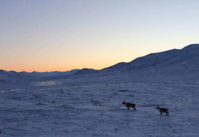
High noon at Chandalar Shelf on the winter solstice. BLM photo by Tyra Olstad - Does the highway close in winter?
-
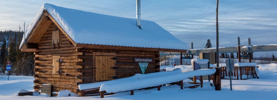
No. The road and private services remain open for trucks hauling supplies to the oilfields and camps, and private tour companies offer aurora-watching trips all winter. The BLM keeps a few facilities maintained year-round. The Arctic Interagency Visitor Center and Yukon Crossing Contact Station are closed between September and May, however.
Between ice and blowing snow, winter driving conditions can be extremely challenging. Before embarking on any trip--especially in winter--be sure to check road conditions at 511.alaska.gov.
- Are the bugs really that bad?
-
YES.
Hordes of mosquitoes emerge in mid-June and last into August. They're followed by biting flies and gnats, which last into September. Insects are worst on calm days and in low, wetland areas. Hike and camp on ridges or wide gravel bars along the rivers where a breeze may provide relief. A head net, bug jacket and insect repellents are essential if you plan on any outdoor activities.
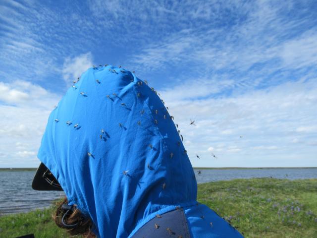
Yes, the mosquitoes really are that bad. Photo by Tyra Olstad - Where is the best place to see the midnight sun?
-
In summertime in the Arctic, the sun circles the horizon, but the Brooks Range can get in the way of its circumambulation. The best views are from the top of Gobblers Knob (17 miles north of the Arctic Circle Crossing and 43 miles south of Coldfoot), or anywhere north of Atigun Pass, where you can experience a full 24 hours of sunlight.
- When is the best time to see the aurora, or "northern lights"?
-
Whenever there isn't a "midnight sun." And whenever there aren't clouds. In Coldfoot, it's typically dark enough to see the northern lights by the end of August. September and March are ideal, as there's a good balance between daylight and darkness, and temperatures are still comfortable enough to stay outside and enjoy the show.
- What causes the aurora?
-
Just as the Earth has north and south geographic poles, we have north and south magnetic poles as well, generated as the planet's rotation slowly sloshes around molten metals in the Interior. The aurora is created due to an interaction between:
- Earth's magnetic field, which is concentrated at these magnetic poles
- electrically charged particles (ions) emitted by the sun (called the “solar wind”),
- and atmospheric gasses.
The "lights" that we see are produced when particularly strong solar winds transfer energy to the magnetosphere to react with different gasses--bright yellow-greens for lower-altitude oxygen; unusual reds for higher-altitude oxygen; and purplish edges for nitrogen.
- How did Coldfoot get its name?
-
When gold was discovered along Myrtle Creek in the foothills of the Brooks Range in 1898, a miners' camp was established at Slate Creek and grew quickly. Slate Creek was later renamed Coldfoot, purportedly in honor of prospectors who’d intended to venture further into the mountains but instead “got cold feet” and turned around.
- What's the elevation?
-
Coldfoot's elevation is about 1,014 feet above sea level.
The highest point along the Dalton Highway is Atigun Pass, at 4,653 feet. Mountains in the area reach about 2,000 feet higher. Far to the east, the highest peak in the Brooks Range, Mt. Isto, is 8,976 feet. At 20,310 feet, Mt. McKinley--the top of the continent--is more than twice as high.
Driving 170 miles north of Atigun Pass to Deadhorse (elevation 49 feet), the highway drops almost 4600 feet. In contrast, the Yukon River crossing is only 400 feet above sea level. The river still has about 800 miles to go until it reaches sea level, dropping an average of only 2 feet per mile.
- When was the wildfire?
-
Which one?
Wildfires are a common and important natural process in Alaska. You'll see patches of boreal forest in all stages of burn and regrowth. In 2022 alone, more than a dozen separate fires burned through more than 89,000 acres in the vicinity of the Dalton Highway south of Coldfoot, including the Fort Hamlin Hills Fire near mileposts 70-73 and the larger Douglas Fire, which crossed the highway between mileposts 141-149. Almost all of the wildfires in the Arctic are ignited naturally by lightning strikes. As long as the fires aren't threatening human lives or infrastructure (i.e., the pipeline), fire management officers typically let them burn, releasing nutrients back into the fairly nutrient-poor soils and allowing for a mosaic of vegetation and habitat types to persist throughout the vast boreal forest. The year 2022 was a bit unusual, in that firefighters were called on to suppress a blaze near Arctic Circle, which had the potential to destroy a recently-renovated campground.
Although uncommon, due to lower vegetation densities and typically soggy conditions, tundra fires are also possible. In 2007, the Anaktuvuk River Fire burned 256,000 acres north of the Brooks Range--about the same amount of tundra that had burned in the previous 50 years, combined.
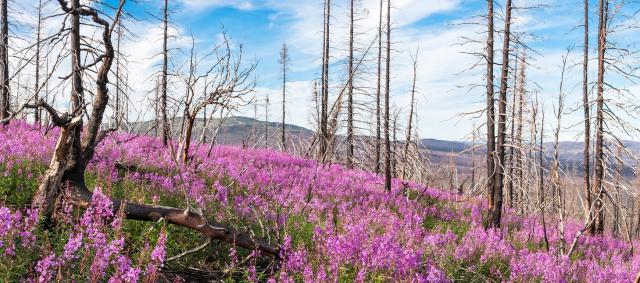
Fireweed and charred spruce trees, two years after a fire. BLM photo by Craig McCaa.