
Gulkana Wild and Scenic River Brochure
The Gulkana River watershed drains approximately 2,140 square miles in Southcentral Alaska. The river begins in the Alaska Range near Summit Lake and flows south into the Copper River, which eventually empties into the Gulf of Alaska between Cordova and Katalla. Several hundred lakes and ponds are scattered throughout the surrounding spruce-dominated forest. Paxson Lake, the largest, is about 10 miles long and one-half to one mile wide. The Gulkana falls 1,250 feet in the 81 river miles between Paxson Lake and its confluence with the Copper River.
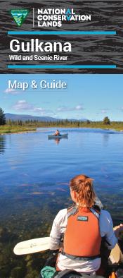
This brochure provides safety tips and navigation information to plan a successful float trip on the Gulkana Wild and Scenic River, as well as information on the cultural history of the area, its unique geology, and the fish and wildlife you might see.
For more information, also check out the Floater’s Guide to the Gulkana Wild and Scenic River.