
BLM Colorado Cadastral Survey assists National Park Service with newest national park unit
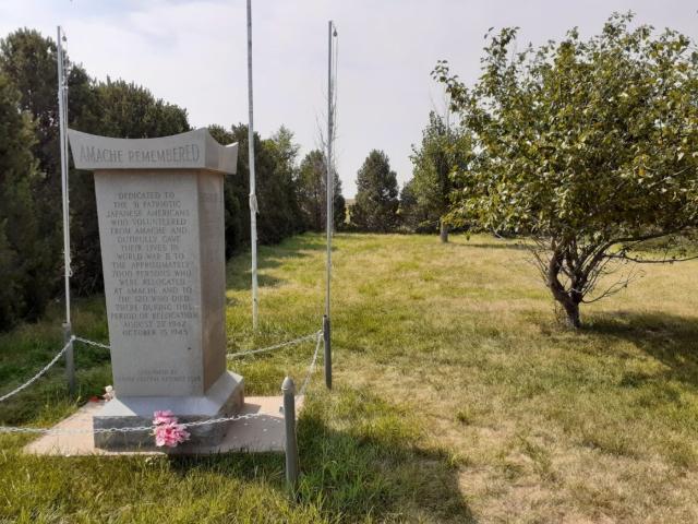
America’s newest national park unit, Amache National Historic Site, has a unique connection to BLM Colorado! BLM Colorado Cadastral Survey supported the National Park Service by providing an official federal authority land survey to facilitate the creation of the newest national park unit.
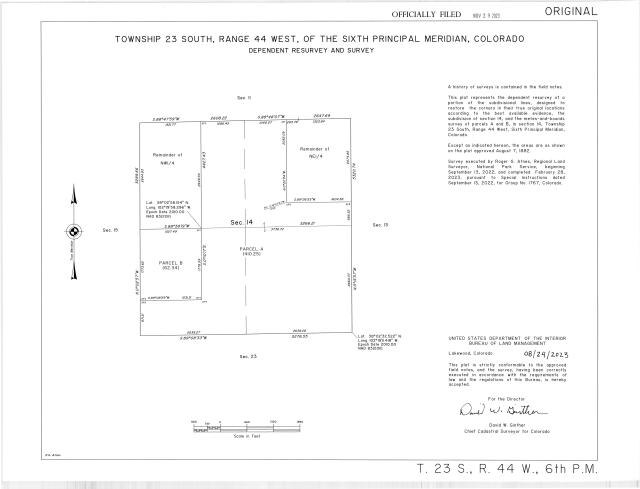
The official land survey conducted by BLM Colorado Cadastral Survey, supported the parcel acquisition by providing the needed legal description and official survey plat for the transfer of the parcel from the town of Granada, Colorado to the National Park Service.
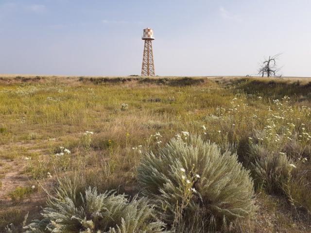
Amache National Historic Site, also known as the Granada Relocation Center, was once an internment camp for nearly 10,000 Japanese Americans who were forcibly removed from their homes between 1942 and 1945 during World War II.
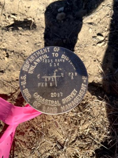
“The BLM Cadastral Survey provides tribal and federal land management agencies with essential information on the location of ownership rights, serving as one of the oldest and most fundamental functions of the United States Government. Originating with the Land Ordinance of 1785, cadastral surveys create, define, mark, and re-establish the boundaries and subdivisions of the public lands of the United States. BLM's Cadastral Survey maintains the essential land grid known as the Rectangular Survey System or Public Land Survey System (PLSS) that is the basis for identification of legal descriptions for land parcels. Growing demands placed on public lands and complex land ownership patterns make the importance of accurate boundaries more critical today than ever before. Clearly defined boundaries provide public land managers and the American people with essential information needed to identify rights and privileges and make the best land decisions.
The BLM Colorado Cadastral program provides services to other Federal Government agencies, including the Environmental Protection Agency, National Park Service, National Resources Conversation Service, U.S. Army Corps of Engineers, and the Department of Justice.
For more information on the Amache National Historic Site: https://www.nps.gov/amch/index.htm
Attachments
Related Stories
- Local Paleoartist Captures BLM Dinosaur Death Struggle
- Framed for Freedom: Bureau of Land Management Eastern States and the Legacy of National Historic Trails
- Firefighters and Archaeologists Collaborate to Protect Historic Mining Site during Monroe Canyon Fire
- Artist in Residence celebrates ‘place of special value’ in southwest Colorado
- BLM Connects Crystal Springs Students to Public Lands Through Hands-On Environmental Day
Office
PO Box 151029
Denver Federal Center - Building 40
Lakewood, CO 80225
United States