
North Fork Owyhee River | Idaho
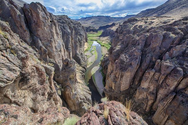
The North Fork Owyhee River consists of steep vertical walled canyon ranging in depth from 200 to 500 feet. As it flows toward Oregon, the canyon changes from a landscape dominated by rhyolite monoliths and pinnacle formations to one engulfed in sheer walls of blocky basalt. The river shoreline is lined with groves of mature and old-growth juniper woodlands. During high spring flows, a portion of this river is used by expert boaters as an outstanding Class V whitewater run.
Photos
Wild and Scenic Rivers
Related Links
Know Before You Go
Contact Us

Activities


Addresses
Bruneau Field Office
Idaho
Directions
In the Owyhee River Wilderness. Joins the Owyhee River at Three Forks, Oregon.