
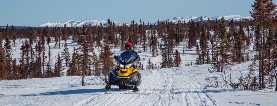
Alaska Travel and Transportation
The BLM manages approximately 70 million acres of public lands in Alaska. Most of these lands are remote, with little or no road access. However, there are multiple opportunities for off-highway vehicle (OHV) use.
Travel and transportation are an integral part of virtually every activity that occurs on public lands. The BLM conducts comprehensive travel and transportation planning to determine why and how to manage roads, trail systems and associated areas on public land to best meet transportation needs. All forms of transportation including foot, horseback and other pack-animal use, mechanized vehicles such as bikes, and motorized vehicle use, are addressed through creation of comprehensive travel and transportation management plans.
The BLM addresses comprehensive travel and transportation management through a land use planning process that produces regional Resource Management Plans (RMP). Land use planning involves public participation and input to identify existing and proposed access needs. Public lands may be open, limited or closed to motorized vehicles to best protect the land's important resources.
- Open: All vehicle use is unrestricted at all times, anywhere in the area.
- Limited: Vehicle use is restricted in certain areas, at certain times, or to certain types of vehicles.
- Closed: All vehicle use is prohibited.
The OHV area designations apply to all recreational use of motorized vehicles within the planning area. Other types of access across BLM-managed lands, such as rights-of-way and commercial use, may be authorized.
The BLM recognizes the importance of access and travel across public lands. As Travel Management Plan decisions are implemented, the BLM will identify areas and routes for motorized and non-motorized uses, develop travel information and trail maps, and continue to move towards a sustainable transportation system. Alaska Public Lands Information Centers, BLM public rooms, and local BLM offices can help identify land ownership and who to contact for more information on allowable motorized vehicle activities on your public lands.
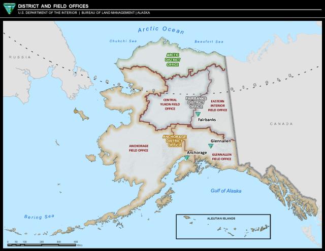
Alaska Office Boundary Map
Draft Plans
None for review at this time.
Final Plans
Anchorage District Office
- Anchorage Field Office
check back for updates
- Glennallen Field Office
check back for updates
Arctic District Office
- National Petroleum Reserve in Alaska
check back for updates
Fairbanks District Office
- Central Yukon Field Office
Central Yukon Resource Management Plan is currently in progress
- Eastern Interior Field Office
Draanjik Travel Managment Plan (Appendix E)
Interim Fortymile Travel Management (Section 2.2.20)
Map - Fortymile Interim Travel Management (Map 6)
White Mountains Travel Management Plan
Map - White Mountains - Summer
Map - White Mountains - Nome Creek Area - Summer
Map - White Mountains - Winter