Kremmling Field Office Seasonal Closures
The Bureau of Land Management (BLM) enforces seasonal closures across public lands managed by the Kremmling Field Office.
Seasonal closure dates and boundaries are subject to change depending on weather/wildlife conditions on site.
For the most up-to-date information, contact the Kremmling Field Office at 970-724-3000.


Seasonal Closures
Review these dates to ensure your activities comply with seasonal closures, which may be subject to change.
- December 15 - April 15
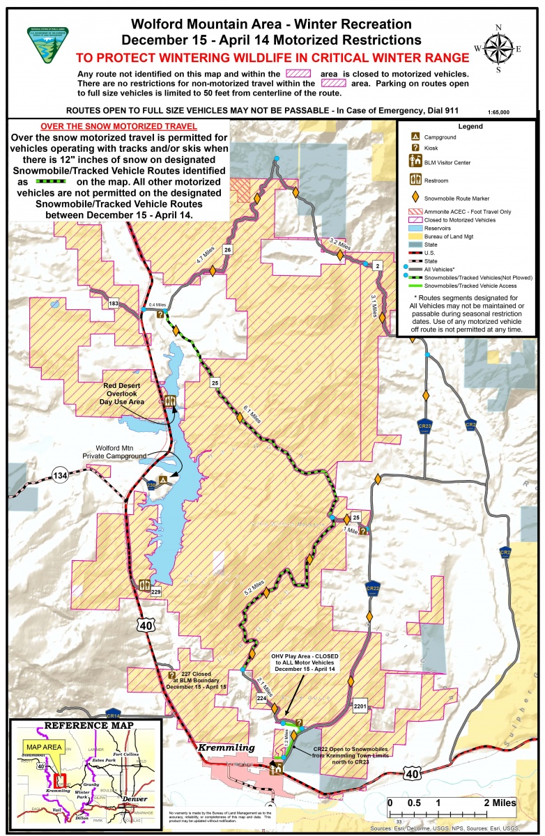
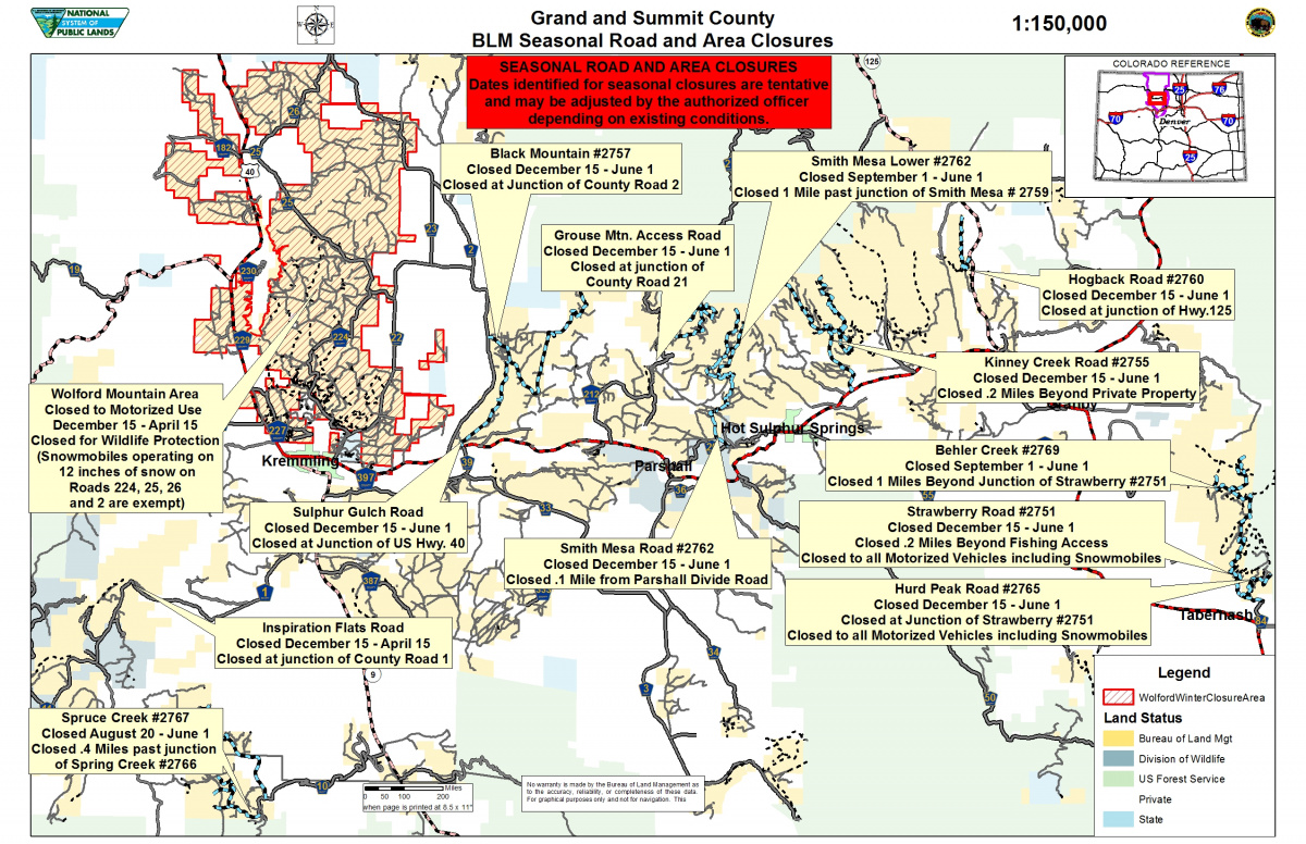
- In the Wolford Mountain area in Grand County, which includes public lands between Highway 40 and Grand County Road 2 (Back Troublesome Road), motorized travel is limited to over-the-snow tracked vehicles on BLM administered lands along roads 224, 25, 26 and 2 when there is a minimum of 12 inches of snow. All other travel routes and areas on BLM lands on Wolford Mountain will be closed to all motorized use. Non-motorized travel typically will be permitted throughout the area during winter travel restrictions. Changing conditions may cause the restrictions to be modified in the Wolford area, so check for restriction updates.
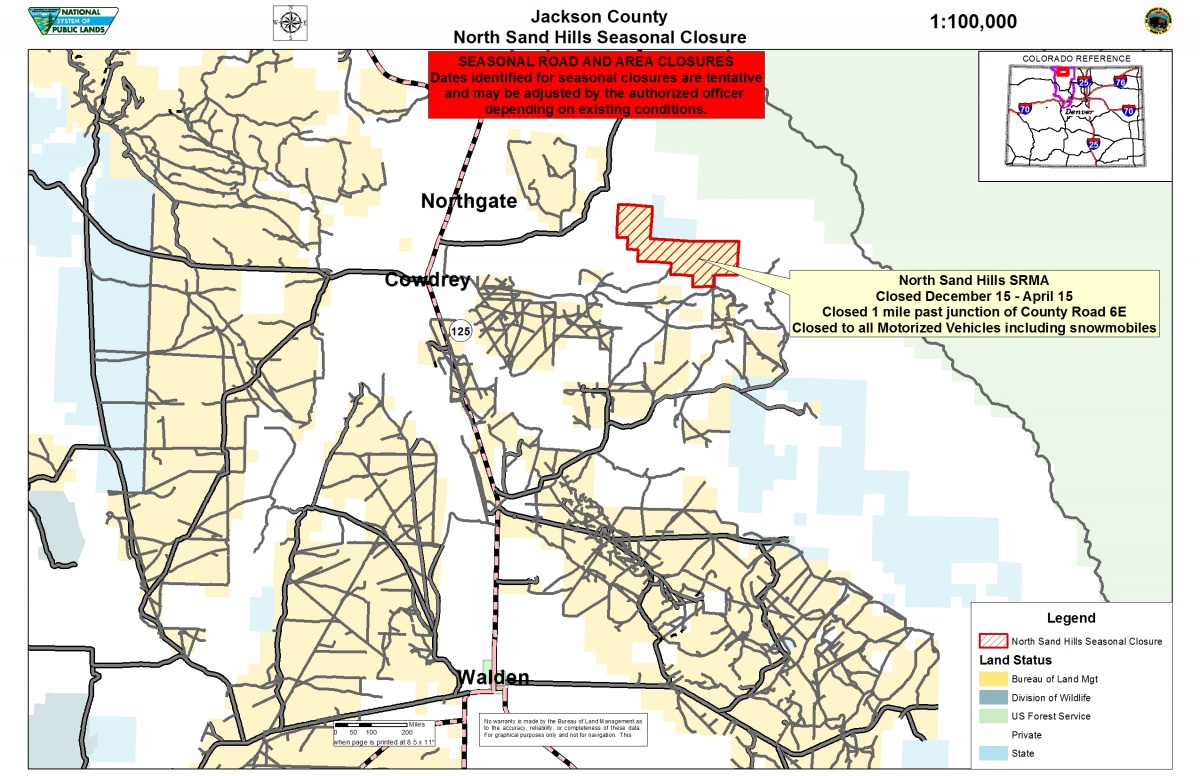
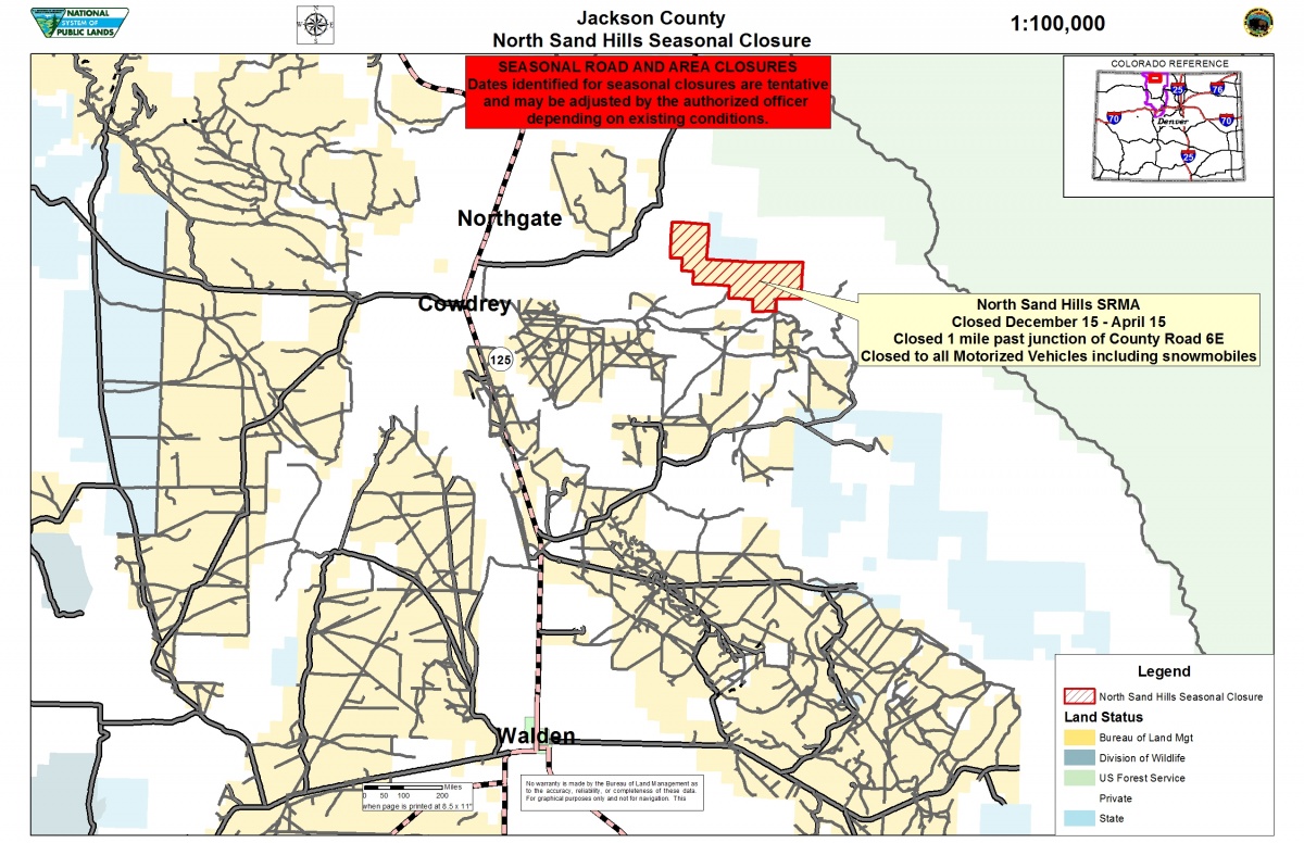
- The North Sand Hills Special Management Recreation Area in Jackson County is closed to motorized and mechanized vehicles, including snowmobiles, during this timeframe.
- December 15 - May 31
- Wolford Mountain Single-Track
- December 15 - June 1
- Grouse Mountain
- December 15 - July 31
- Muddy Creek Trail north of the Muddy Creek fishing access bridge
Additionally, motorized travel is restricted on the following routes to over-the-snow tracked vehicles when there is a minimum of 12 inches of snow unless otherwise noted. The roads may be gated until there is sufficient snow.
- December 15 - April 15
- Inspiration Point Flats Road - north of Trough Road (County Road 1)
- December 15 - June 1
- Black Mountain Road - from County Road 2
- Sulphur Gulch Road - access from US Hwy 40
- Smith Mesa Road - north Parshall Divide Road between Hot Sulphur Springs and Parshall
- Kinney Creek Road - East of Hot Sulphur Springs and 2.2 miles north of US Hwy 40 (see below about possible logging operations). Please stage on BLM lands and do not block private driveways
- Hogback Road - from Hwy. 125
- Strawberry Road - beyond the Fraser River Canyon Trail parking area. Closed to all motorized vehicles, including snowmobiles and other tracked vehicles.
- Hurd Peak Road - from intersection of Strawberry Road. Closed to all motorized vehicles including, snowmobiles and other tracked vehicles.
To report violations or for further information regarding the Wolford Mountain area travel restrictions, please visit the Kremmling Field Office, 2103 E. Park Ave., or call 970-724-3000.
Maps
Explore the full suite of seasonal closure maps available from the Kremmling Field Office. Check them before you head out but know that conditions and closures may change.
For the most up-to-date information, contact the Kremmling Field Office at 970-724-3000.
- Statewide Interactive Seasonal Closure Map
BLM Colorado implements seasonal closures across the state to reduce disturbance to wintering wildlife during the most stressful time of year. This interactive web map shows the locations of those seasonal closures.
Additional information can be accessed from the Colorado closures webpage.
- Jackson County North Sand Hills Seasonal Closure Map
Dates identified for seasonal closures are tentative and may be adjusted by the authorized officer depending on existing conditions.
No warranty is made by the BLM as to the accuracy, reliability, or completeness of these data. For graphical purposes only and not for navigation.
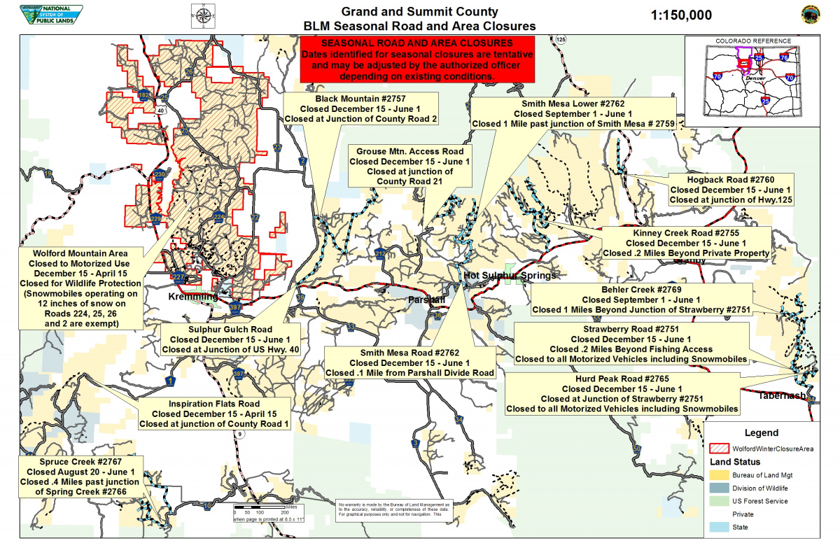
- Grand and Summit County Seasonal Road and Area Closure Map
Dates identified for seasonal closures are tentative and may be adjusted by the authorized officer depending on existing conditions.
No warranty is made by the BLM as to the accuracy, reliability, or completeness of these data. For graphical purposes only and not for navigation.
- Wolford Mountain Area Winter Recreation Motorized Restrictions Map
Any route not identified on this map and within the designated area is closed to motorized vehicles. There are no restrictions for non-motorized travel within the designated area. Parking on routes open to full size vehicles is limited to 50 feet from the centerline of the route.
Route segments designated for all vehicles may not be maintained or passable during seasonal restriction dates. Use of any motorized vehicle is not permitted at any time. In case of an emergency, dial 911.
Over the snow motorized travel is permitted for vehicles operating with tracks and/or skis when there is 12 inches of snow on designated snowmobile/tracked vehicle routes between December 15-April 14.
No warranty is made by the BLM as to the accuracy, reliability, or completeness of this map and data. This product may be updated without notification.